
City of
Bellevue MEMORANDUM
DATE: January 8, 2007
TO: Environmental Services Commission, Arts Commission, Parks and Community
Services Board, Transportation Commission, and Planning Commission
FROM: Matt Terry, Planning and Community Development
Goran Sparrman, Transportation
Patrick Foran, Parks and Community Services Denny Vidmar, Utilities
SUBJECT: Draft Bel-Red Subarea Plan
We are pleased to introduce a first draft of a new Bel-Red Subarea Plan for your review. This draft follows from a long process that began over two years ago with the crafting of a Bel-Red vision by the Bel-Red Steering Committee. This draft stems from the Steering Committee’s
vision and recommendation, and the draft subarea plan outline that some of commissions
reviewed in December.
This draft integrates all areas of the Steering Committee recommendation into a new Bel-Red
Subarea Plan. This approach deliberately limits amendments to other portions of the
Comprehensive Plan, including the general elements and other subareas, to those absolutely
needed to avoid inconsistencies or incompatibilities with the new Subarea Plan. The new Bel-
Red Subarea boundaries will correspond to the boundaries of the Steering Committee
recommendation shown on the preferred alternative map, resulting in modifications to the
Wilburton/NE 8th and Crossroads subarea boundaries to be consistent. Ultimately, the subarea
plan will be illustrated and figures will be added to help convey key ideas and make the vision more powerful and enticing.
Review of this draft by the boards and commissions will begin in January. As earlier discussed, the intention is that each commission will focus on the portions of the plan related to their
primary area of responsibility. As part of your review, each commission might ask:
• Does this draft capture the intent of the Steering Committee recommendation for the
future of the Bel-Red Subarea?
• Is it supportive of implementation strategies or other actions that are appropriate for the
city to take to fulfill the vision, such as land use regulations and capital improvements?
• Are there any policy additions or changes that should be considered in the commission
recommendation to the Planning Commission?
We would request that commission feedback be captured as concerns and suggestions rather than fine tuning of specific words. In addition to addressing its areas of responsibility, the Planning Commission has an additional unique role as the commission responsible for recommending changes to the Comprehensive Plan to the City Council. Therefore, the four other commissions will be asked to make recommendations to the Planning Commission.
With each commission having a slightly different schedule, some commissions may forward
their recommendations in January, while others continue their review and make a
recommendation in February. Additional follow up comments on policies and recommendations on transportation projects may occur as late as March. At that time, staff will work to prepare an updated draft subarea plan that consolidates the recommendations of the five commissions,
which the commissions will have an additional opportunity to review. Additional implementation work by the commissions may continue after adoption of the Subarea Plan.
While this timeline encourages the commissions to forward recommendations to the Planning Commission relatively quickly so as to provide the Planning Commission with time to review recommendations from all four of the other commissions, we want to ensure that each
commission has time to complete a thorough review. If a commission requires more time, we will work with the commission and its staff to schedule the time needed. It is important to draw this policy work towards a conclusion as early as practical because these policies inform and guide the work on implementation, which is also proceeding at this time.
Thank you for your involvement with the development of the Bel-Red Subarea Plan. This is a unique process that seeks broad involvement by five of the city’s boards and commissions, as well as a steering committee, stakeholders and the public. We look forward to the insight and thoughtful comments that you will add to the draft Bel-Red Subarea Plan.
Bel-Red Subarea Plan
Commission Review Draft, January 8, 2008__________________________________
Overall Goal: To develop a sustainable urban development pattern that dramatically reshapes the future of the Bel-Red Subarea, while allowing the area to transition gracefully from its past.
Overview
As one of Bellevue’s major employment areas, the Bel-Red Subarea historically included a large share of the City’s land zoned for light industrial and commercial uses.
Particularly on the west end, land uses include sprawling, large lot warehouses and
distribution buildings, with acres of surface parking. The transportation network is sparse and discontinuous, with little in the way of a street grid. Six streams run through the area, all heavily impacted by past development, but remarkably still provide some functioning fish habitat. The area has one major city recreational facility (Highland Park and
Community Center), but no substantial neighborhood parks or trails.
In recent years, Bel-Red’s light industrial past has seen significant declines, and the area has been in transition. Several large employers, such as Safeway distribution and the King County Journal, moved out or greatly reduced their operations in the area. Between 1995 and 2004, employment dropped by more than five percent in the Bel-Red area, while increasing by twenty percent in Bellevue as a whole.
Meanwhile, areas on both the east and west sides of Bel-Red have transformed
dramatically, and other changes are on the horizon. Downtown Bellevue to the west has
developed into a dynamic high-rise employment and residential center, connected across
I-405 to a major, multiple institution medical district. To the east, Redmond’s Overlake
area has become a prominent high technology employment center. The introduction of
light rail, under consideration by Sound Transit as a way to connect Downtown Bellevue
to Overlake by way of Bel-Red, is another potential change. Light rail provides a key
opportunity to re-think the land use and transportation relationship in the Bel-Red area, with this new transportation investment as a potential catalyst for redevelopment that takes on a much more pedestrian-friendly and transit-supportive character.
With these considerations in mind, the City undertook a major planning effort to update the vision and plan for the future of Bel-Red. Guided by a citizens steering committee
and with extensive public involvement, this new Bel-Red Subarea Plan is the result. The overall thrust of this Plan is to guide Bel-Red on a new path, toward a model of compact, mixed use, “smart growth;” a path to set Bel-Red on an economically and
environmentally sustainable course for the future, and to take on a new role within the
city and the Puget Sound Region.
This Subarea Plan informs a range of actions, by both public and private entities. It
establishes a vision and overall policy framework to convey the City’s intention for the
Page 1
Draft B-R Subarea, Commission review draft ver. 1b.doc
January 8, 2008
future of Bel-Red, creating a sense of the area’s potential and helping to inspire decisions
by many actors. The Plan will be implemented through a combination of development
regulations and incentives, capital investments, and other public and private strategies.
Bel-Red Subarea Vision___________________________
The Bel-Red corridor in 2030 will be an area that is unique within the city of Bellevue
and the entire Puget Sound region. It will be an area where thriving businesses will be
adjacent to, and sometimes mixed with, livable neighborhoods, all served by a multi-
modal transportation system that connects the area to the greater city and region. The
area will also be distinguished by environmental and community amenities that will serve
residents and employees in the area, as well as residents from surrounding neighborhoods
and the entire city. The area will transition gracefully over time, with existing businesses
being accommodated while new types of development will occur as conditions warrant.
Specifically, the area will be distinguished by the following attributes:
• A thriving economy: Bel-Red will be home to major employers, types of businesses
and employment sectors unique to this part of Bellevue, and services that are
important to the local community.
• Vibrant, diverse neighborhoods: Bel-Red will contain a broad range of housing
types to meet the needs of a diverse population of varied income levels.
Neighborhoods will have convenient access to shopping, jobs, and community
amenities, and will also be well connected to the larger city and region.
• A comprehensive, connected parks and open space system: Bel-Red will have a
park system that serves residents, employees, and visitors of the area, and provides
recreation and open space benefits for residents from surrounding neighborhoods as
well. System components will include trails along stream corridors, urban and natural
open space areas, community facilities, community and neighborhood parks, and
cultural/arts features.
• Environmental improvements: Redevelopment of the corridor will provide
opportunities for major environmental enhancements, including improving riparian corridors, adding trees and green spaces, and providing a more environmentally sensitive approach to managing storm water and other natural resources.
• A multi-modal transportation system: Bel-Red’s transportation system will take
maximum advantage of its proximity to Downtown Bellevue and Overlake by
providing convenient access and short travel times within and outside the corridor for drivers, transit riders, vanpools and access vans, bicyclists, and pedestrians, while minimizing spillover traffic impacts on adjoining neighborhoods.
• A sense of place: Bel-Red, and the neighborhoods within it, will have a character
that is different from Downtown Bellevue, Overlake, or other Bellevue
neighborhoods. The area will build on its industrial past, and recall its natural,
agricultural and ethnic heritage, while incorporating new development types that offer a unique experience for residents and employees. Public art and a distinctive cultural environment will also add to Bel-Red’s character.
• Appropriate scale of development: Development and redevelopment in Bel-Red
should complement, not compete with, Downtown Bellevue, and should provide
graceful transitions in scale in areas adjacent to residential neighborhoods.
Page 2
Draft B-R Subarea, Commission review draft ver. 1b.doc
January 8, 2008
• Timing of development: As the Bel-Red corridor redevelops over time, provision of
transportation and other infrastructure and public amenities (such as parks) should
occur concurrently with or in advance of development.
• Sustainability: New neighborhoods, buildings, streetscapes, parks and open space
systems, environmental enhancements, and transportation facilities will also be
planned, designed and developed using state-of-the-art techniques to enhance the
natural and built environment and create a more livable community.
Review Note: Policies are temporarily numbered A1, A2… for referencing during the review process. Numbers will be assigned in the final document consistent with the standard Bellevue Comprehensive Plan convention.
General Policies_________________________________
By taking advantage of the Bel-Red area’s unique location, and the opportunities
associated with high capacity transit, this Plan steers Bel-Red onto a new path. Departing
from its low intensity, industrial past, Bel-Red’s future will become a model of smart
growth and sustainability, the type of planning needed in this era of global climate
change. It will offer outstanding opportunities for living and working, while occupying a
unique economic niche for Bellevue and the Eastside. Clearly this entails a major
transformation for parts of the area, but change will happen over time, with some areas
changing earlier and other areas remaining very much the same for years to come.
Policies
S-BR-A1___ Implement the Bel-Red Subarea Plan in a manner that integrates the three dimensions of sustainability: sustainable economy, society, and environment; meeting the needs of the present without compromising the needs of future generations.
Discussion: In essence, the term “sustainability” conveys one critical thought and
intention: that the current generation meets its needs and desires in a manner that
allows for future generations to have as rich opportunities to meet their own needs
and desires. It means making decisions with the long term, and many generations,
in mind. It requires a balancing act, considering the environment, the economy,
and the social system, to ensure that all three are taken into account in critical
decisions.
S-BR-A2___ Promote a differentiated economic niche for Bel-Red, retaining many
existing businesses while attracting dynamic “new economy” businesses in a form not
found elsewhere in Bellevue. Maximize opportunities afforded by Bel-Red’s strategic
location between Downtown Bellevue and Redmond’s Overlake employment center, as
well as the opportunities brought about by light rail transit coming through the area.
S-BR-A3___ Reduce and mitigate the environmental and transportation spillover impacts of new development, and work to continually enhance environmental conditions in the area, through a combination of development regulations and incentives, public
investments, and other public and private strategies.
Page 3
Draft B-R Subarea, Commission review draft ver. 1b.doc
January 8, 2008
S-BR-A4___ Develop and implement a phased approach to new commercial
development, so that transportation, open space, and other infrastructure is in place or committed to serve the needs of growth, consistent with Figure BR-3. This includes establishment of a year 2030 commercial growth cap consistent with the terms of an interlocal agreement with the city of Redmond, for the purpose of coordinating land use and mitigation between the two cities.
Land Use_______________________________________
Goal: To develop a land use pattern that is environmentally sustainable and economically vibrant, and that creates distinctive new commercial and
residential neighborhoods for the Eastside.
The Subarea Plan provides an opportunity to re-cast land use in a more sustainable,
pedestrian-friendly and transit-oriented form, while accommodating existing uses and
minimizing impacts on nearby neighborhoods. The intent of Subarea Plan is to be a
model of responsible growth, and to create a land use type and form that is distinctive for
Bellevue and the Eastside. The Subarea Plan map is shown as Figure BR-____ .
A major theme of the Subarea Plan is the “nodal” development pattern, which
concentrates future development in the vicinity of potential future light rail stations.
Nodes are envisioned to be areas of sufficient development intensity, amenities,
recreation opportunities, and mix of uses that support a high level of pedestrian activity. The decision to focus new employment-generating and higher density residential uses in the nodes is intended to link development areas to locations where planned transportation facilities will support development, and to protect residential neighborhoods located to the north, south and east of the corridor from cut-through traffic.
Land uses within nodes can reach higher development intensity levels and heights than in
the surrounding parts of the Subarea. Buildings that are larger and higher than what the
base zoning would allow, both inside and outside of nodes, can only be achieved through
participation in an incentive system that will provide a range of public amenities.
The Subarea Plan recognizes the economic value and the benefits to the community of
the many existing light industrial and service uses in the area. The planned land use
designations retain areas for many of these commercial uses to continue. In areas where
the land use designation has changed to support nodal, mixed use or residential
development, the plan seeks an appropriate transition. Existing light industrial uses and
services uses with an industrial character, that were conforming under the previous
zoning, are accommodated without making them non-conforming, although new light
industrial uses will not be allowed. Other services uses that are compatible with planned
new uses are encouraged to continue, and new commercial uses are allowed.
Page 4
Draft B-R Subarea, Commission review draft ver. 1b.doc
January 8, 2008
Policies
S-BR-B1___ Develop land uses consistent with the Bel-Red Subarea Land Use Map (Figure BR-__).
S-BR-B2___ Concentrate the majority of future Bel-Red growth into a series of mixed use, pedestrian-friendly and transit-oriented development nodes, with higher density and height therein, as enabled through a land use incentive system. Within each node, provide for tiered building heights, with maximums at the center.
S-BR-B3___ Implement a land use incentive system that makes available additional floor area ratio (FAR) and height in exchange for infrastructure and amenities that contribute to the public good.
Discussion: As in the Downtown Subarea, a land use incentive system is a
cornerstone of implementing this Plan. Base as-of-right FARs and heights are
established at levels significantly below the maximums, with higher levels
achieved only by providing public benefits through features such as public open
space, trails, environmental enhancements, affordable housing, and other public
amenities.
S-BR-B4___ Encourage mixed use development, promoting opportunities to live, work, shop, and meet other needs within close proximity.
S-BR-B5___ Accommodate existing light industrial uses that were legally established as of the date of this Plan’s adoption, by allowing for their continued operation, expansion, and re-building if destroyed. Preclude new light industrial uses from being established, and discontinued light industrial uses from being re-established.
Discussion: This policy is to be implemented through the City’s land use
regulations. Whereas light industrial uses were prevalent in Bel-Red’s past, the
vision for the Subarea’s mixed use, commercial and residential neighborhoods
portends an evolution toward a different future. While it is appropriate to support
existing light industrial uses, this policy precludes new ones from being
established, in order to support a gradual transition to the desired future.
S-BR-B6___ Allow the continued operation of existing, and allow new, service uses that
are compatible with planned future land uses. Accommodate existing service uses that are
less compatible with residential and higher intensity, mixed use development (i.e., those
that create noise, odor, fumes, aesthetic or other impacts), but preclude the new
establishment of these types of service uses in transit nodes and in stand-alone residential
areas.
Discussion: This policy is to be implemented through the City’s land use
regulations. The services sector is quite broad, and includes uses such as health
care, business and professional office, household repair, and auto repair. Many of
these service uses have characteristics of general retail, are compatible with
mixed use commercial and residential, and are encouraged in Bel-Red’s future. A
smaller sub-set of service uses, such as auto repair, auto dealers and boat dealers
(particularly their service/repair components) and towing, display characteristics
Page 5
Draft B-R Subarea, Commission review draft ver. 1b.doc
January 8, 2008
similar to light industrial uses. These types of uses are less compatible with transit nodes and stand-alone residential areas, and thus new uses of this type are
precluded in these areas.
S-BR-B7___ Encourage commercial and residential building siting and design to
incorporate stream corridors as a significant on-site amenity, while helping to restore and enhance the ecological functions of these corridors, through the use of development
regulations and incentives.
S-BR-B8___ Develop and implement landscaping standards that promote sustainable
design, and encourage natural drainage practices where appropriate and feasible.
S-BR-B9___ Provide graceful edges and transitions between new land uses and
established light industrial areas, and between new development and neighborhoods in adjacent subareas.
Discussion: The transition between new mixed use and residential developments and existing Bel-Red light industrial uses is a special challenge. The siting and
design of new buildings should be accomplished in a manner that minimizes
conflicts with existing industrial uses, for the sake of creating a desirable working and living environment for new tenants. Redevelopment of Bel-Red also creates the challenge to ensure that new development is a good neighbor with existing
neighborhoods near Bel-Red. Development regulations and design guidelines
should address both of these challenges.
Key cross references, Land Use:
• General Policy S-BR-___, regarding land use phasing.
Urban Design___________________________________
Goal: to achieve a design character that results in aesthetically beautiful,
distinctive, and long-lasting places that evoke a strong sense of Bellevue and the Northwest, and a dynamic public realm that encourages social
interaction.
Past development of the Bel-Red Subarea did not allow for strong attention to the field of urban design. Development was loosely guided and rather discontinuous, with little
attention to architectural form, connectivity, and the public realm. By contrast,
transformation of Bel-Red into the dynamic mixed use place envisioned by this Plan will require a great deal of attention to high quality and sensitive urban design.
For new mixed use neighborhoods to successfully attract residents, employees, and
visitors, the design of the built environment will need to be pedestrian-friendly, integrated with transit and mobility options, and include deliberate “place-making.” Building and site design and materials will need to reflect the vision for the Subarea, and attention to quality and permanence.
Page 6
Draft B-R Subarea, Commission review draft ver. 1b.doc
January 8, 2008
The urban design process is also an opportunity to integrate environmental components with new development, where trees, landscaping and open space not only improve
aesthetics, but also work to enhance the function of the natural environment, such as by helping manage stormwater flows.
Policies
S-BR-C1___ Use design guidelines to promote pedestrian-friendly and transit-oriented design, ensure quality and a sense of permanence, promote environmental sustainability, and create a distinct sense of place. Conduct design review for all mixed use, office and residentially designated areas of the Subarea, and any other locations where land use incentives are applicable. Apply additional depth and attention to the details of design review within transit-oriented development nodes.
Discussion: Design review should pay special attention to creating a pedestrianfriendly environment, by helping to create vibrant, interesting, safe, walkable and interconnected sites.
S-BR-C2___ Integrate transit in the design of public and private developments, so that the form and connectivity of the built environment support travel choices.
Discussion: Features such as transit stops near major buildings, building entrances
oriented toward transit stops, and direct pedestrian connections between buildings
and transit help to integrate transit and land use, improving the pedestrian
environment and supporting travel choices.
S-BR-C3___ Encourage place-making and a dynamic public realm by integrating
publicly accessible plazas, open spaces and other gathering places with development, in public and private projects.
S-BR-C4___ Promote environmentally sensitive design in public and private projects,
including practices such as the US Green Building Council LEED certification of
buildings, use of natural drainage systems, water conservation measures, and other
practices.
S-BR-C5___ Encourage diversity in the built environment through a variety of building heights and forms, building articulation and modulation. Encourage building rooflines and floorplates that break down the scale of buildings, help to differentiate Bel-Red from Downtown, and enhance the architectural variety of the area.
S-BR-C6___ Encourage the use of building materials that are of high quality and
durability, are appropriate for the area climate, and that have a sense of permanence.
S-BR-C7___ Reinforce the area’s sense of place and Northwest provenance by
encouraging innovative building and site design, construction techniques and materials that reflect the industrial roots of the area while emphasizing the emerging urban
character of Bel-Red.
Page 7
Draft B-R Subarea, Commission review draft ver. 1b.doc
January 8, 2008
S-BR-C8___ Protect solar access to public spaces and important views from public spaces, as defined through the land use regulatory framework.
S-BR-C9___ Promote parking design and management that supports local uses in a manner compatible with the area’s urban design, transit and pedestrian orientation,
including:
a. Encourage shared parking;
b. Encourage structured parking as opposed to surface parking, particularly
in identified development nodes;
c. Prohibit surface parking between buildings and sidewalk, and provide
visual screening and/or landscaping relief of surface parking; and
d. Limit parking supply in transit development nodes.
S-BR-C10___ Reinforce neighborhood character and identity through the use of
gateways and neighborhood signage. Prohibit signage, such as building-top signage, that is out of scale with or detracts from the public realm.
S-BR-C11___ Encourage private and public use of public art to enrich design aesthetics and add character, identity and a sense of place.
S-BR-C12___ Design and develop an outstanding street environment that promotes
streets as key urban places, sensitive to their context and providing an interesting and
aesthetically rich experience. Apply a street hierarchy with design guidelines and street
standards that provides an appropriate combination of the following elements:
a. Strong consideration of character and aesthetics in the design and
implementation of all street projects;
b. Integration of open space and landscaping, including street trees;
c. Environmentally sensitive practices, including natural drainage systems
where appropriate;
d. Sidewalk development standards that promote pedestrian functionality and
interest, and avoid obstructions;
e. Ground floor differentiation, including preferred uses, visual and physical
access;
f. Mid-block pedestrian crossings; and
g. On-street parking, where it contributes to pedestrian convenience and
safety.
Environment_________________________________
Goal: to redevelop the Bel-Red area as a model of environmental
sustainability, realizing opportunities provided by new development to achieve significant improvements over current conditions.
Environmental sustainability is one of the overarching principles and hallmarks of this
Plan. As noted in the General Policies section above, this suggests a long-term orientation,
and an intention to meet current needs in ways that leave a rich legacy for future
generations. New development and reconstruction in Bel-Red should protect sensitive
Page 8
Draft B-R Subarea, Commission review draft ver. 1b.doc
January 8, 2008
areas and other natural resources, promote energy and resource conservation, and
enhance transportation choices. This will provide multiple benefits, from improvements
in natural functions and habitat, to healthier and more beautiful places for Bellevue
residents. Special attention in this section is placed on improving stream corridors, and
implementing a more environmentally sensitive approach to managing stormwater.
Stream Corridor Restoration
With a predominance of industrial and commercial uses in the Subarea, natural areas in Bel-Red are not obvious to the casual observer. Nonetheless, a number of streams and natural areas exist, providing the opportunity to restore some natural systems and
substantially enhance the area’s character. Surface water resources in the Subarea include seven drainage basins that encompass six streams, a pond, and two wetlands functioning as regional stormwater treatment facilities (Figure BR-___ ).
In general, these basins exhibit the typical characteristics of urbanized watersheds. Their streams suffered severe impacts during the development that occurred in the area in the 1960s and 1970s, prior to the advent of current environmental regulations. The types of impacts and stream constraints include fish passage barriers, impervious surfaces,
buildings adjacent to streams, and piped stream segments. However, most of the streams within the Bel-Red Subarea do support fish, including salmon, at locations within and/or downstream of the Subarea.
This Plan embraces the concept of removing fish passage barriers, daylighting piped
stream segments, and restoring riparian habitat to transform these streams into
community and environmental amenities. Restoring 50 to 100 feet of natural streamside vegetation that incorporates a public trail network is anticipated to provide multiple
benefits, enhancing fish and wildlife habitat, improving water quality, increasing open
space and neighborhood buffering, linking local and regional trails, encouraging social
gathering, and other lasting benefits. A beautiful and vibrant stream corridor will
encourage the community and new development to refocus on the stream as an integral natural treasure in an urban environment. While there are opportunities along each stream corridor, the greatest opportunities for enhancement have been identified along the West Tributary and Goff Creek. Achieving this vision will require wider riparian corridors than currently exist, plus acquiring and developing “opportunity areas” where elements of the parks and transportation systems interface with the streams.
Natural Drainage Practices
Private-sector redevelopment, transportation projects and new parks all present
opportunities for incorporating “green infrastructure.” In particular, natural drainage
practices, sometimes referred to as low-impact development, manage rainwater runoff in a manner that allows it to infiltrate into the soil on site, or even to be used on site, rather than running off site into nearby streams.
Natural drainage practices include features such as rain gardens, pervious pavement,
vegetated roofs, amended soils and rain recycling. These types of approaches do not work
in all settings, such as sites with poorly permeable soils or high water tables, and they are
Page 9
Draft B-R Subarea, Commission review draft ver. 1b.doc
January 8, 2008
most effective for smaller streams. In many cases they are more cost effective,
environmentally sound, and aesthetically pleasing than traditional stormwater treatment
and storage measures. They do not remove the need for conventional detention to handle
large storm events, but they may reduce the needed size of these facilities. A number of
techniques are available, and a customized approach may be designed for individual
locations.
Policies
S-BR-D1___ Promote the rehabilitation of streams and their adjacent riparian corridors, through a combination of public investments and private development incentives, as a
means to reduce the environmental impacts of development and provide multiple public
benefits. Provide land use incentives to achieve stream protection and rehabilitation that
goes beyond what can be achieved through application of the city’s critical area
regulations, including building setbacks of up to 100 feet in specific locations, to provide enhanced stream buffers.
Discussion: Bel-Red’s six streams are a major part of the area’s natural legacy.
Their rehabilitation will bear multiple benefits for the environment, for Bel-Red
properties where nearby streams can become a significant area amenity, and for
the wider Bellevue community. These benefits include improved water quality,
habitat enhancement, stormwater and flood control, use buffering, aesthetic
enhancements, noise attenuation, and potential trail access where easements are
available.
S-BR-D2___ Protect and rehabilitate wetlands and other designated critical areas in BelRed, through the use of development regulations and incentives.
Discussion: Special attention is needed if Bel-Red’s critical areas are to be
protected and restored, given that much Bel-Red development took place before standards were adopted to identify and protect these sites.
S-BR-D3___ Encourage natural drainage practices where feasible in public and private projects, as an alternative to traditional stormwater treatment and control. Allow natural drainage practices to offset traditional treatment and control standards to the extent practicable, and provide other incentives to promote their use if needed.
S-BR-D4___ Explore stormwater basin planning as a future step. Such planning would encompass coordinated stormwater treatment and detention across multiple properties in whole or parts of water basins, and may provide for broader environmental benefits as compared to a site-by-site approach.
S-BR-D5___ Consider opportunities for off-site stormwater mitigation, as a means to provide for a more coordinated approach to detention needs, and potentially achieve broader environmental benefits.
Discussion: In some cases, providing combined offsite stormwater mitigation may
help achieve some of the broader objectives of this Plan. For example, several
properties could combine stormwater management requirements on the West
Tributary by expanding an existing wetland providing fish and wildlife benefits,
Page 10
Draft B-R Subarea, Commission review draft ver. 1b.doc
January 8, 2008
increasing open space, as well as providing stormwater detention and water
quality treatment. Opportunities for off-site mitigation will be determined on a case-by-case basis, determined by overall ecological and public improvements over on-site.
S-BR-D6___ Encourage the use of “green infrastructure,” the design and development of infrastructure projects in a manner that deliberately achieves multiple environmental and other public benefits.
Discussion: Traditional infrastructure projects often were designed to solve a
single functional problem, mainly flood control. The concept of “green
infrastructure” suggests that many infrastructure projects have the potential to
provide multiple community benefits, such as enhancing neighborhood character
and aesthetics, urban heat reduction, greenhouse gas reduction, or providing
access and open space. If these multiple benefits are to be realized, they must be
considered starting with early design work forward through all phases of project
development.
S-BR-D7___ Incorporate environmental education and interpretation into public and private projects, where appropriate.
S-BR-D8___ Provide for density transfers within the Bel-Red Subarea as a means to help achieve stream corridor and open space objectives.
S-BR-D9___ Consider the Bel-Red Subarea as a potential receiving site for regional Transfer of Development Rights (TDRs), as a means to achieve conservation of rural resource lands outside the Countywide Urban Growth Boundary.
Discussion: Transfer of Development Rights is a market mechanism for land
conservation. Development rights from sensitive sites needing protection (sending sites) are purchased by and transferred to urban sites where the density can be
responsibly accommodated (receiving sites). Such a mechanism could be used, for example, to help protect the Lake Tapps rural watershed, where Bellevue will
draw an increasing share of its future water. Since private funding for such TDR
purchases is among a long list of desired public amenities, regional TDRs should
be explored in light of the full array of public mitigations and benefits desired
from private development.
Key cross references, Environment:
• Urban Design Policy S-BR-(C4)___, regarding environmentally sensitive site and
building design
Page 11
Draft B-R Subarea, Commission review draft ver. 1b.doc
January 8, 2008
Parks and Open Space____________________________
Goal: to create a robust, aesthetically beautiful, and functional parks and open space system that serves the needs of Bel-Red and the broader
community, and that connects with and complements the larger Bellevue parks and open space system.
Bel-Red’s legacy of light industrial and commercial uses have left little in the way of
existing park and open spaces, with the notable exception of Highland Park and
Community Center. As the area evolves, a comprehensive and connected system of parks, open space and trails will be needed to provide for the recreation and enjoyment of
residents, employees, and visitors to new Bel-Red neighborhoods. These new parks will also complement and connect to the citywide parks system, for the benefit of surrounding neighborhoods and the broader community.
The Subarea Plan envisions a park system with an array of elements that cannot not be
neatly summarized in a suburban level of service standard: community and neighborhood
parks, riparian corridor open spaces, open spaces developed as part of natural drainage
treatments and designed as public amenities, passive and active plazas and other urban
open spaces, and a comprehensive trail system on and off roads, including along stream
corridors. Beautiful and functional open spaces will help transform the area, support new
residential and commercial uses, improve the environment, and be an asset for the
broader Bellevue community.
In addition to a range of community-oriented park, open space and trail opportunities, Bel-Red may be a suitable location for a potential major recreation facility that would meet an identified citywide need for both indoor and outdoor recreation. If this citywide facility were to locate in Bel-Red, it could also serve as a community park for the new neighborhoods in this area.
Policies
S-BR-E1___ Create a robust, aesthetically beautiful, and functional parks and open
space system that serves the needs of residents, employees, visitors, surrounding
neighborhoods, and the entire community. This system should connect with and
complement the citywide parks and open space system, and include the following:
a. Provide neighborhood parks and smaller “pocket” parks with convenient
access to all neighborhoods;
b. Provide a community park serving Bel-Red residents, employees, and
citywide residents, comparable in size and utility to the Highland Community Park, in the western portion of the study area. The site might be accomplished through lidding of the Metro transit bus base, and would be able to
accommodate indoor and outdoor recreational facilities;
c. Locate neighborhood and community parks along stream corridors, linked
through a series of trails and other open spaces;
d. Develop a “linear park” series of open spaces spanning the extended NE 16th
Street multi-modal corridor through the middle of the Subarea; and
Page 12
Draft B-R Subarea, Commission review draft ver. 1b.doc
January 8, 2008
e. Centrally locate a large civic plaza (public square) within the pedestrian-
oriented 130th Avenue NE development node.
S-BR-E2___ Consider Bel-Red a suitable area to locate a potential major recreational facility to meet identified citywide needs for both indoor and outdoor recreation and sports facilities.
S-BR-E3___ Integrate natural resources management with Bel-Red park system development and operation:
a. Incorporate natural drainage practices into park development to provide
community amenities and watershed benefits, where appropriate and feasible;
b. Integrate the park and open space system with the riparian corridors to achieve
multiple benefits, including enhanced fish and wildlife habitat, improved
stormwater management, trail connections, passive recreation, and environmental
education; and
c. Manage upland park areas to protect habitat and restore natural functions.
S-BR-E4___ Provide an interconnected system of non-motorized trails for mobility within the study area, connected to the larger, regional trail system. The system will emphasize recreational use, but provide transportation benefits as well:
a. Provide non-motorized trails along the stream corridors to connect parks and
other land uses, and links to the trail systems along the BNSF Corridor and NE
16th Street. Initial emphasis will focus on the West Tributary and Goff Creek
stream systems;
b. Provide a major east-west multi-purpose trail along the NE 16th Street corridor.
The corridor will include a generous right-of-way width to accommodate
significant green infrastructure, and to create a high-quality pedestrian and bicycle
environment and auto-free access between neighborhoods. It will connect to
other local and regional trail systems and to light-rail stations, and provide
opportunities to incorporate gateway features; and
c. Support the development of a regional north-south multi-use trail along the BNSF
Corridor that could coexist with potential long-term future rail use, linking to the
NE 16th Street regional trail and other local trail access points.
S-BR-E5___ Promote the development of “green streets” throughout the corridor, with an abundance of street trees and areas of landscaping to improve and reduce the amount of stormwater runoff, be aesthetically pleasing, and provide an attractive pedestrian
experience.
Key cross references, Parks and Open Space
• Arts and Culture Policy S-BR-___, regarding the creation of a cultural arts
district
Page 13
Draft B-R Subarea, Commission review draft ver. 1b.doc
January 8, 2008
Housing________________________________________
Goal: to encourage Bel-Red redevelopment to result in a diversity of housing types and prices, including a significant share of “workforce
housing.”
Housing policy has many linkages to a truly sustainable future, with economic, social and environmental dimensions. Having a close-in supply of housing of types and prices that match available jobs can contribute both to Bel-Red’s economic competitiveness and its potential to meet the needs of families who want to live on the Eastside. Establishing
housing near Bel-Red’s jobs and services will also reduce trip lengths and allow for a
higher share of trips by transit, bicycling and walking, with environmental benefits in
energy conservation and air quality. This Plan’s intent to create the potential for 5,000 new housing units in an area that today has almost no housing is a remarkable
opportunity to make progress in all three of these dimensions.
The above housing outcomes entail very significant challenges. New urban residential neighborhoods will require an array of public and private investments in open space and other amenities needed to support high quality, livable places. Providing for affordable and workforce housing may be an even bigger challenge.
Housing affordability is a citywide issue, and should be considered in a comprehensive
strategy of which Bel-Red is a part. This Plan creates the potential for thousands of new
housing units, and provides opportunities not found in other parts of the city to create
entirely new residential and mixed use neighborhoods in close proximity to jobs, services
and transit. It is critical to consider an approach to housing affordability up-front, at the
time this new development potential is being created, or the opportunity for a coherent
strategy may be lost. This Plan establishes a multi-faceted strategy to address housing
creation and housing affordability through a mix of land use designations, development
regulations and incentives, direct public investments, and other public and private
approaches.
Policies
(Staff Comment: The Bel-Red Steering Committee recommendation on housing left many unanswered questions which the Planning Commission is sorting through. Significant additions or changes to these draft housing policies may be needed as this Planning Commission discussion ensues.)
S-BR-F1___ Encourage a diversity of housing types, from high density, multi-story housing in transit nodes, to medium density housing outside nodes, to townhomes and other forms only rarely found elsewhere in Bellevue.
S-BR-F2___ Promote affordability in Bel-Red’s new housing stock, with a target that a
minimum of __% of new units be affordable to low and moderate income households,
and another __% be affordable as “workforce housing,” for households earning up to
120% of median income. These targets will be addressed through a combination of
Page 14
Draft B-R Subarea, Commission review draft ver. 1b.doc
January 8, 2008
development regulations and incentives, public investments, and other public and private strategies, such as employer-assisted housing.
S-BR-F3___ Monitor the affordability of new housing in Bel-Red and make adjustments to implementation strategies, including development regulations and incentives, as
needed to meet the identified targets.
S-BR-F4___ Integrate the strategy for promoting housing affordability in the Bel-Red area with the City-wide approach of which Bel-Red is a part.
Arts and Culture________________________________
Goal: to identify and realize opportunities to integrate arts and cultural works and attractions into Bel-Red.
Arts and cultural uses and works are important neighborhood-building and place-making elements. In Bel-Red, they can play a significant role in enhancing the quality of life,
vibrancy, and attractiveness of the area, helping to attract creative professionals to live and work here, and benefiting the broader community. Accordingly, this Plan calls for public art, cultural uses and complementary activities to be broadly integrated throughout the redevelopment of the Subarea.
One specific concept is the creation of a cultural/arts district near 136th Place NE, in the vicinity of the existing Pacific Northwest Ballet school. Such a district could include
adaptive reuse of other existing buildings for additional classroom, rehearsal and, smaller performance spaces. This district has the potential to be a very significant neighborhood and community amenity, to be used by individual artists, educational institutions, and
nonprofit organizations. Uses might also include the production of ceramics, sculpture, blown glass, and others arts and crafts.
Policies
S-BR-G1___ Encourage artists, arts and cultural organizations, and arts related uses to locate in the Bel-Red area, capitalizing on proximity to existing arts uses and availability of suitable spaces.
S-BR-G2___ Encourage the development of an arts/cultural district near 136th Place NE, as shown on the Bel-Red Land Use Map, Figure BR-1.
Discussion: This arts/cultural district would build upon existing arts and cultural uses, and expand out to include additional opportunities for arts education,
rehearsal, performance, and production activities. Land use incentives and public investments would be used to help achieve these outcomes.
S-BR-G3___ Promote public art, cultural activities and urban design that reflects the BelRed area’s character, heritage, and ecology, with emphasis in the following areas:
Page 15
Draft B-R Subarea, Commission review draft ver. 1b.doc
January 8, 2008
a. Integration of public art into publicly accessible spaces, both privately and
publicly developed;
b. Inclusion of public art in transportation projects, including light rail transit
projects; and
c. Incorporation of public art in interpretation and celebration of stream corridor
improvements and other environmental enhancements
S-BR-G4___ Promote flexible live and work space for artists in the Bel-Red area by encouraging the creation of live/work and work/live units, in adaptive reuse of existing buildings or in new development.
S-BR-G5___ Encourage arts uses as appropriate transitional uses for existing buildings or areas, as Bel-Red evolves over time.
S-BR-G6___ Explore opportunities for traditional and technology based media to create a range of artistic expression that is tied to and complements the area’s economic
development.
Discussion: The Bel-Red area’s proximity to high technology uses may create
significant opportunities for innovative artistic expression, tying artist activities to the area’s broader economic development.
Transportation
Goal: to create a more complete, connected, and well balanced
transportation system, while protecting neighborhoods from spillover traffic impacts and while ensuring that transportation investments contribute to the area’s sense of place and sustainability.
The Bel-Red area has a sparse and discontinuous transportation system. The few arterials in the western portion of the Subarea were designed to serve low intensity, light industrial uses, so lack connected sidewalks or mature streetscapes. Arterials in the eastern portion carry commuter traffic and provide local access to retail and service uses. This system provides limited connections for east-west travel, few transit options, and minimal
facilities for pedestrians and bicyclists.
To support the Bel-Red land use vision, this Plan includes improvements to the
transportation system on all fronts. These will provide better vehicular, transit and non-
motorized connections within the Subarea and to other parts of the City and region.
Transportation improvements will occur consistent with this Plan’s emphasis on
sustainability and on making Bel-Red a highly livable place. Providing travel choices is a key element of sustainability. Efforts to reduce commuter trip demand, encourage ridesharing, walking and bicycling, and promote transit service will further pursue this end. Designing transportation projects as “green infrastructure;” i.e., to incorporate open space, place-making elements, and environmental design such as natural drainage practices, is another element of this Plan’s focus on sustainability.
Page 16
Draft B-R Subarea, Commission review draft ver. 1b.doc
January 8, 2008
Policies
Overall Transportation Policies
S-BR-H1___ Support the Bel-Red Subarea Land Use Plan with a multi-modal
transportation system consistent with Figure BR-___ (map of system improvements), that provides enhanced, multi-modal travel connections within the Bel-Red Subarea, and to other parts of the City and region.
S-BR-H2___ Incorporate natural drainage practices and other opportunities to enhance the natural environment into transportation projects where appropriate, effective and
feasible.
Discussion: Transportation projects may include significant opportunities for
environmental enhancements, such as improvements in stormwater management or removal of existing fish passage barriers.
S-BR-H3___ Identify and preserve necessary rights of way for the transportation projects identified in this Plan (See Table BR-___, Bel-Red Transportation Project List.)
Roadways
Bel-Red Subarea roadway system policies promote arterial improvements including the
major NE 16th Street multi-modal corridor, plus local streets to connect uses and enhance
the character of Bel-Red in a new grid system with smaller block sizes. Traffic analysis
shows that transportation capacity improvements are needed mostly in the western part of
the Subarea, because much of the potential employment and residential growth is planned
for this area.
S-BR-H4___ Develop arterial improvements, including added vehicular capacity, to serve trip demand generated by the Bel-Red Land Use Plan.
S-BR-H5___ Extend and expand NE 16th Street as a multi-modal corridor that includes vehicular, light rail, and non-motorized travel modes to serve east-west trip demand across the Bel-Red area, while incorporating significant urban open spaces, and
environmentally sensitive design features.
Discussion: The expansion of NE 16th Street is a lynchpin project for Bel-Red.
The extended corridor will be the key east-west arterial connection, tying together
much of the new Bel-Red land use. It is also the City’s desired location for light
rail, and for major new pedestrian and bicycle access across the Bel-Red area. The
vision for the corridor is ambitious, incorporating all these transportation modes,
and including a “linear park” series of open spaces spanning the corridor. These
improvements will be designed in a manner that protects wetlands and other
critical areas, and to the extent feasible, incorporates natural drainage practices and other elements of environmentally sensitive design.
S-BR-H6___ Develop local streets to establish a new grid system with smaller block
sizes, particularly in development nodes; emphasizing continuity, connectivity and
community character. Minimize crossings of streams and wetlands by local streets; use
Page 17
Draft B-R Subarea, Commission review draft ver. 1b.doc
January 8, 2008
environmentally friendly pedestrian and bicycle crossings where needed to provide local connectivity.
S-BR-H7___ Encourage garage and service vehicle access via local and secondary streets and alleys. Limit access points along arterial streets.
S-BR-H8___ Work with the Washington State Department of Transportation to improve connections to State Route 520 by completing the interchange at 124th Avenue NE, to allow access to and from the east, and to design the project to minimize impacts to
adjacent residential neighborhoods.
S-BR-H9___ Design Bel-Red arterials and local streets in a manner that contributes to community character, open space, and environmental enhancements.
S-BR-H10___ Include on-street parking where it contributes to the pedestrian environment and other elements of the desired neighborhood character.
S-BR-H11___ Incorporate public access and environmental restoration components, such as removal of fish passage barriers and the creation of wildlife passages, in the design and development of roadways that intersect stream corridors.
Pedestrian and Bicycle System
Within the Bel-Red Subarea many segments of roadway have no sidewalks. Bicycle
accommodation is limited to shared roadway facilities; there are no exclusive bicycle
lanes.
Creating a multi-modal transportation system to support a mixed use environment
requires excellent pedestrian and bicycle access. The Subarea Plan offers the potential to create transit-rich development nodes and neighborhoods in which walking and bicycling opportunities abound. A wide range of non-motorized improvements is anticipated; from sidewalks and mid-block pedestrian connections, to trails along riparian corridors and the Burlington Northern Santa Fe (BNSF) railroad corridor, and new neighborhoods and
roadways that are designed from the start with pedestrians and bicyclists in mind.
Proposed bicycle facilities would serve all types of users, from novice to expert, and all types of trips, including recreation and commuting. Links to local parks and connections to the regional system are part of the vision.
As a major future arterial and light rail corridor, an extension of NE 16th Street is also
planned to be the primary component of the east-west non-motorized transportation
system. Providing a high quality pedestrian and bicycling environment along this arterial
will create non-motorized linkages between neighborhoods, regional trail systems, and
light rail stations with limited or minimal auto conflicts. The east-west pedestrian and
bicycle corridor is also intended to link the various north-south trails and sidewalks.
S-BR-H12___ Improve pedestrian connectivity and the quality of the pedestrian
environment with a comprehensive sidewalk and trail system, including on-street
Page 18
Draft B-R Subarea, Commission review draft ver. 1b.doc
January 8, 2008
sidewalks, through-block pedestrian connections, mid-block crossings, and a network of separated trails. Include pedestrian amenities such as pedestrian-scaled lighting, seating, transit shelters, and weather protection.
S-BR-H13___ Develop a multi-use trail system throughout the Subarea that provides
both local and regional connections, including major non-motorized facilities along the
extended NE 16th Street, along the West Tributary of Kelsey Creek and other stream
corridors, and incorporating the planned regional trail along the BNSF railroad corridor.
S-BR-H14___ Develop multiple access points to the planned BNSF corridor multi-use
trail.
S-BR-H15___ Provide grade-separated road crossings of the proposed trail system along the West Tributary of Kelsey Creek, and of other separate trails where feasible.
Transit
Past transit service in the Bel-Red Subarea was quite limited, and generally available only on the area’s perimeter. Future land use will be served by a greatly enhanced transit
system, including both conventional and high capacity transit service, and an integrated land use pattern that promotes travel choices.
The Subarea Plan envisions a light rail route between downtown Bellevue and Overlake, traversing the Bel-Red Subarea on an alignment along approximately NE 15th/16th Street. Such an alignment with stations at planned development nodes maximizes the potential to create transit-oriented, mixed-use neighborhoods, and greatly increases ridership and
performance of the light rail system. Light rail stations in the vicinity of Overlake
Hospital Medical Center, 122nd Avenue NE, 130th Avenue NE, and at 152nd Avenue
NE in Redmond’s Overlake area, would allow for about three-quarters of future Bel-Red residents and employees to have convenient, walkable access to the stations. When light
rail is operating, “feeder” bus service can be reallocated to connect other City
neighborhoods with the Bel-Red light rail stations.
Light rail transit is an exciting opportunity and part of the preferred vision for Bel-Red.
However, if the region decides not to implement light rail, this Plan is still viable. The
“nodal” development pattern, and mix and intensity of use envisioned will greatly
promote travel choices of all types, including rubber-tired bus transit. The City will work
with Metro and other conventional transit providers to greatly enhance service to Bel-Red,
with a special emphasis on supporting the emerging development nodes identified above.
This will be critical both to ensure that transit serves the area in the shorter term (before
light rail is developed), and in the longer term, either to feed light rail stations with bus
service or create effective transit alternatives should light rail not be developed in the
corridor.
S-BR-H16___ Work with King County Metro and other transit providers to serve
emerging new land uses in the Bel-Red Subarea, and to connect to and support future light rail, including:
Page 19
Draft B-R Subarea, Commission review draft ver. 1b.doc
January 8, 2008
a. Enhance conventional transit service throughout the Bel-Red Subarea;
b. Provide a level and type of service that, to the extent feasible, emulates high
capacity transit in future light rail station areas, as an interim measure in advance of light rail operations; and
c. Provide transit feeder service from other Bellevue neighborhoods into transit-
oriented development nodes at future LRT stations.
S-BR-H17___ Work with Sound Transit to realize the City’s preferred light rail route, alignment and station locations, as shown in Figure BR___. Support the development of light rail stations in the vicinity of Overlake Hospital Medical Center, 122nd Ave. NE/NE 16th Street, and 130th Ave./NE 16th Street.
S-BR-H18___ Include transit-supportive improvements with new public and private
development, such as transit shelters, wayfinding signage, and other features through a combination of public investments and a regulatory framework applicable to private
development.
S-BR-H19___ Work with Sound Transit to determine the need for a future light rail maintenance facility in Bel-Red, and if needed, to locate it where compatible with planned land uses and transportation facilities and services.
Transportation Demand Management
By closely integrating land use and transportation planning, this Subarea Plan goes a long way toward promoting travel choices. The Plan supports a mix and intensity of land uses that allows for fewer and shorter trips, and promotes a balanced, multi-modal
transportation system that creates an environment that allows for more trips to be
convenient for transit and non-motorized options,. Subsequent efforts can help users
become aware of and take advantage of these travel options.
S-BR-H20___ Implement a transportation demand management program to reduce BelRed single-occupancy trip demand, and increase the share of trips utilizing transit,
carpools and vanpools, and pedestrian and bicycle options.
Neighborhood traffic calming/mitigation
This Plan supports on-going efforts to minimize neighborhood cut-through traffic and speeding associated with Bel-Red development. Mitigation for potential traffic impacts on arterials must create a roadway character that alerts drivers that they are in a
neighborhood and encourages them to drive accordingly. Medians, special paving, and other options to address traffic volume and speed on arterials will be developed in
coordination with the affected neighborhoods.
For non-arterial streets, traffic-calming devices and traffic control measures will be
considered on a case-by-case basis, applying the City’s Neighborhood Traffic Control
Program criteria within residential neighborhoods in and around the Bel-Red Corridor.
Page 20
Draft B-R Subarea, Commission review draft ver. 1b.doc
January 8, 2008
S-BR-H21___ Develop and implement strategies to minimize neighborhood cut-through traffic associated with Bel-Red development. Monitor the outcomes of these efforts and make adjustments as needed to ensure their effectiveness.
Key Cross-References, Transportation:
• Urban Design Policy BR___, regarding parking policies to promote pedestrian-
friendly and transit-oriented design, particularly in development nodes
• City-wide Comprehensive Plan Transportation Element, Chart TR.1,
establishing Bel-Red Subarea mode split targets and arterial LOS standard
• City-wide Comprehensive Plan Transportation Element, High Capacity Transit
policies
Interjurisdictional Coordination__________________
Goal: to provide for effective coordination and mitigation of impacts that cross jurisdictional boundaries
Many interactions occur between the the Bel-Red Subarea and the adjacent Overlake area
in the city of Redmond, particularly with regard to travel patterns. The two cities have a
long history of working together to address cross-jurisdictional impacts, and the Bel-Red
Subarea Plan continues to promote this level of interjurisdictional coordination. The
intent is to ensure that any cumulative impacts of the Bel-Red and Overlake plans are
identified and mitigated, and also that there is synergy between the plans in terms of light
rail implementation, streetscape design, pedestrian and bicycle facilities, and other issues.
In addition to coordination with Redmond, implementing the Bel-Red vision will require on-going coordination with Sound Transit, King County Metro, and Washington State Department of Transportation (WSDOT), to ensure that transportation facilities and
services are implemented over time.
Policies
S-BR-I1___ Continue to coordinate with the City of Redmond on the planning and
implementation of land use and facilities that have cross-jurisdictional impacts, and work
together to mitigate such impacts. Coordination may include but is not limited to
systematic sharing of information, joint advocacy for regional investments benefiting the
two areas, and financial contributions toward facilities that mitigate interjurisdictional
impacts.
Discussion: An updated interlocal agreement is an appropriate mechanism for
formalizing the terms for coordination between the two cities. Such an agreement should identify appropriate mitigation for the East Bellevue area that considers: 1) the combined effects of land use development in the Bel-Red area of Bellevue and the Overlake area of Redmond; and 2) the strong neighborhood preference to
avoid projects that add general capacity to East Bellevue.
Page 21
Draft B-R Subarea, Commission review draft ver. 1b.doc
January 8, 2008
S-BR-I3___Coordinate with state and regional transportation and transit agencies
(WSDOT, Sound Transit and King County Metro) on planning and providing
transportation projects and services needed to implement this Subarea Plan.
Key cross references, Interjurisdictional Coordination
• General Policy S-BR-___, regarding growth phasing and growth caps
Implementation_______________________________
Goal: to ensure an ongoing and effective process , with the right tools
available, to result in effective implementation of the Bel-Red subarea vision
The Bel-Red Subarea Plan is an ambitious vision that calls for a substantial departure
from the area’s past. In addition to sweeping land use changes in portions of the area, the plan calls for very significant investments in transportation, parks, and environmental improvements. Much of these investments will need to come from properties undergoing redevelopment. Some of this will occur as redevelopment brings sites up to newer land use and urban design standards. Some will occur with land use incentives, allowing
greater building intensities or height in exchange for development contributions to
infrastructure and amenities. A city funding strategy will likely also play a role, by
utilizing both existing revenue sources and new financing tools.
The transformation will not happen overnight, but rather will likely unfold over a number of decades. Successful implementation will require a coordinated strategy, with ongoing commitment, a full array of tools, and dedication over time.
Policies
S-BR-J1___ Implement the Bel-Red Subarea Plan through a combination of
development regulations and incentives, capital investments, and other public and private strategies.
Discussion: Some improvements anticipated by this Subarea Plan will be
provided through land use development regulations that enable new land uses to occur. Other improvements will be provided through a land use incentive system that allows for larger and taller buildings than can occur under the basic zoning, in exchange for the provision of certain public amenities. Yet other improvements will be included in a public financial strategy, as described below.
S-BR-J2___ Establish a financial strategy that provides for the costs of public
infrastructure and amenities needed to support Bel-Red development and identified as
specific projects in this Plan to be born by various parties based on their relative shares of
impacts and benefits. Cause developing properties to contribute the principal share of
needed public improvements, to the extent they are the primary beneficiary of such
improvements. Implement existing and new financial tools as needed to carry out this
strategy.
Page 22
Draft B-R Subarea, Commission review draft ver. 1b.doc
January 8, 2008
Discussion: Redevelopment of the Bel-Red Subarea requires a broad array of
investments in public infrastructure and amenities. Various classes of properties, including developing properties, existing properties, and the general City should share these costs based upon the relative share of benefits they receive.
S-BR-J3___ Reserve the right-of-way needed for the Bel-Red public infrastructure and amenities identified in this Plan as early as practicable.
S-BR-J4___ Allow for private development to voluntarily advance the building of public infrastructure improvements, in order to enable land use to proceed in sync with the
availability of needed infrastructure; consistent with the phasing approach set forth in
Policy S-BR-A4. Such investment may be repaid in part by latecomers agreement or
similar device.
S-BR-J5___ Require the dedication and improvement of local streets at the time of development, consistent with Figure BR-6___, to enable development of frontage improvements and a local street pattern that provides for access and loading, and improved transportation connectivity.
S-BR-J6___ Encourage master planned developments and other processes that better coordinate and integrate this Subarea Plan’s objectives than individual development of small parcels. Consider mandatory use of master planned development approval for large sites, to facilitate site planning for vehicle access and pedestrian needs.
S-BR-J7___ Encourage business and property owners to support the ongoing
development of the Bel-Red area through a business improvement organization.
Neighborhoods/Districts__________________________
Bel-Red is a large Subarea, with the potential for developing a number of distinct
neighborhoods. These include the “development nodes” around future light rail stations, areas of mixed use and relatively dense development where public and private
improvements are expected to create a pedestrian-friendly and transit-supportive
environment. Additional neighborhoods will form outside the development nodes. Some will be fairly consistent with past development; others will be a significant departure. The intent of this Plan is to capitalize on these various land use patterns within Bel-Red, to break down the large expanse of the Subarea and create a series of neighborhoods, each with its own distinct character and sense of place.
Development Nodes
The nodal development pattern concentrates development in the vicinity of potential
future light rail stations, generally within a quarter-mile radius. Development nodes are
located in the vicinity of Overlake Hospital, at 122nd Avenue NE, at 130th Avenue NE,
and at 152nd Avenue NE (with a station in Redmond). These nodes would be mixed-use
in nature, with a high level of pedestrian access and amenities. Land use intensities in
these nodes can reach a maximum development intensity of 2.5 FAR, but only through
participation in an incentive system that provides public amenities in exchange for higher
Page 23
Draft B-R Subarea, Commission review draft ver. 1b.doc
January 8, 2008
densities. Maximum building heights vary by development node, with the highest
allowed heights near the center of the nodes. As with intensity, these maximum heights above the base zoning height limits are allowed only through participation in the amenity incentive system.
Node in the vicinity of Overlake Hospital Medical Center
S-BR-K1___ Provide for office uses in this area, with an emphasis on medical office.
Initially higher intensities are limited to an area adjacent and to the east of Overlake
Hospital, and heights in this area may reach 150 feet. Sound Transit is contemplating an
additional light rail station on either the northwest or southeast side of Overlake Hospital.
When that station location is determined, an area of additional development intensity and
height may be designated through a subsequent Comprehensive Plan amendment.
Discussion: This is an area directly adjacent to Overlake Hospital Medical Center
and the Group Health Ambulatory Care Center, by far the largest medical
complex on the Eastside. In addition to these institutional uses, the area is
characterized by a wide range of medical office uses that complement the medical
campus.
Node at 122nd Avenue NE
S-BR-K2___ Provide for a mix of office, housing and retail uses in this area, with office as the predominant use. Potential height in the center of this node may reach 150 feet, and up to125 feet in the perimeter.
Discussion: This office-supportive node is located on the west side of the subarea,
where it is better served by regional transportation infrastructure and has lesser
potential for traffic impacts on East Bellevue neighborhoods. Housing and retail
uses are encouraged to be part of the mix of this neighborhood, to avoid a sterile
office-only area and to create a balance of activities. Parks, open spaces, and
recreational opportunities are envisioned as part of this urban environment.
Node at 130th Avenue NE
S-BR-K3___ Provide for a mix of housing, retail and services in this area, with an
emphasis on housing; include a pedestrian-oriented retail area along 130th Avenue NE. Potential height in the center of this node may reach 150 feet, and up to125 feet in the
perimeter.
Discussion: This area is envisioned as a predominantly residential neighborhood
with an active retail street at its core. With its focus on residential uses, this area
represents a key opportunity to develop a range of housing types and densities.
An urban plaza located near 130th Avenue NE will serve as a “town square.”
Node at 156th Avenue NE, near the Overlake transit station location in Redmond S-BR-K4___ Provide for a mix of housing and retail uses in this area. Potential heights may not exceed the zoning in effect prior to adoption of this Plan.
Discussion: This mixed use node is on the edge of Redmond’s
designated Overlake neighborhood, and is within the walkable area of the planned Overlake transit station at 152nd Avenue NE.
Page 24
Draft B-R Subarea, Commission review draft ver. 1b.doc
January 8, 2008
Land Uses Outside Nodes
Medical office area along 116th Avenue NE
S-BR-K5___ Provide for office uses in this area, with an emphasis on medical office, and with an FAR up to 1.0.
Retail along the central portion of the NE 20th Street corridor.
S-BR-K6___ Provide for retail uses in this area, with FARs and heights not to exceed the standards for the General Commercial designation that is applicable city-wide. Encourage little significant land use change in this area, which is not contemplated for more intense
development.
Area south of Bel-Red Road
S-BR-K7___ Provide for a mix of office and housing in this area, with low-intensity
buildings of one or two stories serving as an appropriate buffer between the uses north of Bel-Red Road and the single-family residential neighborhoods to the south. While office should remain a focus, housing in this area is also a suitable transition use.
Mixed Use Retail/Housing Areas (area just west of 148th Avenue, area near Highland Park and Community Center, and the triangular area south of NE 12th Street, east of 120th Avenue NE)
S-BR-K8___ Promote additional development of retail uses in these areas, together with mixed use development that incorporates housing.
Housing Emphasis Area (area north of the Metro east base along the south end of NE 20th Street)
S-BR-K9___ Promote stand-alone housing in this topographically high area, taking
advantage of view corridors to the south and west, as well as potential improvements to the West Tributary stream corridor.
Area south of NE 12th Street and contiguous to Lake Bellevue
S-BR-K10___ Provide for mixed use commercial and residential uses in this area. Allow maximum building heights through the land use incentive system up to 60 feet, with
height limits up to 75 feet if this area is subsequently identified to fall within the
Overlake Hospital light rail transit node.
Page 25
Draft B-R Subarea, Commission review draft ver. 1b.doc
January 8, 2008
Additional Subarea Plan Components
Figures
1. Land Use Map
• Establishes new Subarea boundaries coincident with the S/C report
• New Bel-Red Comp Plan designations to be established, consistent with zoning
2. Bel-Red Surface Water Resources
3. Map of Environmental, Parks and Open Space Projects
5. Map of Transportation System Improvements, including Phasing
6. Map of Street Hierarchy and Local Streets
Tables--Project Lists
1. Transportation Projects
• List and brief descriptions of specific projects
• Includes joint East Bellevue (and Overlake) mitigation project(s) TBD
2. Parks and Open Space Projects
• List and brief descriptions of specific public projects
3. Environmental Projects
• List and brief descriptions of specific stream rehabilitation segments identified
as public projects
Page 26
Draft B-R Subarea, Commission review draft ver. 1b.doc
January 8, 2008
Other Potential CPAs—General Elements
Note that General Element CPAs are intended to be kept to a minimum.
Transportation Element
• Amend MMA boundaries?
• Amend LOS and mode split target
• Note: High Capacity Transit policies will be amended via Light Rail Best
Practices effort underway via separate Steering Committee
Urban Design Element
• Amend Figure UD.1, adding NE 16th, 120th, 124th as designated boulevards
Capital Facilities Element?
• Funding policies?
Subareas and Transp. Facility Plans (Comp Plan Vol. 2)
• Amend Crossroads, Wilburton boundaries
• Update Bel-Red/Overlake TFP
• Rescind Bridle Trails, Bel-Red and Crossroads TFP
• Update East Bellevue TFP
• Update the Pedestrian and Bicycle Facility Plan (underway via separate work
program)
Page 27
Draft B-R Subarea, Commission review draft ver. 1b.doc
January 8, 2008

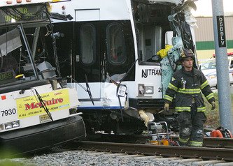


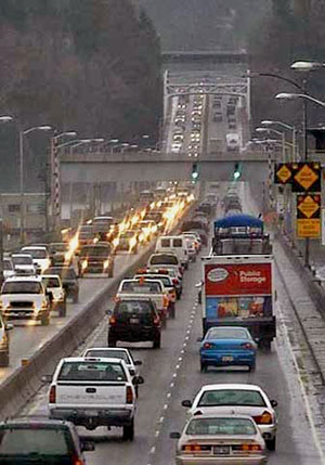


Unsound Transit
