The phrase,'Unsound Transit', was coined by the Wall Street Journal to describe Seattle where,"Light Rail Madness eats billions that could otherwise be devoted to truly efficient transportation technologies." The Puget Sound's traffic congestion is a growing cancer on the region's prosperity. This website, captures news and expert opinion about ways to address the crisis. This is not a blog, but a knowledge base, which collects the best articles and presents them in a searchable format. My goal is to arm residents with knowledge so they can champion fact-based, rather than emotional, solutions.

Transportation

Showing posts with label 4.21 I-5. Show all posts

Tuesday, April 8, 2008

I-5 to adopt variable, lower, speed limits to improve traffic flow

SEATTLE (AP) -- The speed limit on a 6-mile stretch of I-5 in Seattle will change several times a day when the Transportation Department installs new overhead electronic signs.

The department says variable speed control should help traffic flow more smoothly and prevent rear-end collisions.

Four signs will be installed in the northbound lanes next year between Boeing Field and I-90.

Drivers near the airport might be held to 30 mph or 40 mph to reduce the chance of them running into stop-and-go traffic downtown.

A DOT project manager, Carol Hunter, says the $25 million project is one of the programs meant to relieve congestion during the removal of the Alaskan Way Viaduct in Seattle.

Variable Speed limits coming to stretch of I-5

DOT plans changing speed limit on I-5 in Seattle for traffic flow


Apr 8, 12:05 PM EDT

SEATTLE (AP) -- The speed limit on a 6-mile stretch of I-5 in Seattle will change several times a day when the Transportation Department installs new overhead electronic signs.

The department says variable speed control should help traffic flow more smoothly and prevent rear-end collisions.

Four signs will be installed in the northbound lanes next year between Boeing Field and I-90.

Drivers near the airport might be held to 30 mph or 40 mph to reduce the chance of them running into stop-and-go traffic downtown.

A DOT project manager, Carol Hunter, says the $25 million project is one of the programs meant to relieve congestion during the removal of the Alaskan Way Viaduct in Seattle.

Wednesday, March 12, 2008

Handling the Planned Closure of I-5

Last updated August 17, 2007 11:24 p.m. PT

Sounder train
Meryl Schenker / P-I
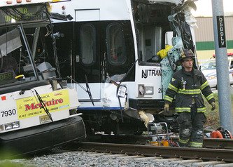
Although it was standing room only, the mood was good, as Cynthia Softli of Kent, with the Department of Corrections, rides Sounder for the first time.

Commuters showed they can adapt, at least briefly

A thousand little things done differently made all the difference

By JENNIFER LANGSTON
P-I REPORTER

Like so many others, Patrick Hirayama took the bus Monday, heeding warnings that a few lane closures on Interstate 5 could cause a traffic Armageddon.

They didn't. He got back in his car the next day.

"My wife wanted the dog dropped off at day care ... and he doesn't fit on my 10-speed," said the computer administrator, who switched among a car, the bus and a bike for the rest for the week.

A thousand little things people did differently -- took vacations, drove with a neighbor, left earlier, caught the bus to a Mariners game -- made the I-5 lane closures largely painless, at least in the earlier part of the week.

It's an interesting lesson for a region that tends to fixate on pouring concrete -- building light rail or a tunnel or freeway lanes -- rather than changing behavior to solve traffic problems.

"The dialogue about transportation here has been very polarized, and it has really been about big megaprojects," said Jessyn Farrell, executive director of the Transportation Choices Coalition, which promotes alternatives to cars. "It's a lot of little solutions that make a big, complicated system work."

Those who favor replacing the Alaskan Way Viaduct with surface street fixes and transit argue that people could adjust to that as well, despite similar predictions that gridlock would ensue.

"I think they're almost intentionally made to support an antiquated 1950s view of transportation -- that somehow freeways are the solution to our traffic woes, and when they're out of service everything breaks down," said Seattle City Councilman Peter Steinbrueck.

Public transit ridership in some cases hit record highs Monday, evidence that Seattle's drive-alone diehards may be more flexible than anybody gives them credit for.

But forecasting exactly how people will react to freeway closures is no science. If no one changed routine this week, there would have been crippling backups, said Morgan Balogh, a traffic engineer with the state Department of Transportation.

"We have to let people know the seriousness of the work we're doing," he said. "Then they're very adaptable, and they don't want to sit in traffic more than anybody else. There's lots of different ways to get from one place to another."

But Balogh and others agree that there's a big difference between what people are willing to do for two weeks and for the rest of their lives.

All this week proves is that people usually do whatever is in their best interest, said Chris Vance, former chairman of the state Republican Party.

Indeed, people seduced by pictures of nearly empty freeways increasingly returned to their cars as the week wore on, which, predictably, caused long backups Friday.

If people have a better alternative to driving on a given day, they'll use it, Vance said. But that doesn't mean the region should continue to neglect critical road infrastructure.

"It worries me because the rail zealots will say, 'Great, let's make it so impossible to drive that we'll force everybody to take transit,' " he said. "But you can't put a truck on the train, and trucks are a critical component of our economy. You have to be able to move goods and products throughout the region."

This week's freeway lane closures did offer a window of opportunity by nearly forcing commuters out of their comfort zones, experts say. Most people don't use public transit simply because they're unfamiliar with it, but a big disruption can persuade them to experiment.

It was no small test for agencies such as King County Metro and Sound Transit, which had to accommodate an influx of people with few new resources, said Mark Hallenbeck, chairman of the Transportation Research Center at the University of Washington.

"If they have a good experience on the bus, you might generate a bus rider for life," he said. "If it's late or they're scared at the bus stop at Third and Pine because there's a shooting that day, you've just reinforced that fear of the unknown."

Sound Transit, for instance, ramped up service by securing more than 1,000 additional parking spots and adding a fifth train between Puyallup and Seattle. But that still wasn't enough on Monday, when some commuters couldn't find spots and were packed onto trains.


Elliott Bay Water Taxi

ZoomMeryl Schenker / P-I

Teresa Smith, left, and Amy Wilson, putting on makeup, ride the Elliott Bay Water Taxi to Seattle. Wilson is a regular water taxi commuter. The fare is $3 each way, unless you have a bus pass (as Wilson does), in which case the fare is free.

"I think it was an unfortunate introduction," said Raymond Gach, a systems manager who takes the Sounder Train from Auburn to Seattle every day. "Normally, it's very relaxing and you can have a cup of coffee."

Sound Transit spokeswoman Linda Robson said that even Friday, when ridership is typically lighter, the northbound morning trains were carrying far more people than usual.

Rail choices will expand this fall, she said, when Sounder plans to introduce two more trains between Seattle and Tacoma, including one that serves a reverse commute. One additional train will go to Everett, she said.

People want more transportation options that fit the contours of their daily lives, whether they're commuting or taking kids to the zoo, said Farrell, of the Transportation Choices Coalition.

Ballot measures in November that would fund $47 billion in highway improvements and extending Sound Transit's light rail would go a long way toward fulfilling the region's wish list of megaprojects.

The planning committee for the roads package lists its cost at $7 billion. But the total rises to $16 billion when estimates for construction, inflation, interest and other debt payment costs incurred over 30 years are factored in.

Likewise, Sound Transit states the cost for the projects associated with the fall ballot as $10.8 billion, but the total cost is nearly three times that when building and operating the expanded light rail system are coupled with the financing costs over 50 years.

It remains to be seen whether a tenuous truce between some roads and rails proponents will fracture, or whether voters will raise taxes for it. Both measures must pass for either to succeed.

The Metro bus expansion approved by voters last year will help with some problems, such as lack of frequency and spotty mid-day service on certain routes.

But experts say it's also important to study the fine grain of how people commute, shop, play, pray and recreate around the region, in order to offer smaller, more surgical solutions.

Those could include making it easier for people to find spontaneous ride-shares online, tailoring employer contributions or introducing people to neighbors who work in other small businesses on the same block.

"We know this is temporary," Farrell said of the I-5 closures. "We need to make really serious investments in transit to make it work permanently, not just for commuters but for families."

charts

Tuesday, March 11, 2008

RTID plan a disaster for Pierce County

Sen. Kastama March 15, 2007
Tacoma News Tribune op ed

Pierce County RTID plan risks becoming a road to nowhere

By Sen. Jim Kastama

“The Road to Abilene” is an old story that relates the dangers of groupthink. In this story, a family decides to embark on a road trip. Unfortunately, family members fear speaking up to avoid confrontations — even when they become aware of glaring, obvious problems. They wind up traveling a road littered with anger, frustration, blame and eventual failure.

Sadly, our own version of “The Road to Abilene” is taking place right here in Pierce County in the form of the Regional Transportation Investment District (RTID) road package that will go before the voters next November. Community members, business leaders and elected officials are so afraid of pointing out the obvious flaws with this package that they have created a false sense of agreement.

Let me give you an example. The current RTID proposal would extend State Route 167, the major highway that streams down from Auburn, passes through Sumner and dead-ends in an old strawberry field in Puyallup. Its extension from Puyallup to the Port of Tacoma is vital because it will connect the Port to warehouses in the Auburn/Kent valley and provide up to 80,000 high-paying port-related jobs.

What is not mentioned when 167 is discussed is that RTID proposes to extend this highway to the port with only one lane in each direction for most of its length, with no interchanges at Interstate 5. In addition, the plan leaves the project more than $150 million short of funding, so it may never actually be built even if voters approve it.

An equally obvious deficiency in the RTID plan is the funding for the Cross Base Highway, which will connect I-5 near Lakewood to Frederickson, the largest industrialized zoned area in Western Washington. This is a good economic investment, as it will open this area to truck traffic that will allow for further business expansion in Pierce County. Yet, as with the plan for 167, the RTID proposal is more than $100 million short of the funds needed to build the Cross Base Highway. Again, it may never actually be built, even if voters approve it.

With such glaring problems, why are our Pierce County leaders so hesitant to point out these flaws? Partly because they fear any public disagreement will lead voters to reject RTID’s proposal next November. In other words, the plan may be flawed, but it’s better than nothing.

The other reason is that they believe the governing board for RTID is so inflexible, and so dead-set against prioritizing its project list, that it will do little good to argue with them or offer alternatives.

An example is RTID’s insistence on widening State Route 162, the old Sumner/Orting highway. The cost of this project is approximately $250 million — almost the exact amount by which the other two projects are underfunded. Unlike the other two projects, however, SR 162 does not rank in the “Top Tier” category for economic impact as determined by the South Sound Chambers of Commerce. Nor is SR 162 considered “a Highway of Statewide Significance” by the Legislature.

The question is why are we sacrificing State Route 167 and the Cross Base Highway — projects that will provide high paying jobs in a time of increasing global competition — for a project that brings little or no economic benefits to the region? It is argued, in fact, that expanding SR 162 will lead to more sprawl, more congestion and more crowded schools, leading ultimately to an increase in everyone’s taxes.

This question, and others, needs to be asked. If not, RTID’s package is certain to be voted down by the voters next November and there will be a lot of anger and finger pointing by the leaders and citizens of Pierce County.

Instead, we need to start debating alternatives now. In the Senate I have offered two different options. One would give RTID the taxing authority to completely build all three projects in their plan. The other would re-prioritize projects within RTID’s current funding formula to fully build State Route 167 — with four lanes and an intersection at Interstate 5 — and the Cross Base Highway. Thus far, RTID has shown little interest in either option.

I have been fiercely criticized by proponents of the current package who would prefer I ignore these problems, as others have. But I grew up in Pierce County in a time when neighbors looked each other in the eye, and I think voters deserve a healthy debate to discern the truth. And you deserve roads that work for you instead of another “Road to Abilene.”

Sen. Jim Kastama, D-Puyallup, chairs the Senate Economic Development, Trade & Management Committee and sits on the Senate Transportation Committee.

Monday, March 10, 2008

Gregoire: "Watch me tear Viaduct Down!"

Gregoire: 'Watch me' tear down the viaduct
Governor tells the city she won't let issue be pushed to back burner 1/3/08
By CHRIS McGANN
P-I CAPITOL CORRESPONDENT

OLYMPIA-- With or without Seattle's approval, the state will tear down the earthquake-damaged Alaskan Way Viaduct in 2012, Gov. Chris Gregoire said Thursday.

"It's coming down in 2012. I'm taking it down -- the middle," she said, referring to the elevated portion of the span that runs roughly from Battery Street Tunnel to Pioneer Square, which has been the most vexing and controversial piece of the transportation puzzle.

"That's the timeline. I'm not going to fudge on it. And if we don't have some alternative by then, boy are we going to have a mess on our hands because it's coming down."

Asked if she, as governor, could trump the state's largest city and county and unilaterally tear down a highway that carries more than 100,000 vehicles a day through the heart of Seattle, Gregoire said:

"Yeah, watch me."

The governor set a hard deadline after a tortured and unsuccessful attempt to resolve the issue last year. At that time Seattle, King County and the state fought and floundered in their attempts to produce a viable option for replacing or rebuilding the viaduct.

Instead of a new $2.8 billion elevated highway similar to the current viaduct the state wanted, Seattle Mayor Greg Nickels fought for a more expensive tunnel and King County Executive Ron Sims wanted a street-level solution that would have included much more transit.

Last year Gregoire twisted arms and issued her recommendation but ultimately deferred the decision to Seattle voters, who rejected both a proposed elevated rebuild and a more expensive tunnel along the waterfront. The surface option was not on the ballot.

In the end, elected leaders agreed to a truce and opted to begin demolition and utility relocation on the south end of the roadway.

That gave everyone until 2012 to agree about how to replace the double-decker section through the heart of the city.

Now Gregoire said she's not letting the issue get pushed to a political back burner.

Seattle Deputy Mayor Tim Ceis said setting an inflexible deadline is unrealistic.

"This is not just an issue for the city of Seattle to ensure that the system functions when it comes down, this is an issue for the entire state of Washington, because this is the economic center for the state," he said.

If the statement was intended to be a threat, Ceis said, it would be out of character to Gregoire.

"I find it hard to believe that she is issuing a threat right now because we are all working so well together. ... It's everybody's objective to get the viaduct down as soon as is possible and practical. But in order to do that, you have to ensure that projects have been funded and completed that allow the transportation system to continue to function if you cut off that corridor."

He said the city and the state are making good progress toward crafting a workable solution the people will agree on.

"No matter what, the state has to be a constructive partner in this project," Ceis said. "The state has the funding and we need to be able to make those fixes to the rest of the system in order for the viaduct to come down by 2012."

Ceis said the timeline was not, in itself, impossible, "but it's going to take a real push by all parties involved."

As for the sticky question of how to pay for the project, Gregoire said the state would keep its commitment to provide $2.8 billion. Any more would have to come from other sources.

Although she plans to team up with other governors to appeal to the federal government for increased investments in state infrastructure projects, Gregoire said that money would not be secured in time for the viaduct replacement.

Sims applauded the governor's hard deadline and her openness to addressing the problem with a much more comprehensive solution.

"The viaduct has to come down. It's not safe," Sims said. "I support (Gregoire's) position on that. It is a tough decision to make ... but it's the smart thing to do."

In the past, Gregoire opposed a surface option, but in recent months she has said she's now open to the idea.

In last year's debate, Speaker of the House Frank Chopp, D-Seattle, was unbending about his desire to rebuild an elevated viaduct.

"I'm comfortable with her statement," he said. "That project has got to get resolved; it cannot just go on forever."

He said Gregoire had already made her deadline clear.

"I remember her telling me that a long time ago because obviously, it's a safety issue," he said.

As the discussion continues about a surface option, leaders are careful to explain they aren't simply talking about a ground-level highway along the waterfront.

The viaduct traffic would have to be dispersed and otherwise addressed through a wide swath of Seattle.

"What Greg (Nickels) and Ron (Sims) and I have talked about is: 'Let's stop thinking about replacement of the Alaska Way Viaduct and start thinking about how do we do transportation in all of Seattle from I-5 to the waterfront,' " Gregoire said.

"We really are fundamentally not efficient and effective now. Our offramps from I-5 are not efficient to the flow of traffic. What international city do we know of that would have two-way traffic in downtown? What international city do we know of that would have street parking in the middle of downtown?

"We have not stepped back, collectively ... and said, 'How can we make this a user-friendly, international city?'

"That's why a 'surface option' is on the table now," Gregoire said. "If we simply say replace the viaduct, and if that's all we do, the surface option won't work. I still stand by that. I've looked at it, the ramifications to the waterfront are terrible. We won't have any legitimate freight mobility. ... The surface option works only (and I don't know if it does) but only if you look at the totality."

P-I reporter Chris McGann can be reached at 360-943-3990 or

The Case for the Eight Lanes on 520

Special to The Times

In the central Puget Sound region, two critical parts of our highway system must be replaced soon due to safety concerns.

One project — the replacement of the aging and deteriorating Alaskan Way Viaduct — has attracted $2 billion in state funding and plenty of attention from the media and government officials.

However, the region's other crucial project — replacing the Highway 520 bridge and its approaches — hasn't received the equal funding or attention it deserves.

While 110,000 vehicles travel daily on the six-lane viaduct, 115,000 vehicles each day use the far-more-congested four-lane 520 bridge across Lake Washington. Whereas historically the bridge primarily served travel into Seattle during the morning commuter period, 55 percent of the bridge users now are outbound from Seattle in the morning.

Built in 1963, the bridge is not only unsafe and at risk of collapse in a severe earthquake or windstorm, it is the bottleneck element of the 520 corridor. This is quite evident by the huge traffic backups from each end of the bridge.

There is consensus that the bridge must be replaced soon, before a potential disaster strikes. The problem is agreeing on how to replace it.

So far, the state Department of Transportation has limited the options for a new 520 bridge to either a four-lane replacement or variations of an expanded six-lane bridge that devotes the two added lanes to buses and carpools.

We and other Eastside Transportation Association members favor a solution that DOT, unfortunately, isn't considering: a six/eight-lane hybrid alternative with the six-lane portion between Interstate 5 and Montlake on the Seattle side, plus two additional lanes on the bridge, to its first off-ramps, to relieve 520's bottleneck condition.

The central Puget Sound region is expected to grow by 1 million people over the next 25 years. This population increase and corresponding economic growth will result in greater demand on our busy highway corridors like 520.

If you think the traffic backups at each end of the bridge are bad now, just imagine how intolerable they will be in 2025 with no relief of the bridge bottleneck.

While some argue we shouldn't encourage more vehicles on our highways, it's worth noting that more than half of all transportation funding for the Puget Sound region is for transit programs like Metro and Sound Transit. However, only about 4 percent of all trips are taken by transit, with the remaining 96 percent by auto users.

Transit should be part of our strategy to reduce congestion in our region, but we shouldn't punish auto users by refusing to sufficiently increase capacity in key highway corridors to reduce congestion.

The new 520 bridge should last 45 to 50 years. It would be extremely shortsighted to spend billions of dollars on a new bridge that is even more congested on the day it opens than it is today.

The DOT says we can't create an eight-lane bridge across the lake because 520's intersections with I-5 and I-405 are too congested.

However, we've used the department's own data to show that up to 40 percent of all the 520 traffic has nothing to do with the freeways at each end. This portion of traffic uses only the midsection of the 520 corridor between Montlake Boulevard Northeast and Bellevue Way Northeast. The main reason for the backups at either end of the bridge is the bottleneck in the main section of the bridge itself.

But because Seattle leaders don't want any additional general-purpose lanes on a new 520 bridge, DOT has tossed our reasonable analysis aside.

It's extremely likely that tolls will be used to repay a portion of the bridge-replacement cost. But they will apply only to the non-HOV users who will receive no benefit from the project in terms of congestion relief.

Our six/eight-lane hybrid alternative would provide some congestion relief as well as increasing toll revenue and/or reducing the toll rates. In fact, the toll under the hybrid plan would be 75 cents lower per trip! The DOT hopes that tolls will drive non-HOV users away from the corridor. But where will they go?

Gov. Christine Gregoire likely will decide the bridge's fate in a few months. We hope the governor will use wisdom and foresight in picking a replacement. Our six/eight-lane hybrid alternative may not be politically popular for many people, but it is the best solution for better accommodating future traffic needs in the 520 corridor.

Jim Horn is a former state legislator from the Eastside's 41st District who chaired the Senate Highways and Transportation Committee. Jim MacIsaac is a transportation consulting engineer with more than 40 years' experience in the region.

Puget Sound a leader in Intelligent Transportation Systems

2/1/00

Washington State Department of Transport Traffic Systems Management Centre

Next page button
WSDOT Centre of OperationsA tour of the WSDOT facility, located at Dayton, Shoreline north of Seattle, was kindly provided by Matt Beaulieu. The centre of operations houses the extensive CCTV system to process traffic images from around the Seattle region, covering about 110 miles of Puget Sounds highways. The images are monitored by the centre staff as well as being fed to at least seven local TV stations. The live CCTV feeds are used in broadcast travel information as well as a dedicated University channel which has 24 hour a day broadcasting solely for travel information. The only condition laid down by WSDOT is that they are given the credit for the images broadcast and this is generally adhered to.

A best practice has been set up with the television companies and the fact that this is largely followed is an indication of how important they consider the CCTV images to be in terms of their traffic bulletins.

External links to the CCTV system include access by the Police but different levels of permission exist to manage the various users of the system. Functions carried out at the operations centre that are subject to this include camera control, ramp metering control and the variable message sign system.

To further highlight the information sharing that exists around Seattle the operations centre is equipped with direct links to the State Police highway patrol incident computer. A dedicated monitor displays incidents as soon as the Police have entered them. Operators then have the option of using the CCTV system to verify or validate the incident. Police radio channels are also available for the same purpose. Computer entered incident reports are completed promptly and directed to the Internet server to be incorporated into the site content.

Monitoring the effects of urgent bridge repairs More than 3,000 inductive detection loops installed around the freeways are used to calculate congestion levels, the same method that exists around Nottinghamshire, but in this case data is fed into a custom written piece of software to generate a graphical congestion map - the same map that is published on the Internet (see earlier this section). Visually, the map is easy to use, and an impression of the state of the entire freeway around Puget Sound can be quickly digested. The schematic map was developed using a wire-frame computer drawing of the road network and the software (written in the "C" programming language) scanning the congestion levels then shades areas of the map different colours for different levels of traffic flow. The Control Centre's display of the map also includes icons for ramp meters and other highway equipment and acts more as a geographical information system including fault status of the various equipment out on the street. We had researched the same congestion map whilst in Nottingham and the visit here provided a good insight as to how it was actually produced and valuable steps forward in producing a similar map for Nottingham.

Information is also fed to travellers via a Highway Advisory Radio channel and message signs exist and are activated when a travel message is active. This indicates which frequency to tune to, to get pertinent information. These signs are in addition to the 55 variable message signs positioned around the road network, usually just prior to an interchange.

Future developments include more work on the congestion map to include click-able icons to access more information about congestion or an incident etc.

These icons would be automatically added to the map display via software and be of more use to Internet users in terms of obtaining a better view of incidents around Seattle.

My sincere thanks to Matt Beaulieu - Washington State Department of Transport

Batelle Transportation Division

Chris Cluett Ph.D, is a senior research scientist with Battelle Transportation Division based in Seattle. Whilst visiting the Washington TSMC he kindly spared me some time to chat about traveller information systems. Battelle is a private sector company who develop new technologies and products for both industry and government. Their applications are spread across many fields including medical, chemical and transportation. Battelle has a wealth of experience in the evaluation of intelligent transportation system (ITS) deployments across the States.

On the subject of the future of traffic and travel information, Chris and I were both of the opinion that the existing Internet technologies are providing a firm foundation of information exchange which other information tool providers will be latching on to. A good example was demonstrated by Chris with a Palm Pilot, which is acts as an electronic personal organiser, among other things. This particular model was able to access the Internet via a wireless connection with its integrated modem. The demonstration given accessed the current Seattle traffic conditions just before having to travel from 145th back down to the TRAC offices at 45th. The Palm Pilot was able to display the impressive real time congestion map and thus enable us to decide on the best route. Other information displayed included results of a search for flight UA2111 from Seattle Tacoma airport. The information came back almost instantly with a comprehensive report that the plane had arrived in San Francisco, the time of its arrival, how late it was and why, the gate and the baggage claim area. Maybe some of this information was superfluous (maybe not) but as an active demonstration of technology and information gathering whilst on the move it was impressive. The equipment is really a glorified electronic Filofax weighing about the same but with severely enhanced functionality and flexibility. It can act as a notebook, word processor, diary, e:mail recipient, calculator, clock etc. Not to mention specialised applications and Internet access.

The Internet pages viewed were limited to frame-less web sites and there were also limitations with the monochrome graphics. It was, however, easy to see what the Palm Pilot, and variations of, would be capable of in the next few years (or more likely, months). Colour versions already exist and the prices are falling in fact some cost as little as a leather bound Filofax.

On debating the merits of charging for access to traffic and travel information. Even though this can be deemed desirable, in order to fund current and future projects with the absence of capital funding, and even though the information is clearly required by travellers, the moment that there is a hint of charging for the information then there is also hint that the number of accesses to the services would fall greatly. The Internet does allow other sources of income to be secured via sponsored pages although SmartRoute systems in Boston couldn't get any useful income even with the massive amount of web hits that they receive.

Chris Cluett is also responsible for several presentation documents based on the use, deployment and feedback of various ITS systems across the U.S. He kindly furnished me with copies of such which are full of fascinating and useful statistics further indicating the value of traveller information and include the results of both focus groups and online surveys.

Information gleaned for the commute to work:
  • 61% Radio
  • 27% Television reports
  • 22% WSDOT Internet site
  • 11% Nothing
Information gleaned whilst travelling:
  • 90% Radio
  • 1.3% WSDOT Internet site
Information gleaned for the commute from work:
  • 90% WSDOT Internet site
  • 62% Specifically CCTV images on Internet
  • 29% Radio
The main uses of the WSDOT internet are:
  • 99% Assessing route specific congestion information
  • 96% Judging the effect of incidents on a journey
  • 95% Deciding among alternative routes
  • 92% Estimating trip duration
  • 89% Timing trip departure
Less use is made for selecting a travel mode and decisions based on weather conditions although the numbers are still high:
  • 49% selected travel mode (32% found information useful)
  • 60% Deciding if weather conditions made driving unsafe (51% found the information useful)
Other interesting results indicated whether or not advertising on the web site would be deemed desirable, with respondents being evenly split on this issue and comments indicating that advertising shouldn't interfere with accessing timely traffic information. Other users were vehement in rejecting all advertising on such sites.

Suggestions for improvements on the congestion map included:
  • Fill in information gaps on freeway network
  • Add more major roads and arterial routes
  • Provide estimates of travel time between self selected destination and origin
  • Provide direct measures of speed for segments
  • More details on traffic incidents
  • Local weather conditions
Some users expressed concern that too much information may lead to a slower loading time for the map.

The presentations contain much more information but I have just included useful highlights in order to keep this report within one volume. Chris also directed me to an online electronic library of useful related information.

My sincere thanks to Chris Cluett.

Smart Trek

Similar to Boston's (and many other city's) SmartRoute Systems, Seattle also boasts an impressive multi-mode, multi-media traveller information service. SmartTrek, led by the Washington State Department of Transport, incorporates real time congestion mapping on television and Internet, transit links, Weather, CCTV, incident reports, bus tracking, ferry tracking and links to other pertinent traveller information via the Internet interface of the SmartTrek service. It has been developed in partnership to service commuters, tourists and freight companies alike. Among the partners are the Federal Highway Administration, the Federal Transit Administration, the University of Washington, King County Department of Transportation, the Puget Sound Regional Council, Washington State Department of Information Services, Boeing, Microsoft, Seiko Communications Systems, the City of Seattle, the City of Bellevue, Metro Traffic Control, PB Farradyne, Battelle, IBI Group, Pacific Rim Resources and David Evans and Associates, Fastline, Etak, American Communications, ICON, Washington State Ferries, and the Greater Redmond Transportation Management Association.

Overall, Smart Trek, in the Seattle area, has been a two-year effort involving 25 public and private organisations and is devoted to increasing the efficiency of regional highways and transit systems.

The traffic in the Puget Sound region is recognised as bad and deteriorating, partly due to an increase in population. As mentioned initially, the geography of Seattle and the Puget Sound area is such that expansion of the arterial routes and freeways is exceptionally difficult if not impossible in parts. Smart Trek's primary aim is to combine technological transportation solutions hopefully resulting in a more educated and altogether safer use of the roads with time saving benefits for all. Travellers are able to make more educated travel decisions regarding time and mode by tapping into to the various information outlets as a result of the SmartTrek project.

Seattle's Smart Trek


The same traffic information can be accessed via Internet or a local cable television channel that broadcasts both CCTV and computer generated congestion mapping.

Seattle's Smart Trek
Smart Trek is described as a Model Deployment Initiative (MDI) demonstration project and wasn't cheap to develop (approximately $18 million). However it is hoped that providing the most up to date, accessible and wide ranging travel based information the performance and efficiency of the roads will improve to cope with the expected growth. 27 individual projects have been designed to provide Seattle with one of the most developed intelligent transport systems (ITS) in the U.S.

Among the innovations are:

  • A Microsoft "Sidewalk" on-line entertainment guide that includes real-time and customised traffic information as well as expected travel times for alternate routes.
  • A variety of hand-held or in-vehicle systems to translate traffic and transit information into usable messages.
  • A cable television program that provides up to the minute glimpses of key travel corridors along with average speeds is well under development.
  • Frequently updated, colour coded, traffic flow maps.
  • Expanded use of the existing variable message sign infrastructure.
  • A Highway Advisory Radio system to help complete a system of information sources available throughout the region.
  • Dynamic roadway signs around Seattle Centre to allow visitors to know in advance where to park.
  • Custom traffic and accident information on message-receiving wrist-watches and pagers.
  • Updated bus arrival information on airport-like television monitors located at major transit centres as well as the Internet.
  • Closed circuit television cameras to monitor traffic on the Tacoma Narrows Bridge and video speed detectors along Interstate 5 to provide Tacoma-area traffic information on the Internet.
  • Traffic updates and on AutoPC, a new in-vehicle navigation system.
  • Mobile video cameras that instantly send pictures of accident victims to emergency room doctors to assess how best to move and treat patients.
  • Traffic conditions displayed on monitors at SeaTac International Airport.
As well as assistance for commuters and general travellers it is hoped that the emergency services will benefit from the introduction of an enhanced 911 system that supports the introduction of "Mayday" devices from two companies. Emergency responses will be speeded up due to location information being sent to response centres. The system utilises global positioning system (GPS) technology to make the despatching of emergency vehicles efficient and the monitoring of their locations accurate.

On the traffic management front congestion and accident information is gleaned from around and beyond Seattle. As far south as Tacoma is covered.

The ultimate aim again is to enable travellers to make educated decisions about their travel choices to cut down on congestion and eliminate the requirement for new roads. Although the development costs of $17.9 million are large, to say the least, the cost of new roads and bridges would probably dwarf that amount. New roads would also probably increase car usage and certainly have a detrimental effect on the environment around Puget Sound. Real-time congestion mapping. Click for a larger version

Having reviewed a lot of the impressive SmartTrek Internet site (www.smarttrek.org) and researching the background and project information, I had generated several questions and points for discussion for Pete Briglia, the ITS Program Manager at the TRAC offices of the Washington State Department of Transport.

SmartTrek was born out of the geographical constraints of the various Counties of Washington, as highlighted previously. The myriad lakes and waterways greatly limit the building of new roads into and out of Seattle. HOV lanes had been installed to encourage best use of commuting time and ramp-metering technologies were employed to control access from slip roads to Interstates based on levels of congestion and using traffic signals. A full flow of vehicles from a slip road onto an Interstate lane caused what was regarded as unnecessary congestion on the Interstate. A lot of the projects like these were funded directly from Federal road tax funds. The funds were strictly to be spent on approved Metropolitan Planning Organisation Traffic & Travel projects, a point that SmartTrek had little problem with.

Individual projects were set-up involving several all-important partnerships. Over time 6 or 7 small ITS projects had evolved and eventually were encapsulated to form the SmartTrek project. Pete stressed the importance of setting up partnerships with companies and other organisations early on in projects. They were validly described as true partnerships, or good co-operative relationships, with both parties gaining something from the investigation of ITS i.e. SmartTrek gains increased connectivity and extra real time systems and the companies involved developed new products or product components as a result of investing and researching. The key seemed to be to identify the overlaps in the various business plans to forge these relationships. An example of a good relationship came from IBM. They had developed a personal digital assistant with a view to incorporating ITS information connectivity into it. The product failed and was never launched as a serious product, which really ended IBM's interest. However, when IBM redeveloped and redefined a product that could have had ITS implications, they were very quick to forward this to what was then known as the SWIFT project

In the case of the SWIFT project (Seattle Wide-area Information for Travellers) the rules dictated that SmartTrek had to let the potential partners approach them and not the other way around. SWIFT was set-up to deploy and test various parts of the urban traveller information systems using everyday devices to provide the information.
  • Seiko - Message Watch (radio communications)
  • IBM - Notebook computers - for bus locations and congestion information
  • Delco - In car radios with GPS bearing and distance information
  • More recently palmtop computers using web technologies have been on trial
Some of the companies involved had a vested interest in TTI systems for their workforce commute e.g. Microsoft were interested in access to custom route and diversion information.

The highway information gleaned was initially accessed via a telephone call centre but radio and TV companies got involved when running the call centre became to onerous a task at over 70 calls per hour with minimum staff!

The growth in the popularity of the Internet was a key signal for SmartTrek to utilise it as an information outlet, especially when considering the potential audience. Also, existing systems had links to the new SmartTrek website rather than repeating information, thus leaving SmartTrek to focus on new areas and new technologies (e.g. Riderlink and Metro King County Transit). This focus gained momentum when grant money was secured and a team set-up to explore the gaps in traveller information.

A lot of the early problems involved systems incompatibility. E.g. the web was a good outlet for information and the excellent network of road sensors was providing excellent real time road information, but only to the traffic control department. The money secured provided technical expertise to join the technologies and enhance the information product. Other technical advances were made with the AVL Busview system, which was further developed as a web based Java application (AVL information gleaned directly from Metro King County Transit Control where buses have radio communications to give location signatures and also transmission of odometer readings to track the bus).

Ferry view, another GPS application, was developed to track and publish the position of passenger and vehicle ferries with the potential of allowing travellers to decide on the best route to take. With the geography of the area being as it is, it made sense to inform travellers of road conditions ahead and the latest ferry situation. This information was previously available on VMS but could take no account of which individual vessel would be available e.g. different capacities for vehicles etc. A partnership with Media Communications enabled SmartTrek to gain line of sight communications to the ferry terminals and therefore links to the WSDOT server.

Web cameras have also been installed in ferry terminals to provide travellers with, hopefully, enough information to make route / mode decisions.

The success of the various SWIFT projects led directly to the development of the SmartTrek Internet site although the timescale allowed did not cater for usability testing for this important phase. This was noted as undesirable, but the only concession made was to access other valid evaluation reports e.g. a TRAC survey of 10,000 Seattle commuters completed around 1990 did help with certain perceptions regarding content as well as revealing that computers were acceptable tools with which to access information (not necessarily Internet).

There has been a lot of feedback to the now fairly comprehensive SmartTrek site. The overwhelming majority of this being positive with 93% agreeing with the statement:

"Using traffic information on the web has helped me to save time"

Other impressive figures include:
  • 81%Avoided traffic incidents and congestion
  • 75% Had a reduction in stress levels
  • 33% avoided unsafe driving conditions
Any problems identified are processed and active revisions and re-evaluations are all part of the process of managing the site. The University of Washington campus now has a laboratory specifically for usability testing which will soon be utilised for a new development of the weather information system.

A partnership with ETAK was forged to develop incident mapping, which is now an integral part of the web site, and personalised real-time traffic information for cellular phones was in the pipeline during my stay. ETAK, AT&T, and Motorola have combined forces to offer wireless up-to-the-minute displays of local traffic conditions. Other information outlets include auto e:mail, paging, palm tops and all forms of P.C.

In terms of web hits, SmartTrek were getting around 80 million per month, although this does cover every single file (e.g. one page with twenty individual graphics = 21 hits). However there are still a massive 8000 user sessions per day (May 1998) increasing to 12,000 per day (April 1999). A large increase occurred during a period of particularly bad weather with 16,000 per day in December 1998 and a maximum of 35,000 on the worst day for weather during that month.

After the apparent success of the SWIFT / SmartTrek project, future plans include the further development of ITS to include State-wide information. Currently SmartTrek does an excellent job for Puget Sound region of West Washington (i.e. the King County, Kitsap County, Snohomish County and Pierce County). However, Pete Briglia was in full agreement that ITS does not stop at County boundaries or at the terminal of a particular mode of transport.

Further enhancements include the introduction of construction and weather / road condition information that will be pertinent over the winter months. These systems are currently being developed and will be integrated into SmartTrek soon. The weather systems will access NEXRAD or Next Generation Weather Radar. Applications are planned for the new Doppler weather radar system to provide information pertinent to Ferries (wind speeds and directions) and more accurate short term weather predictions for better maintenance scheduling and transit operations (early snow warnings etc.) All this as well as the possibility of tying up with other systems to provide weather related transportation statistics.

In terms of information outlets, Pete's experiences have led him to believe that the Internet is the way forward. Whether the end product has full Internet access or not is becoming increasingly irrelevant. Internet technologies are developing to take web pages and forward them to other media e.g. WAP phones, palm pilots and hopefully the return of the message watch (whose decline wasn't helped when it was suggested that traffic information may become a subscription service).

Ideally traffic and travel information systems should provide one stop shopping for multi mode / multi county transport. Currently SmartTrek lacks cycling and pedestrian information, but the county does lack cycle tracks apart from in certain parks.

There is a school of thought that exists, that, even after all of this effort, the congestion problems will continue in Seattle. King County is very much a car culture place (to think otherwise has been described as subversive!) and one that is still developing and growing. Modal change on a medium scale is not expected, although if WSDOT can continue to provide and develop comprehensive information, coupled with good transit services, commuter complaints about traffic queues will hold less weight. Expected journey times depending on mode may also become a strong information feature.

Successful Approaches to Deploying a Metropolitan Intelligent Transportation SystemOther aspects of the discussion focused on the use of radio stations and television companies to broadcast traffic and travel information. In the U.S. this is heavily sought after information and therefore obviously classifies as prime time with all the revenue implications that go with it. Again CCTV traffic images are fed live to the TV stations who appear more than keen to broadcast them as an enhancement to their other travel and weather information services. Broadcast traffic news is frequent during the main commuter hours with bulletins as often as every ten minutes. A full time University TV channel also exists and is dedicated to TTI. This incorporates CCTV feeds, congestion maps and highway speeds.

In addition to providing useful insights into approaches to traveller information, Pete kindly provided me with a complete, and extremely valuable presentation entitled: "Successful Approaches to Deploying a Metropolitan Intelligent Transportation System".

My sincere thanks to Pete Briglia

Saturday, March 1, 2008

Nickel and TPA Gas Tax Projects are way behind

Despite Claims, Gas Tax Projects Are Not on Track

by Michael Ennis
Director, Center for Transportation
March 2008

In 2003 and 2005, state officials raised the gas tax by 14.5 cents to pay for 432 Nickel and Transportation Partnership (TPA) projects. Now, state leaders are not fulfilling what they said when they imposed these tax increases.

Despite overestimating revenues and underestimating costs by $3.8 billion, state policymakers assert this year’s supplemental transportation budgets preserves these projects. Through a series of accounting adjustments, lower interest rates and overhead reductions, leaders claim they have funded the gap.

The following remarks illustrate how state leaders explain their assurances to the public:

“We followed the governor’s lead, scrutinized every last project and were able to produce a budget that keeps projects on track...”
-Rep. Judy Clibborn, February 20, 2008

“The House Chair’s proposed budget maintains the commitment to the Nickel and Transportation Partnership projects.”
-Budget Highlights, House Transportation Budget, February 20, 2008

“The Governor’s 2008 budget proposal keeps these projects moving forward and addresses immediate safety needs.”
-Statement on the Governor’s website for her proposed Transportation budget

“Democrats…said their budget keeps all of the 400-plus planned highway and bridge projects moving forward.”
-David Ammons, AP article, February 22, 2008

Upon reviewing each of the proposed budgets however, shows that state policymakers are not maintaining their commitment. In 2003, state officials promised taxpayers that 158 Nickel projects would be complete by 2013 and that the 274 TPA projects would be completed by 2021.

The Governor’s budget delays ten projects beyond these original promise dates; the Senate delays eleven and the House delays fifteen. Some projects are delayed more than fourteen years, which implies they may never be built. Pushing projects beyond their original completion dates breaks the promises made to voters when the tax increases were first adopted.
The following table shows the delays in each of the budget proposals.


Michael Ennis is director of the Center for Transportation at Washington Policy Center, a non-partisan public policy research organization with offices in Seattle and Olympia. Nothing here should be construed as an attempt to aid or hinder the passage of any legislation before any legislative body. For more information contact WPC at 206-937-9691 or online at washingtonpolicy.org.

Tuesday, June 5, 2001

Please don't let light rail ``go south'', and steer clear of I-5

June 5, 2001

Honorable Paul Schell
Mayor, City of Seattle

Dear Mayor Schell,

My name is Jonathan Dubman. I am an active member of the Montlake Community Club and I have been closely following Sound Transit and other regional transportation issues and engaging many others in discussions on these important topics. I have generally supported your agenda from early on, but I was recently very disappointed to hear of your enthusiasm for "going South" with Link, if we assume the entire system can't be built at once.

Furthermore, I understand you have expressed some degree of support - and please correct me if I'm wrong - for an eventual alignment north of downtown close to I-5.

There are a great many reasons why that is an inadvisable approach.

Simply put, the University Link segment would be an enormous boon to the transportation infrastructure to the region, a belated success. The segments to the south, if built first, would be so ineffective, and manufacture such a coalition of enemies, as to doom future phases of this important system.

Transit must first go where the lion's share of the people and the jobs are: First Hill, Capitol Hill, the University District, Northgate, and of course, downtown. There are the designated urban hubs of the region. These are the areas that have been accepting growth, and all the attendant traffic, with the expectation that light rail was going to come and solve some of our mobility problems. These are the areas with land use that best supports light rail.

Southeast Seattle has a transit-dependent population with high Metro ridership, but let's be frank about it - it's the redevelopment potential that would give that region the density to justify the large expense of constructing light rail. And that could take a long time to develop, at the possible expense of affordable housing there. Why not start light rail where the existing density is, and build a system that will convince the region that even the starter light rail is a big success, and higher density can afford a high quality of life, and we're serious about transportation concurrency?

Many within Rainier Valley have been very vocal against at-grade light rail through their community. I respect both sides of this issue. Whether or not their fears are justified, a lot of people there really don't want it. Tukwila doesn't want it down route 99. The airport won't be ready for light rail for years, and even if we did build light rail to the airport, Metro express route 194 would still be faster from downtown. Sound Transit's own operating plan calls for half the frequency south of downtown than north of downtown, and that is because north is where the ridership is. The Federal Full Funding Grant Agreement was made for the north segment first because that's the segment that's easiest to justify.

Those arguments seem to make a strong case for University Link as the first segment of light rail in the region, if cost weren't an issue. But is University Link the most cost effective segment? The answer is a resounding "yes"!

The Executive Summary of the recently released Central Link Board Workbook bears this out. University Link is by far the most cost effective segment of the Central Link light rail system. While it's admittedly easy to oversimplify here, let's take a quick look at the numbers, straight from this document:

* University Link: Cost of $2,250 million (today's estimate) for ridership of 85,000, or $26,000 per daily rider.
* CPS to Henderson: Cost of $1,580 million (conservatively using the low estimate) for ridership of 27,000, or $58,000 per daily rider.
* CPS to South 200th: Cost of $2,250 million (again, using the low estimate) for ridership of 51,000, or $44,000 per daily rider.
* Capitol Hill to Henderson: $2,150 (again, using the low estimate) for ridership of 60,000, or $35,000 per daily rider.

These are construction costs, not including operating expenses, but operating expenses should not vary that greatly among these various routes.

While the projected revenue service dates vary, they do not vary by much. University Link is projected to open Fall 2009. The earliest projected opening date is mid 2008 for CPS to Henderson, perhaps 15 months earlier, but that system has less than half the cost-effectiveness of University Link by the straightforward calculations above.

In the interim, Southeast Seattle can be served reasonably well with a new in-city express bus route or routes - call them "7X" and "9X" - that run frequently, with few stops, from downtown or Capitol Hill along MLK with traffic signal priority. This could be done in the relatively short term to provide improved service for Southeast Seattle much faster than with Link, and feed into University Link when that is complete. With this plan, Southeast Seattle could see big improvements sooner than anyone else, and there won't be any injury statistics or lawsuits related to at-grade rail down MLK.

There are those who support the "Ride Free Express" or some other solution involving buses. The biggest problem is, in the north direction there is no uncongested right of way for buses to travel on, and I-5 doesn't even have two-way HOV operation. Where would these buses go?. How do we expect to handle transit north of downtown if we don't build Link? If you think another technology could be the answer here, I'm happy to consider that, but it seems clear that buses aren't going to cut it.

There are those who think that Capitol Hill has good bus service now, so why is Link necessary? While Capitol Hill may have excellent bus service to downtown and decent bus service to the University District, try getting from Capitol Hill to downtown Bellevue, or to Northgate. Even to the University District, buses snake through a lot of congestion. Capitol Hill transit service is not as great as it's cracked up to be.

Next to University Link, Capitol Hill to Henderson is the segment under consideration that makes the most sense (except for well-publicized reservations about at-grade operation in the Rainier Valley). But this would make sense only as a very interim solution. It seems like folly to construct a hugely expensive rail system that doesn't cross the biggest bottleneck in the city, the ship canal. We would still need generous bus service from the University to Capitol Hill. Direct service downtown would also be required. Downtown is the place that's already the easiest to get to from Capitol Hill, and route 9 does directly serve First Hill and Rainier Valley from Capitol Hill.

And of course, the place we really want to end up is Northgate, itself an urban hub, but also within shot of rapidly growing south Snohomish County, which generates a lot of the traffic south into Seattle. It is going to be much harder to effectively serve South King County than North King County with light rail any time in the foreseeable future, given that it's 7 miles from Northgate to downtown, with just a handful of stops, and about 15 miles just to get to Sea-Tac, which will still be 40 minutes away from downtown by light rail. We may want to build great infrastructure everywhere, but we have to start where it's going to be most effective.

There are those who support an I-5 alignment for north Seattle. I used to think the same myself, until I realized that between downtown and Northgate, this alignment would service not one major center of activity. How will Eastlake and Portage Bay / Roanoke Park feel about more transportation infrastructure, and another huge bridge, in front of their doors? They strongly oppose the idea. A station stop at Campus Parkway instead of Pacific Street has lower ridership and requires disruptive cut-and-cover construction in the already suffering University District. And a station stop near I-5 makes no sense at all. It would be the death knell for the University District as we know it today. How many transit users want to visit the Blue Moon Tavern on 45th near I-5, versus the University and the Ave? How would we shuttle everyone to where they are going? With more buses that travel down traffic-choked arteries? Are we planning to redevelop the station areas near I-5 with high rises to justify light rail? Imagine the effects on I-5 of all the light-rail related pedestrian and vehicle traffic next to the exits. The topography, the comparatively low density of the built environment, the dominance of low-density zoning (much of it single-family), the high levels of traffic and noise, and the limited pedestrian crossings in the vicinity of I-5, to say nothing of the complexity and costs of constructing a light rail system in this overburdened corridor, all point to the fact that I-5 is not only not the best but perhaps the worst choice for an alignment north of downtown. Can we build adjacent to I-5 while keeping I-5 open the whole time? Can we visualize the effect of closing part of I-5 and the bus tunnel at the same time? That would be a good time to get out of town.

I encourage you to consider very seriously the possibility of routing University Link under the Montlake Cut to save $50 million and raise the level of the stations in the University District. A station could be built near Rainier Vista, the UW Medical Center and Husky Stadium, and would service the University population very well. Moreover, such a station would interface much more readily with transit across SR-520, the forgotten stepchild of Seattle's transportation infrastructure, which is considering a tunnel connecting the Eastside directly with this very spot. If we could intercept buses from the Eastside at a University District station, perhaps we could get them off the downtown streets, off of congestion on I-5, and make up for the fact that they are no longer in the tunnel.

Please forgive me if there's a critical piece I'm missing here, but with all this in favor of University Link, why would you support another segment of this crucial piece of our transportation infrastructure in the region?

The only reason I can see to postpone the segment north of Capitol Hill is to refine the alignment, perform the necessary study for the Montlake Cut alignment, and coordinate with the Trans-Lake Washington Project. If that is your motive, I strongly respect that, and support Capitol Hill to Henderson as the next best way to get started on this important north-south artery. Please let me know your reasons for your current stance, how strongly you take that stance, and if you might be willing to reconsider in light of the arguments above.

Thank you,

Jonathan Dubman

2014 E Calhoun Stre

The articles are posted solely for educational purposes to raise awareness of transportation issues. I claim no authorship, nor do I profit from this website. Where known, all original authors and/or source publisher have been noted in the post. As this is a knowledge base, rather than a blog, I have reproduced the articles in full to allow for complete reader understanding and allow for comprehensive text searching...see custom google search engine at the top of the page. If you have concerns about the inclusion of a specific article, please email bbdc1@live.com. for a speedy resolution.