
History of Streetcar and Light rail
From the mid-19th century onwards, horse-drawn trams (or horsecars) were used in cities around the world. In the late 1880s electrically-powered street railways became technically feasible following the invention of a trolley pole system of collecting current by American inventor Frank J. Sprague who installed the first successful system at Richmond, Virginia. They became popular because roads were then poorly-surfaced, and before the invention of the internal combustion engine and the advent of motor-buses, they were the only practical means of public transport around cities.[2]
The streetcar systems constructed in the 19th and early 20th centuries typically only ran in single-car setups. Some rail lines experimented with multiple unit configurations, where streetcars were joined together to make short trains, but this did not become common until later. When lines were built over longer distances (typically with a single track) before good roads were common, they were generally called interurban streetcars in North America or radial railways in Ontario.
In North America, many of these original Streetcar systems were decommissioned in the 1950s and onward as the popularity of the automobile increased. Britain abandoned its last light rail system except Blackpool by 1962.[3] Although some traditional trolley or tram systems still exist to this day, the term "light rail" has come to mean a different type of rail system. Modern light rail technology has primarily German origins, since an attempt by Boeing Vertol to introduce a new American light rail vehicle was a technical failure. After World War II, the Germans retained their streetcar networks and evolved them into model light rail systems (stadtbahnen). Except for Hamburg, all large and most medium-sized German cities maintain light rail networks.[4]
The renaissance of light rail in North American began in 1978 when the Canadian city of Edmonton, Alberta adopted the German Siemens-Duewag U2 system, followed three years later by Calgary, Alberta and San Diego, California. Britain began replacing its run-down local railways with light rail in the 1980s, starting with Tyneside and followed by the Docklands Light Railway in London. The trend to light rail in the United Kingdom was firmly established with the success of the Manchester Metrolink system in 1992.
Historically, the rail gauge has had considerable variations, with narrow gauge common in many early systems. However, most light rail systems are now standard gauge.[4] An important advantage of standard gauge is that standard railway maintenance equipment can be used on it, rather than custom-built machinery. Using standard gauge also allows light rail vehicles to be delivered and relocated conveniently using freight railways and locomotives. Another factor favoring standard gauge is that low-floor vehicles are becoming popular, and there is generally insufficient space for wheelchairs to move between the wheels in a narrow gauge layout.
Origins of light rail in North America
The renaissance of light rail in North American began in 1978 when Edmonton, Alberta adopted the German Siemens-Duewag U2 system, followed three years later by Calgary, Alberta and San Diego, California. These modern light-rail systems are more like subway or metro systems that operate at street level. They include modern, multi-car trains that can only be accessed at stations that are spaced anywhere from a couple blocks to a mile or more apart. Some of these systems operate within roadways alongside automobile traffic, and others operate on their own separate right-of-way.
[edit] Politics of light rail in North America
Due to lower density of many American cities, LRT speed relative to the automobile, generally lower ridership levels, and questions of cost-effectiveness, the construction of light rail systems has spurred political controversy as a use of public funds. Arguments made against light rail systems often bill it as less practical than equivalent bus systems and less effective than increases in highway capacity. Arguments in favor of light rail point to overall improvements in safety and quality of life in cities supporting rail-based mass transit and long-term sustainability benefits.
[ Usage of light rail in North America
North American Light Rail Ridership City Number of Boardings
Average Weekday (thousands)1 Annual Total (millions)²
Toronto 322.4 88.6
Calgary 220.0 52.6
Boston 200.4 70.6
San Francisco 148.2 43.4
Los Angeles 137.7 39.7
Portland 104.3 32.1
San Diego 100.9 28.8
Philadelphia 68.6 18.8
Dallas 62.4 17.6
St. Louis 58.7 16.1
Salt Lake City 58.3
Edmonton 42.7 15.6
Houston 37.8 10.6
Denver 30.8
San Jose 30.5
Minneapolis 28.8 7.9
Pittsburgh 26.0 7.3
Buffalo 18.0 5.4
1Second Quarter 2006
22005
Sources: American Public Transportation Authority,
Diesel light rail
A few recently-opened systems in North America use diesel-powered trains, including the River Line in New Jersey (opened in 2004), the O-Train in Ottawa (opened in 2001), and the upcoming SPRINTER in northern San Diego County, California (projected to be opened by late 2007). Diesel operations are chosen in corridors where lower ridership is expected (and thus do not justify the expense of the electric power infrastructure) or which have an "interurban" nature with stations spaced relatively far apart (electric power provides greater acceleration, making it essential for operations with closely-spaced stations). Operations with diesel-powered trains can be an interim measure until ridership growth and the availability of funding allow the system to be upgraded to electric power operations.
Light rail in the United States
United States use of light rail is low by European standards. According to the American Public Transportation Authority, of the 20-odd light rail systems in the United States only five (Boston, San Francisco, Los Angeles, San Diego and Portland, OR), achieve more than 25 million passenger boardings per year, and only Boston exceeds the 50+ million boardings per year of the London Docklands Light Rail system.
Compared with that of Canada, the United States federal government offers considerably more funding for transportation projects of all types, resulting in smaller portions of light rail construction cost to be borne at the local and state levels.[citation needed] This funding is provided by the Federal Transit Administration though as of 2004 the rules to determine which projects will be funded are biased against the simpler streetcar systems (partly because the vehicles tend to be somewhat slower). Some cities in the U.S. (e.g. San Pedro, California) have set about building the less expensive streetcar lines themselves or with only minimal federal support.
Boston
The oldest and busiest light rail in the United States is the MBTA Green Line in Boston. With 235,300 daily ridership on its 25.4 miles (40.9 km) of track, the Green Line is a primary transportation route in Brighton and Allston for students and for the work force where the line runs further downtown.
The subsurface portion of the line had originally built to alleviate congestion for street level trolley cars. In 1932, the expansion of the Boston subway resulted in the creation of four westbound surface portals as the line split off four ways above ground to what would later be called the B, C, D, and E lines. Though, unlike most trolleys, the lines have their own separate path in the medians of their respective roads, still three of the four lines do not have grade-separated right-of-ways and consequently are forced to wait in traffic lights. The D line is an exception to this because it runs on a disused grade-separated railroad right-of-way.
A recent project by the MBTA was the 2004 removal of the Causeway Street Elevated portion of the line, which was replaced with underground tunnel, as a part of Big Dig environmental remediation, leaving the Lechmere Viaduct as the only remaining elevated part of the line. Other work includes many station overhauls that will improve handicapped accessibility.
Los Angeles
The Los Angeles County Metro Rail light rail system comprises three lines: the Green, Gold, and Blue lines. Collectively they have 134,300 daily weekday boardings. The Blue line, in particular is the second-busiest line in the United States with 72,295 boardings. The Blue and Gold Lines run mostly at grade, with some street-running, elevated, and underground stretches in more densely populated areas. The Green Line is entirely grade separated, running in the median of the I-105 Freeway and then turning southward along an elevated route. The Blue Line opened first, in 1990. The Green Line began service in 1995, and the Gold Line entered service in 2003.
This short section requires expansion.
San Francisco
The San Francisco Municipal Railway (MUNI) light rail lines are vestigial from its streetcar days, and it is one of few American cities to continuously operate light rail from the streetcar era. As a result, the present-day system has above ground portions running in mixed traffic, stopping at traffic lights as streetcars, while buried sections have their own right-of-way like a subway. Though in other United States cities in 1950s, the trend was to replace streetcars with bus service, five heavily used lines traveled through tunnels or otherwise had private right-of-ways, making bus replacement not viable. About this time, plans for a subway, the Muni Metro, were drawn up, opening in 1980. Similar to Boston's Green Line, five separate lines above ground converge to one subway route, though in the former, the underground line was constructed first and surface routes later.
In response to the dot com boom, the system became strained and Muni ordered newer, larger vehicles, which turned out to have their own noise and braking problems. In 1998, a four station extension of the trunk line was built, and in 2007 light rail service began on a new line going south from downtown, achieving limited success. Plans are underway for a three station underground light rail line, expected to serve 78,000 daily riders by 2030. Due to underground routing, the cost for the 1.7-mile (2.7 km) line is estimated at $1.5 billion.
Portland, Oregon
The Metropolitan Area Express (MAX) system serves the Portland metropolitan area. It has 44.3 miles (71.3 km) between three lines: the Blue, Red and Yellow and serves 104,200 daily, counting the free boarding "Fareless Square". Like most modern light rail systems MAX runs in mixed traffic in the city, but has its own right-of-way further out. The 2-car trains are length limited by the relatively small (200 ft) blocks in downtown Portland.
The MAX system was born out of funds left over from the canceled Mount Hood Freeway, with the Blue line opening in 1986, the Red Line connection to Portland International Airport opening in 2001, while the latest line to be opened was the Yellow Line in 2004, which connects downtown to Portland Expo Center via Interstate Avenue. The Green Line is a 6.5-mile (10.5 km) track under construction intended to connect Gateway Transit Center and a new Clackamas Town Center Transit Center, while a planned Orange Line would be built from the Green Line's southern terminus at Portland State University.
San Diego
San Diego Trolley currently comprises three lines, the Blue, Orange and Green, collectively running on 51.1 miles (82.2 km) of track and achieving a ridership of 107,000. During the time that the Metropolitan Transit Development Board (MTDB) was drawing up options for a transit system, Hurricane Kathleen made landfall, damaging many of the tracks operated by the freight carrier, San Diego and Arizona Eastern Railway, and cutting them off from the greater Southern Pacific Railroad, and South Pacific petitioned for abandonment. The auspicious timing of the incident led the MTDB to buy and repair the tracks, opening a 13.5-mile (21.7 km) light rail segment on 1981, while also reestablishing freight service on the same line (the Blue Line runs on shared-use track). The system has been expanded incrementally ever since. There are currently plans for an 11-mile (18 km) extension to the University City community, connecting the University of California, San Diego (UCSD) campus and University Towne Centre shopping center to the rest of the system.
St. Louis
St. Louis light rail consists of two lines, both running through the city center with 73.3 kilometers (46 miles) of track. There are terminals across the Mississippi River in western Illinois, at Lambert Field Airport, and in the southwestern part of the county. The first part of the system opened in 1993. The second line of the system, the "Cross County Extension," entered service in 2005. All track is in independent right of way, mostly at surface level. In the downtown area, the system uses abandoned railway tunnels built in the 19th century. There are three underground stations, which have an ancient appearance with rough-hewn rock walls. The "Cross County Extension" also has a few portions in tunnels, which are large and of modern concrete construction. Since it opened expansion has continued, if slowly. Ridership, at more than 16 million yearly, has always exceeded expectations.
Dallas
Dallas Area Rapid Transit (DART) is the operator of the 45-mile (72 km) light rail system that runs in Dallas and three of its suburbs, along with a 34-mile (55 km) commuter rail line that connects to Fort Worth and runs through Irving, a DART member city. The LRT lines began with the opening of the 20-mile (32 km) starter system in 1996. In the first few years after the turn of the century, DART opened several small expansions, culminating in the opening of Victory Station, serving the American Airlines Center in 2004.
DART currently runs two LRT lines. The Red Line begins in southwest Dallas at Westmoreland Station and runs northeast to downtown, then runs north through the suburbs of Richardson and Plano to its terminus at Parker Road Station. The Blue line begins in South Dallas at Ledbetter Station and runs north, joining the Red Line at 8th and Corinth Station on its trek to downtown. It continues north to Mockingbird Station before it breaks away from the Red Line and turns northeast toward Garland, ending its run at Downtown Garland Station.
The system is currently under expansion as the Green Line is under construction and will run from Pleasant Grove in southeast Dallas to the suburbs Farmers Branch and Carrollton. It is set to open in two phases, first in September 2009, then in December of 2010. Other expansions include the Orange Line, to run from downtown, the Las Colinas in Irving and on to DFW Airport. Also, the Blue Line is set to expand east to Rowlett and south to Interstate 20. When the latest expansion round is completed, DART's system will have 93 miles (150 km) of LRT.
Salt Lake City
The Utah Transit Authority (UTA) runs the 19 mile (31km) light rail system known as TRAX in the Salt Lake Valley. The system, which opened in 1999, serves approximately 58,300 people every day and contains 69 vehicles.[5] The system has 2 lines, both of which end Downtown at EnergySolutions Arena. One line ends at the University of Utah, while the other ends in the suburb of Sandy. Four extensions have recently been approved and funded, with completion expected by 2014.
Houston
The Metropolitan Transit Authority of Harris County, Texas (METRO), started its opened its METRORail service on January 1, 2004 to very large crowds. The system currently consists of a single track of 7.5 miles (12.1 km). The system serves 45,000 passengers daily. Like many other light rail systems in America, METRORail runs in city streets and does not have its own right of way. Two-car trains are the maximum on the line due to Downtown Houston's city block size.
San Jose
San Jose's light rail network, owned and maintained by the Santa Clara Valley Transportation Authority, consists of 42.2 miles (67.9 km) of track across three different lines.
The Alum Rock - Santa Teresa line serves the eastern, northern, downtown, and southern areas of San Jose. The Mountain View - Winchester line operates between Mountain View and the Winchester neighborhood of San Jose. Both of these lines share the same tracks and stations on First Street between Tasman Drive in northern San Jose and the San Jose Convention Center in downtown. A third line, the Ohlone-Chynoweth - Almaden line, is a three-stop spur that connects the Almaden Valley area to the Alum Rock - Santa Teresa Line.
Minneapolis
The Twin Cities have one LRT Line, the Hiawatha Line. This line runs from downtown Minneapolis, next to the Metrodome, near the University of Minnesota campus, to the Minneapolis-St. Paul International Airport, then to the Mall of America. This line opened in 2004. Two other lines are in planning: the Central Corridor, which runs from downtown Minneapolis to downtown St. Paul; and the Southwest Corridor, which runs from Eden Prairie to downtown Minneapolis.
[edit] New Jersey
In New Jersey, New Jersey Transit provides light rail service along three lines in different parts of the state.
Jersey City
In Jersey City, New Jersey, the Hudson-Bergen Light Rail (HBLR) services the eastern and southern parts of the city and other areas of the Gold Coast to North Bergen, New Jersey, extending south to Bayonne on one branch.
Newark
The Newark Light Rail, previously the Newark City Subway, is a grade-separated line running through the center of Newark that now runs northward to Belleville, with a second branch to Newark-Broad St. station. This line originally was the #7 streetcar line before its conversion to light rail in the early 2000s.
Trenton to Camden via Burlington City
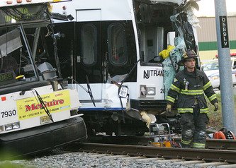
The River Line is a diesel light rail line in southern New Jersey, running along, except at its ends, what was previously the Bordentown Secondary, from Trenton to Camden, serving communities along the Delaware River between thee cities. This line is one of only two diesel light rail lines in North America, and the only one in the United States.
Baltimore
The Baltimore Light Rail is a single line reaching from BWI Airport south of Baltimore, through the city and north to a strip mall and office park. With 30 miles (48 km) of track, the line achieves a daily ridership of 24,500.
Major efforts toward the creation of the light rail were championed by then mayor William Donald Schaefer, who wanted a transit link to the new baseball park, Camden Yards, about to be built downtown. In order to have the line completed the month that the Baltimore Orioles started playing in Camden Yards, the system was built entirely without federal money, a rarity in late 20th century U.S. transit projects. Federal funds would later be used to double track the whole system, decreasing headways which had been restricted to 17 minutes.
The light rail line was built entirely at grade, even through downtown's narrow streets. Though the majority of the track's length is grade-separated from acquiring disused railroad rights-of-way, trains run in the streets in some portions downtown and must obey traffic lights there as well. The Maryland Transit Administration has drawn up plans for an additional four lines which may be light rail, bus rapid transit, or heavy rail to create a comprehensive city system. As of 2007, only the future of one line is certain. The Red Line, which is in its intermediate planning stages, would be an East-West link via either bus rapid transit or light rail. Whichever mode is selected, officials have insisted that the line be underground through the city center because of Baltimore's narrow streets and dense traffic.
Charlotte
Charlotte's LYNX system consists of a single 9.6-mile (15.4 km) line called the Blue Line. After receiving a positive Record of Decision from the Federal Transit Administration on May 19, 2003, continued preparation and land acquisition would finally result in its groundbreaking in spring 2005. The line is in full operation, at a projected final cost of $462.7 million. This price tag does not include indirect or ancillary costs such as rerouting water and sewer lines to accommodate the line, estimated at an additional $72 million as of April 2006.
The Blue Line's construction was part of a greater comprehensive transit network for the Charlotte region. 70.6 more miles of track are planned, though many of these may be Bus Rapid Transit or streetcar lin
Pittsburgh
Pittsburgh Light Rail
Pittsburgh's light rail network, commonly known as The T, is a 25-mile (40 km) light rail system in Pittsburgh, Pennsylvania; it functions as a subway in downtown Pittsburgh and largely as an at-grade light rail service in the suburbs. The system is owned and operated by the Port Authority of Allegheny County (PAT). It is the successor system to the far more extensive streetcar network formerly operated by Pittsburgh Railways.
The current lines, which run south from the downtown into the South Hills area, were formerly operated by PCC streetcars. Beginning in the 1980s PAT reconstructed the lines along the existing right-of-way and ordered new trams from Siemens. PCCs continued to operate in tandem with the new light rail vehicles until 1999 when the last five were retired from service. PAT also constructed a new subway line in the downtown, ending decades of street-running in the Golden Triangle. Current expansion plans include an extension from the downtown subway under the Allegheny River to connect with PNC Park and Heinz Field; the North Shore Connector is slated to open by 2011.
Buffalo
Buffalo's light rail line of only 6.6 miles (10.6 km) was to be a starter line in a much larger system. However with the declining population of the area, no expansions were sought. The small line still averages over 20,000 daily riders
[edit] Seattle
Seattle's Sound Transit light rail system consists of a 1.6-mile (2.6 km) line known as Tacoma Link. Extensions to the University of Washington are planned to begin operation in 2009. The initial phase, Link light rail in Tacoma, is already operational. Voters in the Sound Transit service area rejected a controversial plan to extend light rail and roads in a 2007 vote, but may approve a light rail-only extension on the ballot in 2008.
Light rail in Canada
A Calgary Transit Siemens-Duewag U2 LRV #2043, part of Calgary, Alberta's C-Train.
Canadian cities have much higher transit use than comparable U.S. cities. Toronto, Ontario (metropolitan population 5 million) has twice the transit ridership of comparable U.S. cities, while Calgary, Alberta and Edmonton, Alberta (metro population 1 million each) have riderships three times comparable U.S. cities. Most Canadian cities average 100-200 annual boardings per capita, whereas only the largest U.S. cities with subway and rapid transit systems (Chicago, San Francisco, Washington) exceed 100 boardings per capita. However, Canadian cities have significantly lower capital spending (less than US$60 per capita, versus US$50-$100 for American cities).[6] As a result of lower federal government funding, Canadian cities have to recover a much higher share of their costs out of operating revenues. This lack of federal funding may explain why there are only a few light rail systems in Canada, and why there are intense budget fights over building new ones.
Calgary
Despite the fact that Calgary, Alberta has a lower population density than the sprawling Denver, Colorado, the Calgary C-Train system is the most successful and busiest light rail system in North America, averaging about 250,000 riders per workday.[7][8]
The Calgary system was started in 1981 as the result of decisions to avoid building either downtown freeways or a heavy rail system. At that time, Calgary had less than half a million people and was considered too small for rail transit, but when it first opened the C-Train carried about 40,000 passengers per day. By 2007, Calgary was twice as big with 1 million people, but the C-Train system was over three times as long and carried over six times as many passengers.[7]
As of 2007 45% of the people working in downtown Calgary took transit to work, and the city's objective was to increase that to 60%.[9] The reason is that Calgary's downtown core covers only 1.4 square miles (3.6 km²), is isolated from the rest of the city by two rivers and a railway line, and was built with relatively narrow streets by North American standards. In the 1960s planners proposed a comprehensive freeway system to improve access, but this was rejected due to intense public opposition. However, subsequent growth exceeded expectations and by 2006, Calgary had become the second largest head office center in Canada, with 32,000,000 square feet (3,000,000 m²) of office space and 120,000 people working in the downtown core.[8] The downtown street system is at maximum capacity and has no room for traffic growth, but the city is confident it can add another 60,000 downtown workers in the next 20 years without making space for more cars.[9] Peak hour travel by LRT is equivalent to the capacity of about 16 free flow traffic lanes and allows the city to have fewer than 0.4 downtown parking places available per worker. [10]
Despite the downtown rush, 25% of the riders during rush hour are counterflow commuters - going out of downtown during the morning and into it during the afternoon. Many of these are students going to educational institutions, who receive deep discounts because they are filling seats that otherwise would be empty, and workers doing crosstown commutes to avoid the lack of freeways.[10] However, as of 2007, the C-Train is suffering growing pains. Because population growth has exceeded expectations and LRT ridership has outpaced population growth, Calgary has had trouble buying enough new LRT vehicles and hiring enough new drivers to meet the demand. As a result, many passengers experience lengthy train waits due to overcrowding.[7]
Despite funding problems resulting from lack of support from the provincial and federal governments, there are two extensions under construction. In November 2007, Calgary City Council approved another two further extensions on the two lines, to be completed by 2012. [11]
In addition, on November 20, 2007, Council gave final approval for the new West Leg of Calgary's LRT, which would be the system's fourth leg. Construction for the West leg will begin in 2009, with completion expected in 2012. When the new light rail vehicles ordered for the extension are finally delivered, the city will have a total of 223 LRVs.
Besides the ongoing program of extending all station platforms to 100 m to accommodate four-car trains, transportation planners have identified two additional lines to be constructed within the next 25 years. They are to the North-Central and South-East districts of the city. BRT service is in place along the future North-Central route, and is expected to begin on the South-East route within a year. Calgary will also one day have to place a tunnel in their downtown to accommodate one of these new lines, or a combination of lines, much like Edmonton has already done.
[edit] Edmonton
Main article: Edmonton Light Rail Transit
By contrast with Calgary, in Edmonton, Alberta the Edmonton Transit System built much of its light rail system underground, which meant that it could not afford to lay as much track to the suburbs. In addition, Edmonton's central business district has less office space and the single line which was built did not reach areas which housed many commuters to downtown. The system is successful by North American Standards, but not nearly as successful as Calgary's: it has attracted only a sixth of the ridership. Edmonton is building new extensions at grade that will extend to the TOD Century Park.
According to John Bakker, professor emeritus at the University of Alberta and one of the original designers of the system, going underground was a serious mistake. "Going into tunnels is about 10 times as expensive as going on the surface because you have to relocate utilities", said Mr Bakker. "Edmonton went into tunnels first, and it really bogged down everything thereafter, because they didn't have money". Edmonton's system is only 12 km long, while Calgary's light-rail system covered 42.1 km for about the same cost.[12] As a result, by 2006 Edmonton's LRT ridership was relatively static at 42,000 per day, while Calgary's was over 250,000 and growing rapidly. However, a 10 km South LRT expansion was underway, almost all of it at surface, and was expected to be completed by 2009.
[edit] Ottawa
The O-Train, Ottawa's light rail train system
In the 1970s and 1980s Ottawa, Ontario opted for grade-separated busways (the Ottawa Transitway) over light rail on the theory that buses were cheaper. In practice, the capital costs escalated from the original estimate of C$97 million to a final value of C$440 million, a cost overrun of about 450%.[13] This is nearly as high as Calgary's C-Train system, which had a capital cost of C$548 million, is about the same length, and carries more passengers.[14] Unfortunately, the Ottawa Transitway has reached capacity, with over 175 buses per hour on the downtown section, and has no cost-effective way to increase the volume.[15]
In 2001, to supplement its BRT system, Ottawa opened a diesel light rail pilot project, (the O-Train), which was relatively inexpensive to construct (C$21 million), due to its single-track route along a neglected freight-rail right of way and use of diesel multiple units (DMUs) to avoid the cost of building overhead lines along the tracks. O-Train has had some success in attracting new ridership to the system (a few thousand more riders), due to its connection of a south end big box shopping mall (South Keys), through Carleton University to the east-west busway (Ottawa Transitway) near the downtown core of the city.
Ottawa produced plans to expand both the Transitway and to open additional rail routes. The intention of the light rail project was to add to the system, not to replace the existing Transitway. However, in mid-December 2006, the new Ottawa city council voted to cancel the LRT system despite the fact that funding was already in place and contracts were already signed. As of 2008, lawsuits against the city of Ottawa over its canceled light rail system totaled over $280 million.[16] Examinations for discovery are expected to start in the fall, with the trial beginning in 2009. The trial is expected to be lengthy.[17]
Toronto
Main article: Transit City
LRT in Toronto is somewhat difficult to classify, since the city employs several forms of transit that may or may not be considered "light rail". The legacy streetcar system is still largely in place in the downtown area and is extensive in terms of routes and service intervals. Some lines even tie into integrated subway stations without the need for a transfer, and many traffic signals give priority to streetcars. However, the system as a whole is not normally considered true light rail because the mixed running with surface traffic slows travel considerably. Because of the differences in technology and speed, Canadian transportation planners do not usually classify historic streetcar systems as LRT, although they may technically qualify as such.[18] Two streetcar lines (Spadina/Harbourfront and St. Clair) have been recently rebuilt and come closer to meeting light rail standards as they run in dedicated rights-of-way. However, the largest vehicles used are articulated double streetcars which are much smaller than most LRT trains and these use trolley wheels rather than pantographs to collect electricity. Streetcar fares must also be paid upon boarding as with a local bus. Finally, the Scarborough RT was a demonstration project for elevated light rail that served as a prototype for Vancouver's SkyTrain and JFK's AirTrain). However, it does not meet the common definition of light rail either since it supplies electricity to the trains using two extra power rails (one at +300 VDC and the other at -300 VDC), uses linear induction motors acting on a metal plate between the tracks for propulsion, requires a fully grade-separated right-of-way, and has large stations that have much more in common with a heavy-rail metro. In Toronto it is usually mapped as part of the subway system.
All of the above is now under reconsideration as vehicles near the end of their lifespan and the future size and type of vehicle and trackway is contemplated. On March 16 2007, the Toronto Transit Commission announced a 120 Kilometre Light Rapid transit web throughout the city. This will be a 15 year project predicted to have 175 million-users by 2021. Funding has been announced at the municipal and provincial level, though not the federal. The plan has been released and can also be viewed at TransitCity.ca
Vancouver
In 1986, Vancouver, British Columbia built the Expo Line of the SkyTrain. It is the longest automated light rapid transit system in the world.[19] In addition to using driverless trains, it uses two energized power rails (one at +300 VDC and the other at -300 VDC) rather than overhead wires to supply electricity, making it unsafe to operate in the street or use level crossings. Since it is not conventional light rail it is often called an advanced light rapid transit or light metro system. The network, including the newer Millennium Line and extension, carries about 66 million passengers annually. Vancouver's two new lines under construction, the Canada Line and Evergreen Line, are planned to be grade-separated automated light transit and at-grade light rail, respectively. Additional extensions are planned for the Millennium Line mostly underground under Central Broadway to University of British Columbia. There is preliminary talk about extending the Expo Line (although its routing has not yet been determined).


Unsound Transit
