
Page 1
I-90 Two-Way Transit and
HOV Operations Project
Record of Decision
September 2004
Page 2
Page 3
Table of Contents
PROJECT PURPOSE..........................................................................................................1
FINAL ENVIRONMENTAL IMPACT STATEMENT ISSUED......................................1
SELECTED ALTERNATIVE R8-A...................................................................................1
DOES NOT RESTRICT MEANINGFUL CONSIDERATION OF OTHER
NEARBY REASONABLY FORESEEABLE IMPROVEMENTS WITH
INDEPENDENT UTILITY AND LOGICAL TERMINI...................................................1
ALTERNATIVES CONSIDERED IN THE FINAL EIS ...................................................1
BASIS FOR SELECTING THE ALTERNATIVE.............................................................2
Alternative R-1 (No Build)......................................................................................2
Alternative R-2B Modified (Two-Way Center HOV Lanes)..................................3
Alternative R-5 Restripe (Transit-only Shoulders on Outer Roadway)...................5
Alternative R-5 Modified (Transit-only Shoulders on Outer Roadway).................7
Selected Alternative R-8A (HOV on Outer Roadway) (Preferred
Alternative in the Final EIS)....................................................................................9
MEASURES TO MINIMIZE HARM...............................................................................12
Freeway Operations...............................................................................................12
Speed Management ..................................................................................12
Shoulder Rumble Strips............................................................................12
Enhanced Delineation and Signing ..........................................................12
Enhanced Illumination .............................................................................13
Enhanced Incident Management Program ...............................................13
Other Freeway Measures..........................................................................14
Surface Street Operations ......................................................................................14
Construction .............................................................................................14
Operation..................................................................................................14
Pedestrian/Bicycle Access.....................................................................................14
Visual Resources....................................................................................................16
Air Quality.............................................................................................................16
Noise......................................................................................................................17
Biological Resources .............................................................................................17
Water Resources ....................................................................................................18
Energy....................................................................................................................19
Geology and Soils..................................................................................................20
Public Services.......................................................................................................20
Utilities...................................................................................................................21
MONITORING AND ENFORCEMENT..........................................................................21
Federal....................................................................................................................21
Page 4
State........................................................................................................................21
Regional.................................................................................................................22
Local ......................................................................................................................22
APPENDIX A – COMMENTS RECEIVED ON THE FINAL EIS AND
RESPONSES .....................................................................................................................26
Page 5
1
Record of Decision
I-90 Two-Way Transit and
HOV Operations Project
Project Purpose
The purpose of the project is to improve regional mobility by providing reliable and safe
two-way transit and high-occupancy vehicle (HOV) operations on Interstate 90 (I-90)
between Bellevue and Seattle, while minimizing impacts to the environment and to other
users and transportation modes.
Final Environmental Impact Statement Issued
These improvements are described in the final environmental impact statement (FEIS),
FHWA-WA-EIS-03-01-F, approved on April 27, 2004 and issued on May 21, 2004. The
Notice of Availability appeared in the Federal Register on May 21, 2004.
Selected Alternative R8-A
Alternative R-8A, as described in this Record of Decision (ROD), was designated as the
preferred alternative in the FEIS and is the Selected Alternative in this ROD.
Alternative R-8A is described below with all of the alternatives considered in the Final
EIS.
Does Not Restrict Meaningful Consideration of Other Nearby
Reasonably Foreseeable Improvements With Independent Utility and
Logical Termini
The proposed improvements allow for future improvements to I-90 which may include
the future placement of high capacity transit (HCT) in the center roadway. HCT use of
the center roadway would be evaluated in a separate NEPA/SEPA environmental process,
as appropriate.
Alternatives Considered in the Final EIS
The FEIS examined the following alternatives:
• The No Build Alternative R-1
• Alternative R-2B Modified (Two-Way Center HOV Lanes)
• Alternative R-5 Restripe (Transit-only Shoulders on Outer Roadway)
• Alternative R-5 Modified (Transit-only Shoulders on Outer Roadway)
• Alternative R-8A (HOV Lanes on Outer Roadway)
Page 6
2
Basis for Selecting the Alternative
Alternative R-1 (No Build)
With the No Build Alternative R-1, the existing I-90 roadway would remain the same
with a reversible two-lane center roadway providing HOV and transit lanes in the peak
direction only, westbound in the AM and eastbound in the PM. No environmental
impacts related to the I-90 Two-Way Transit and HOV Operations Project would occur,
and costs associated with the project would not be spent.
Short-term minor construction necessary for continued operation of the existing roadway
facility would be accomplished, and minor safety improvements could be constructed as
required.
Operational revisions to the center roadway would likely be required by 2010 in order to
maintain a minimum of 45 miles-per-hour in travel speed for transit and other HOV
traffic in the center roadway. These revisions could include restricting the use of the
center roadway to high-occupant vehicle (HOV) traffic, which would displace single-
occupant vehicles (SOVs) traveling between Seattle and Mercer Island to the outer
roadways, and/or a change in the HOV eligibility requirement from a two-person
minimum to a three- or more person minimum per vehicle.
Alternative R-1 was not chosen as the selected alternative because:
• The No Build Alternative does not meet the project purpose and need, as it does
not provide two-way transit or HOV operations, or reliable transit service in the
reverse-peak direction in future years.
• The existing outer roadways consist of three general purpose lanes. Alternative R-
8A would add one HOV lane in each direction in the outer roadway. These new
HOV lanes would not be added with the No Build Alternative.
Alternative R-1 does not improve regional mobility:
• The No Build Alternative was found to have the lowest transit ridership in both
peak and reverse-peak directions during the peak period of years 2005 and 2025
• The No Build Alternative would not improve transit reliability in the reverse-peak
direction in 2005. Reliability would continue to worsen by year 2025.
• In 2005, the No Build Alternative would have transit travel times of 2 to 3 minutes
longer than the selected alternative, and 5 minutes longer travel time by year 2025.
• The No Build Alternative would have lower carpool usage than the selected
alternative in both years 2005 and 2025.
Alternative R-1 does not minimize impacts to other users and transportation modes:
• For other freeway users, the No Build Alternative would result in travel times of
10.1 to 13.7 minutes (depending upon the direction) as compared to travel times of
8.4 to 9.0 minutes with the selected alternative.
Page 7
3
• The No Build Alternative would result in approximately 8 hours of congestion for
peak direction traffic and approximately 10 hours of congestion for reverse-peak
direction traffic (same as with Alternatives R-5 Restripe and R-5 Modified). In
comparison, the selected alternative would reduce the hours of congestion to less
than 2 hours in the peak direction and two to three hours in the reverse-peak
direction.
• In year 2005, the No Build Alternative would result in 39,700 hours of travel time
for freeway users, increasing to 73,000 hours by year 2025 (same as with
Alternatives R-5 Restrpe and R-5 Modified). In comparison, the travel time for
freeway users with the selected alternative would be 15% less (33,600 hours) in
year 2005, and 32% less (46,900 hours) in year 2025.
• In year 2025, the No Build Alternative would cause the greatest time delays for
people traveling on transit. Transit riders during both the AM and PM peak
periods would experience an average weekday delay per person of 2.7 minutes as
compared to 0.4 minutes with the selected alternative.
• For persons traveling in vanpools or carpools, the No Build Alternative would
result in 1.7 minutes of delay in 2005 as compared to 1.2 minutes with the selected
alternative, and 4.8 minutes in 2025 as compared to 0.8 minute with the selected
alternative (same as with Alternatives R-5 Restripe and R-5 Modified).
• For persons traveling in the general purpose lanes, the No Build Alternative would
result in 9.6 minutes of delay (same as with Alternatives R-5 Restrpe and R-5
Modified) as compared to 8.0 minutes with the selected alternative.
Consistency With Regional Transportation Plans
• Because Alternative R-1 would not provide any benefit to carpool operations or
improve the attractiveness of higher occupancy modes compared to driving alone,
nor increase HOV usage, Alternative R-1 would not be consistent with the
objectives of the Metropolitan Transportation Plan, Sound Move, The Commute
Trip Reduction Act, Washington State Growth Management Act, and other
transportation and growth management policies of local and regional jurisdictions.
Alternative R-2B Modified (Two-Way Center HOV Lanes)
Alternative R-2B would convert the I-90 center roadway to two-way operation by adding
a concrete barrier, providing one travel lane in each direction. The center roadway would
be restricted to transit and carpools, and HOV eligibility requirements would likely be
changed from 2+ to 3+ by 2025. Two additional HOV direct access ramps would be built
on Mercer Island at 77
th
and 80
th
Avenues, and the Bellevue Way HOV direct access
ramp would be converted to two-way operation.
Under Alternative R-2B, transit riders and carpoolers traveling in the peak directions
would experience increases in delay in 2005. Poor levels of service would persist on the
other roadways for traffic operations in the peak directions of travel both in 2005 and
2025, and congestion levels would increase.
Page 8
4
Center lane closures would be necessary to allow access to the Homer M Hadley (HMH)
floating bridge pontoons for maintenance, which would limit access to the pontoons to
off-peak hours and increase the cost of routine maintenance. Responses to alarms in the
pontoons would require an emergency closure of the westbound center roadway, resulting
in increased maintenance costs, and decreased reliability of the westbound center
roadway for transit and HOV traffic.
Alternative R-2B Modified was not chosen as the selected alternative because:
• The existing outer roadways consist of three general purpose lanes. Alternative
R-8A would add one HOV lane in each direction in the outer roadway. These
new HOV lanes would not be added with Alternative R-2B Modified.
Alternative R-2B does not improve regional mobility:
• In years 2005 and 2025, transit ridership during peak periods in the peak
directions would be the same as for the selected alternative, however by year 2025
transit ridership during off-peak periods would be less than with the selected
alternative.
• Transit reliability in the peak direction would be the same as the other alternatives
with HOV 3+ use of the center roadway, however it would be worse than the
other alternatives with continued HOV 2+ use of the center roadway.
• Alternative R-2B would result in the longest travel times for transit in the peak
direction in years 2005 and 2025.
• Alternative R-2B would increase carpool usage in the westbound direction
(reverse-peak) during the PM peak period in year 2025; however there would be a
decrease in eastbound usage during the PM peak period in year 2025.
Alternative R-2B does not minimize impacts to other users and transportation modes:
• For other freeway users in years 2005 and 2025, Alternative R-2B would result in
the longest travel time in the reverse-peak direction of all alternatives.
• Alternative R-2B would result in the longest period of congestion in the peak
direction in year 2005 of all alternatives and approximately 10 hours of
congestion for reverse-peak direction traffic (same as with the No Build
Alternative and Alternatives R-5 Restripe and R-5 Modified). In comparison, the
selected alternative would reduce the hours of congestion to less than 2 hours in
the peak direction and two to three hours in the reverse-peak direction.
• Alternative R-2B would cause the greatest person hours of travel as compared to
all of the other alternatives. With 42,700 hours of travel in year 2005 and 81,700
hours of travel in year 2025, these numbers would be 8% and 12% greater than
the No Build Alternative and Alternatives R-5 Restripe and R-5 Modified, and
higher than the selected alternative by 27% in year 2005 and 74% in year 2025.
• In year 2005, the Alternative R-2B would cause the greatest time delays for
people traveling on transit (2 minutes) as compared to 0.3 minute with the
selected alternative.
Page 9
5
• For persons traveling in vanpools or carpools, Alternative R-2B would result in
the greatest amount of delay in 2005 of all alternatives (2.1 minutes) as compared
to 1.2 minutes with the selected alternative, and 2.5 minutes in 2025 as compared
to 0.8 minute with the selected alternative.
• For persons traveling in the general purpose lanes, Alternative R-2B would result
in the greatest delay of all alternatives (9.7 minutes) as compared to 9.6 minutes
for the No Build Alternative and Alternatives R-5 Restripe and R-5 Modified, and
8.0 minutes with the selected alternative.
Consistency With Regional Transportation Plans
• Alternative R-2B would be consistent with the objectives of the Metropolitan
Transportation Plan, Sound Move, The Commute Trip Reduction Act,
Washington State Growth Management Act, and other transportation and growth
management policies of local and regional jurisdictions.
Alternative R-5 Restripe (Transit-only Shoulders on Outer Roadway)
With Alternative R-5 Restripe, reversible operation would be retained in the center
roadway, with both lanes operating in the same direction. On the outer roadways, lane
and inside shoulder widths would be narrowed, and transit-only shoulder lanes would be
created on the outside shoulders. Transit-only lanes would operate eastbound during the
morning peak period and westbound during the afternoon peak period. Poor level of
service (LOS) would persist in the outer roadways in both directions of travel.
With the wider westbound outside shoulder, traffic on the HMH floating bridge would be
shifted two feet further away from the shared-use pathway, except that transit buses
would operate on the transit shoulder adjacent to the pathway during the PM peak period,
requiring a higher railing separating the pathway from the adjacent roadway. During
construction, temporary closure of the shared-use pathway on the bridge could be
required to allow for the required railing modifications and work on the adjacent
westbound lane and shoulder.
Alternative R-5 Restripe was not chosen as the selected alternative because:
• The existing outer roadways consist of three general purpose lanes. Alternative
R-8A would add one HOV lane in each direction in the outer roadway. These
new HOV lanes would not be added with Alternative R-5 Restripe; instead
transit-only shoulder lanes would be created for transit use during peak periods.
Alternative R-5 Restripe does not improve regional mobility:
• In year 2005, transit ridership during peak and off-peak periods would be the
same as for the selected alternative, however by year 2025, transit ridership in the
reverse-peak direction during peak periods and in both directions during off-peak
periods would be less than with the selected alternative.
Page 10
6
• Transit reliability in years 2005 and 2025 would be improved as compared to the
No Build Alternative, however there would be no improvement over reliability
measures for the selected alternative.
• Alternative R-5 Restripe would not improve travel times for transit in the peak or
reverse-peak direction in year 2005, and would have travel times in year 2025 of
2 to 3 minutes longer than with the selected alternative.
• Alternative R-5 Restripe would not provide any benefit to carpool operations or
improve the attractiveness of higher occupancy modes compared to driving alone.
• Alternative R-5 Restripe was found to be no different from existing conditions for
HOV usage in 2005 and 2025.
Alternative R-5 Restrpe does not minimize impacts to other users and transportation
modes:
• For other freeway users, the Alternative R-5 Restripe would result in travel time
of 10.1 to 13.7 minutes (depending upon the direction) (same as No Build and
Alternative R-5 Modified) as compared to travel times of 8.4 to 9.0 minutes with
the selected alternative.
• Alternative R-5 Restripe would result in approximately 8 hours of congestion for
peak direction traffic and approximately 10 hours of congestion for reverse-peak
direction traffic (same as with the No Build Alternative and Alternative R-5
Modified). In comparison, the selected alternative would reduce the hours of
congestion to less than 2 hours in the peak direction and two to three hours in the
reverse-peak direction.
• In year 2005, Alternative R-5 Restripe would result in 39,700 hours of travel time
for freeway users, increasing to 73,000 hours by year 2025 (same as with the No
Build Alternative and Alternative R-5 Modified). In comparison, the travel time
for freeway users with the selected alternative would be 15% less (33,600 hours)
in year 2005, and 32% less (46,900 hours) in year 2025.
• In year 2005, Alternative R-5 Restripe would cause delays to people traveling on
transit of 1 minute (same as the No Build Alternative) as compared to 0.3 minute
with the selected alternative. In year 2025, the delay would be 0.7 minute as
compared to 0.3 minute with the selected alternative.
• For persons traveling in vanpools or carpools, Alternative R-5 Restrpe would
result in 1.7 minutes of delay in 2005 as compared to 1.2 minutes with the
selected alternative, and 4.8 minutes in 2025 as compared to 0.8 minute with the
selected alternative (same as with the No Build Alternative and Alternative R-5
Modified).
• For persons traveling in the general purpose lanes, Alternative R-5 Restrpe would
result in 9.6 minutes of delay (same as with the No Build Alternative and
Alternative R-5 Modified) as compared to 8.0 minutes with the selected
alternative.
Page 11
7
Consistency With Regional Transportation Plans
• Because Alternative R-5 Restripe would not provide any benefit to carpool
operations or improve the attractiveness of higher occupancy modes compared to
driving alone, nor increase HOV usage, Alternative R-5 Restripe would not be
consistent with the objectives of the Metropolitan Transportation Plan, Sound
Move, The Commute Trip Reduction Act, Washington State Growth Management
Act, and other transportation and growth management policies of local and
regional jurisdictions.
Alternative R-5 Modified (Transit-only Shoulders on Outer Roadway)
Alternative R-5 Modified would retain reversible operation in the center roadway.
Portions of the I-90 outer roadways would be widened to allow for a wider inside
shoulder for westbound buses. One new transit-only direct access ramp would be
constructed at 80
th
Avenue SE on Mercer Island, and the existing HOV direct access
ramp at Bellevue Way would be converted to two-way operation.
Poor LOS would persist in the outer roadways in both directions of travel.
On the HMH floating bridge, with reductions of the westbound outside shoulder width,
traffic would operate closer to the shared-use pathway; however, this would be partially
mitigated through the addition of screening on the top of the barrier separating pathway
users from traffic. During construction, temporary closure of the shared-use pathway on
the bridge may occur.
The westbound outside shoulder in the westbound Mount Baker Ridge tunnel, on the
HMH floating bridge, and inside the First Hill lid would be reduced in width; therefore,
some routine maintenance operations would require closure of the adjacent travel lane.
Alternative R-5 Modified was not chosen as the selected alternative because:
• The existing outer roadways consist of three general purpose lanes. Alternative
R-8A would add one HOV lane in each direction in the outer roadway. These
new HOV lanes would not be added with Alternative R-5 Modified; instead
transit-only shoulder lanes would be created for transit use. Westbound buses
would operate on the inside shoulder and eastbound buses would operate on the
outside shoulder.
Alternative R-5 Modified does not improve regional mobility:
• In year 2005, transit ridership during peak and off-peak periods would be the
same as for the selected alternative, however by year 2025, transit ridership in the
reverse-peak direction during peak periods and in both directions during off-peak
periods would be less than with the selected alternative.
Page 12
8
• Transit reliability in years 2005 and 2025 would be improved as compared to the
No Build Alternative, however there would be no improvement over reliability
measures for the selected alternative.
• Alternative R-5 Modified would not improve travel times for transit in the peak or
reverse-peak direction in year 2005, and would have travel times in year 2025 of
2 to 3 minutes longer than with the selected alternative.
• Alternative R-5 Modified would not provide any benefit to carpool operations or
improve the attractiveness of transit travel and other higher occupancy modes
compared to driving alone.
• Alternative R-5 Modified was found to be no different from existing conditions
for HOV usage in 2005 and 2025.
Alternative R-5 Modified does not minimize impacts to other users and transportation
modes:
• For other freeway users, the Alternative R-5 Modified would result in travel time
of 10.1 to 13.7 minutes (depending upon the direction) (same as No Build and
Alternative R-5 Restripe) as compared to travel times of 8.4 to 9.0 minutes with
the selected alternative.
• Alternative R-5 Modified would result in approximately 8 hours of congestion for
peak direction traffic and approximately 10 hours of congestion for reverse-peak
direction traffic (same as with the No Build Alternative and Alternative R-5
Restripe). In comparison, the selected alternative would reduce the hours of
congestion to less than 2 hours in the peak direction and two to three hours in the
reverse-peak direction.
• In year 2005, Alternative R-5 Modified would result in 39,700 hours of travel
time for freeway users, increasing to 73,000 hours by year 2025 (same as with the
No Build Alternative and Alternative R-5 Restripe). In comparison, the travel
time for freeway users with the selected alternative would be 15% less (33,600
hours) in year 2005, and 32% less (46,900 hours) in year 2025.
• In year 2005, Alternative R-5 Modified would cause delays to people traveling on
transit of 0.7 minute as compared to 0.3 minute with the selected alternative. In
year 2025, the delay would be 0.6 minute as compared to 0.3 minute with the
selected alternative.
• For persons traveling in vanpools or carpools, Alternative R-5 Modified would
result in 1.7 minutes of delay in 2005 as compared to 1.2 minutes with the
selected alternative, and 4.8 minutes in 2025 as compared to 0.8 minute with the
selected alternative (same as with the No Build Alternative and Alternative R-5
Restrpe).
• For persons traveling in the general purpose lanes, Alternative R-5 Modified
would result in 9.6 minutes of delay (same as with the No Build Alternative and
Alternative R-5 Restripe) as compared to 8.0 minutes with the selected
alternative.
Page 13
9
Consistency With Regional Transportation Plans
• Because Alternative R-5 Modified would not provide any benefit to carpool
operations or improve the attractiveness of higher occupancy modes compared to
driving alone, nor increase HOV usage, Alternative R-5 Modified would not be
consistent with the objectives of the Metropolitan Transportation Plan, Sound
Move, The Commute Trip Reduction Act, Washington State Growth Management
Act, and other transportation and growth management policies of local and
regional jurisdictions.
Selected Alternative R-8A (HOV on Outer Roadway) (Preferred Alternative in the
Final EIS)
Alternative R-8A will provide HOV lanes on the outer roadways. It will retain the
existing reversible operations on the center roadway, with both lanes operating in the
same direction, westbound in the AM and eastbound in the PM. SOVs will only be
allowed to use the center roadway between Rainier Avenue in Seattle and Island Crest
Way on Mercer Island. The center and outer roadway HOV lanes will likely operate with
a 2 + occupants per vehicle restriction
The outer roadways will be modified by restriping and, where feasible, widening the
outer roadways within existing right-of-way to provide one additional travel lane in both
directions on I-90 between I-5 and Bellevue Way. Between Raininer Avenue and
Bellevue Way, this lane will be for the exclusive use of HOV traffic. New HOV direct
access exit ramps will be constructed for eastbound outer roadway HOV traffic at 77th
Avenue SE and for westbound outer roadway HOV traffic at 80th Avenue SE on Mercer
Island. The existing HOV ramp connecting the I-90 center roadway to Bellevue Way
will be modified to provide an HOV-only entrance ramp connection to the westbound
outer roadway HOV lane. The existing HOV ramp connecting the I-90 center roadway to
I-405 will be modified to provide access to this ramp from the eastbound outer roadway
HOV lane.
Levels of service would improve in the outer roadways in both directions, lowering
overall levels of congestion, although queues and delays at the system interchanges
would increase. Shoulder width reductions in the corridor will require closure of adjacent
travel lanes for some routine maintenance operations.
Flammable cargoes may be prohibited from the I-90 tunnels and if prohibited, would be
required to use other regional routes. The prohibition of flammable cargoes in the I-90
tunnels and lids requires consideration of both the frequency of occurrence and the
consequences of crashes involving flammable cargo. WSDOT, in an attempt to allow the
continued use of the I-90 tunnels and lids by trucks carrying flammable cargo, is
committed to further study of the issues associated with the movement of flammable
cargo and the means of managing risks associated with the movement of these cargoes in
the I-90 tunnels and lids.
Page 14
10
A follow up study to the analysis included in the EIS is currently underway to assess the
consequences of a crash resulting in a fire within the I-90 tunnels and lids. The study will
evaluate the performance of the existing ventilation and fire suppression systems and
emergency response plans (ingress/egress) in the event of a fire. The study will identify
system enhancements and /or modifications that may be required to manage the risks
associated with the movement of flammable cargos within the I-90 tunnels and lids.
WSDOT is committed to the implementation of all necessary enhancements and
modifications prior to implementing the selected R-8A operations and allowing the
continued use of trucks carrying flammable cargo within the I-90 tunnels and lids. It is
estimated that this study and the subsequent decision-making process will be completed
in early 2005.
WSDOT’s intent is for flammable cargo to remain on I-90. Before a policy decision is
made as to whether flammable and/or hazardous cargo should be prohibited on I-90 in the
tunnels and lids, a public participation process would be implemented as outlined in the
Code of Federal Regulations (CFR), Title 49 -- Transportation, part 397 --
Transportation of Hazardous Materials; Driving and Parking Rules, Subpart C --
Routing of Non-Radioactive Hazardous Materials, Section 71 Federal Standards
(49CFR397.71), which states that prior to the establishment of a change in flammable or
hazardous route designation, WSDOT shall provide public notification and a 30-day
period in which to comment. If a public hearing is determined to be necessary, the public
shall be notified 30 days in advance of the hearing date.
Construction of Alternative R-8A will involve temporary closures of the portion of the
shared-use pathway on the Homer M. Hadley Floating Bridge to allow for railing
replacement, and for work on the adjacent westbound travel lanes and shoulders. On the
floating bridge, westbound outer roadway, traffic will be located closer to the shared-use
pathway when compared to existing conditions, due to the reduction in width of the outer
roadway right-side shoulder. The addition of screening on the top of the existing
concrete traffic barrier separating bicycle and pedestrian users of the pathway from
westbound I-90 traffic would partially mitigate this impact
.
Alternative R-8A was chosen as the selected alternative because:
• Alternative R-8A best meets the purpose of the project, which is to improve
regional mobility by providing reliable and safe two-way transit and HOV
operations on I-90 between Bellevue and Seattle, while minimizing impacts to the
environment and to other users and transportation modes.
• Alternative R-8A would accommodate the ultimate configuration of I-90 (High
Capacity Transit in the center lanes). Alternative R-8A adds HOV lanes on the
outer roadways which would provide for reliable transit and HOV operations with
the ultimate roadway configuration.
Alternative R-8A best improves regional mobility by providing reliable and safe two-way
transit and HOV operations as measured by the following criteria:
Page 15
11
• In year 2005, Alternative R-8A would result in the lowest travel times for transit
in the reverse-peak direction (6 – 7 minutes as compared to 8 minutes for
Alternative R-2B and 9 minutes for the No Action Alternative and Alternatives R-
5 Restripe and R-5 Modified. In year 2025, Alternative R-8A would result in
travel times of 7 minutes in the reverse-peak direction (same as R-2B), 5 minutes
less than the No Build Alternative (12 minutes), and 2 -3 minutes less than
Alternatives R-5 Restripe and R-5 Modified. The lower travel times for transit
with Alternative R-8A result in the best improvements in transit reliability in the
reverse-peak direction.
• In the peak periods, transit ridership would be improved with Alternative R-8A as
compared to the No Build Alternative to the same levels as predicted with
Alternative R-2B, and greater than Alternatives R-5 Restripe and R-5 Modified.
In the off-peak periods, for year 2025, transit ridership is predicted to be greatest
with Alternative R-8A.
• HOV usage is predicted to be the highest with Alternative R-8A for both year
2005 and year 2025.
Among the alternatives, Alternative R-8A has the greatest effect in minimizing impacts
to other users and transportation modes and would greatly improve conditions as
compared to the No Build Alternative:
• For other freeway users, Alternative R-8A is predicted to result in the lowest
travel times for both the AM and PM peak periods.
• Alternative R-8A would reduce the existing approximately 8 hours of congestion
to less than 2 hours (remaining at less than 2 hours by year 2025), unlike the other
alternatives which maintain or increase hours of congestion as compared to the
No Build Alternative.
• Alternative R-8A would have the greatest reduction in person hours of travel of
all alternatives, a reduction of 15% in year 2005 and 32% in year 2025 as
compared to the No Build Alternative.
• Alternative R-8A would reduce the delay for persons traveling on transit by the
greatest percentage as compared to all alternatives.
• Alternative R-8A would have the lowest delay for persons traveling in the general
purpose lanes of all alternatives.
Consistency With Regional Transportation Plans
• Alternative R-8A would be consistent with the objectives of the Metropolitan
Transportation Plan, The Commute Trip Reduction Act, Washington State
Growth Management Act, and other transportation and growth management
policies of local and regional jurisdictions.
• Sound Move provides for two-way transit operations in the center roadway on the
I-90 bridge between Bellevue and Seattle, similar to the alternative described as
Alternative R2-B. The preferred alternative, Alternative R8-A, differs from the
design proposed in Sound Move in that it would place the transit lanes on the
Page 16
12
outer roadway instead of in the center roadway. Sound Move permits necessary
design modifications such as this under certain circumstances, including
infeasibility and/or impracticality. The reasons supporting the proposed design
include the unacceptability of Alternative R2-B to certain signatories to the 1976
Memorandum Agreement and the center roadway design which would degrade,
rather than improve transit operations. Following the selection of Alternative
R8-A as the proposal to be constructed for this project, the Sound Transit Board
approved the necessary documentation to support the design modification.
Measures to Minimize Harm
The following is a list of project mitigation measures that will be implemented. As
noted below, alternative measures for speed management, delineation and signing, and
enhanced illumination at enforcement/refuge areas require further study as part of final
roadway design. The most effective and feasible solution will be selected for the
alternative measures. The selection criteria will include, but not be limited to, safety
benefits, operational effectiveness and cost.
Freeway Operations
The following project elements are designed to minimize the impacts associated with
operation of Alternative R-8A.
Speed Management
Variable speed limits will be implemented on I-90 between Seattle and Bellevue, pending
further study of the specifics of implementation of variable speed limits in the I-90
corridor. These studies will include development and evaluation of system options and
functions to be addressed by the system (e.g. changing speed limits in response to
congestion, incidents, weather, etc.) and will consider operational, enforcement,
institutional, and legal issues. If variable speed limits are not implemented, other speed
management measures, such as reduced speed limits and/or speed advisory signing, will
be implemented.
Shoulder Rumble Strips
Rumble strips will be provided to mitigate the effects of non-standard lane and shoulder
widths. The rumble strips will be implemented using profiled edge lines, due to the extent
of I-90 roadways carried on structures, where ground-in rumble strips would not be
desirable.
Enhanced Delineation and Signing
Lane visibility will be enhanced by replacing existing painted edge lines and other lane
markings throughout the corridor with profiled edge lines and other enhancements to
existing pavement markings.
Page 17
13
The latter could include enhancements to lane visibility in the I-90 lids and tunnels by
using illuminated pavement markers. The feasibility of installing illuminated pavement
markers in the lids and tunnels will be investigated further as a part of final design,
including consideration of trade-offs with potential tunnel lighting enhancements.
Additional roadway visibility enhancements within the lids and tunnels could include use
of a linear delineation system attached to the face of the traffic barrier in locations where
shoulders are of less than standard width. One example of a linear delineation system that
could be used consists of aluminum panels 6-inches high by 30-inches long that are
laminated with reflective sheeting and crimped in a sharp “wave” shape. The feasibility
and specific types and application of linear delineation will be investigated as part of final
design.
Existing signs will be replaced or refaced as required to meet current standards for
reflectivity and to provide improved legibility for older motorists. The final design will
include a survey of existing signs to determine which signs should be replaced or refaced.
Additional illuminated guide signs westbound in the Mount Baker Ridge lid could give
motorists more time to change lanes for the Rainier Avenue South and I-5 exits. The
feasibility of illuminated guide signs to supplement existing signage in this and other
locations within the tunnels and lids in the corridor will be investigated as part of final
design.
The feasibility of adding new or supplementing existing variable message signs will be
investigated, including a survey of existing variable or dynamic message signs to
determine the need for new or supplemental signs.
Enhanced Illumination
The feasibility of providing roadway illumination enhancements at enforcement/refuge
areas and areas with reduced shoulder widths adjacent to general purpose traffic will be
considered during final design.
Enhancements to existing tunnel lighting systems will be investigated.
Enhanced Incident Management Program
Enhanced incident management will be provided on I-90 in the portions of the corridor
with restricted shoulder widths. These areas include the Mount Baker Ridge tunnels and
lid, the floating bridges, the First Hill lid, and the Mercer Island Central Business District.
The focus of the increased service would be on the outer roadways.
Barrier gates could be used on the HMH floating bridge where access is limited by the
available bridge deck width and the feasible limits on deck widening. Final design will
include consideration of barrier gates as a part of the development of enhanced incident
management provisions.
Page 18
14
Other Freeway Measures
An existing auxiliary lane on eastbound I-90 at the I-405 off-ramp will be extended west
towards the Bellevue Way SE off-ramp. The limits of the auxiliary lane extension will be
determined during final design.
Surface Street Operations
Construction
During construction, information will be distributed to provide drivers with advance
notice of road closures and detours. Detour signs will be erected during road closures.
WSDOT will specify in the construction documents specific dates, times and/or locations
when or where construction activities will be prohibited.
During construction of the ramps at both 77th and 80th Avenues SE, road closures will
not occur on 77th Avenue SE and 80th Avenue SE at the same time. This will ensure
that access to the Mercer Island CBD is not adversely impacted.
Operation
A warrant analysis will be performed to determine if installing a traffic signal at the
intersection of East Mercer Way and the I-90 westbound on/off ramp would meet warrant
criteria. If the location meets traffic signal warrants, the project will include installation
of a traffic signal at this location to prevent I-90 westbound off-ramp queues from
backing up onto the mainline. With a signal in place, the intersection would operate at
LOS B during the 2025 PM peak hour, and the off-ramp would have sufficient capacity
for westbound queues.
The westbound approach at the unsignalized intersection of 76th Avenue SE/I-90
westbound on-ramp/North Mercer Way will be changed to a left turn lane and a shared
right and through lane. This improvement, which will only require re-striping of the
westbound approach, will improve the AM peak period levels of service from LOS E to
LOS B.
An evaluation of the physical roadway area, operational improvements, and funding
alternatives will be performed on the feasibility of adding a southbound HOV lane
through the intersection of Bellevue Way SE/112th Avenue SE/Bellevue Park-and-Ride.
During PM peak period conditions, delay is forecasted to increase compared to
Alternative R-1 conditions due to increased southbound volumes on Bellevue Way SE.
Adding a southbound HOV lane through the intersection south to I-90 would divert 340
vehicles from the general purpose lanes during the peak hour, and would reduce
intersection delay relative to No Build conditions.
Pedestrian/Bicycle Access
If construction activities on the HMH floating bridge require temporary closure of the
shared-use pathway, shuttle service will be provided for pedestrian and bicycle users of
Page 19
15
the shared-use pathway on the HMH floating bridge. Shuttles could be provided on
existing buses, deadheading buses, or with dedicated vehicles.
In addition, a shared-use pathway detour route could be provided on the I-90 center or
eastbound roadways. This route could supplement the dedicated shuttle service to
accommodate weekend recreational traffic, or could be in lieu of a shuttle. The need for
and feasibility of detour route provisions will be evaluated during final design, including
consultation with representatives of shared-use pathway user groups.
To reduce the proximity impact of westbound auto and truck traffic operating closer to
the shared-use pathway, screening will be provided on top of the 32-inch high traffic
barrier. The impacts to be mitigated by screening are noted below.
• Wind buffeting due to passing traffic and/or gusting winds.
• Improved protection from roadway debris for bicyclists.
• Glare from on-coming traffic (present under existing conditions for westbound
bicyclists in the winter months, but would be worsened with a reduced westbound
outer roadway shoulder width).
The design of screening will include consideration of trade-offs between:
• Wind loads on the floating bridge,
• Maintenance issues including access for bridge inspection
• Safety and security issues for shared-use pathway users
• Reductions in access to the shared-use pathway as a refuge for motorists with
disabled vehicles, and
• Aesthetic concerns including views from the shared-use pathway and from the
adjacent roadway.
The addition of screening will decrease the effective width of the shared-use pathway.
To mitigate this operational issue, rub rails will be installed on the railings on both sides
of the pathway, or incorporated into the potential screening on the traffic barrier. Rub
rails will reduce the potential for a cyclist to snag a bicycle handlebar in the balusters of
the existing railing and the type “BP” railing, and will allow cyclists to ride closer to the
railings.
Trade-offs involving screening and rub rails will be evaluated during subsequent design
phases of the Project, including consultation with representatives of shared-use pathway
user groups.
Page 20
16
Visual Resources
Night lighting resulting in glare or light spillover impacts will be kept to a minimum;
however, night construction will be required to minimize impacts to roadway users.
Vegetation, including trees, will be preserved or restored where feasible after
construction. Mitigation areas for vegetation that cannot be preserved or restored will
consist of additional plantings to enhance existing landscaped areas within the I-90
corridor between I-5 and I-405.
I-90 Architectural Design Standards (WSDOT, Revised Edition, December 1986) will be
followed for all visual elements including walls and bridge structures, exposed concrete
texture and color, lighting, and signing.
Restoration of roadside functions such as guidance and navigation, screening, and
roadway buffering will be done in accordance with the WSDOT Roadside Manual where
these functions would be affected by the Project.
Air Quality
The following controls will be implemented to mitigate air quality impacts where
applicable to the specific construction location and activity:
• Control dust emissions by using measures such as spraying water or other dust
suppressant on bare surfaces and covering any soils that may need to be
transported to, from, and within the construction area.
• Cover soil/materials during transport to minimize wind-borne particulate
emissions.
• Minimize the size of the construction area, cover exposed soil and re-vegetate
disrupted areas as soon as possible.
• Construct wind barriers to reduce wind velocity over exposed earth.
• Restrict the speed of construction vehicles when operating in areas of exposed
earth.
• Use wheel washers to remove mud from construction vehicles prior to exiting site
(reduce the potential emissions from re-entrained particulate matter).
• Clean road surfaces regularly to reduce re-entrained particulate matter.
• Locate construction equipment away from sensitive populations and building air
intakes. Locate truck/equipment staging zones to minimize impacts to the public,
especially the elderly and the very young.
Page 21
17
Noise
Construction activities will include the construction industry’s best management practices
to reduce construction noise at nearby receptors along I-90. Construction activities will
comply with local construction noise regulations. Construction mitigation will be
incorporated into construction plans and contractor specifications in the construction
contract. The following construction noise mitigation measures will be implemented.
• Engines of construction equipment will be equipped with adequate mufflers,
intake silencers, or engine enclosures.
• The quietest equipment available will be used where feasible.
• Construction equipment will be turned off during prolonged periods of nonuse.
• Contractors will be required to maintain all equipment and train their equipment
operators.
• Stationary equipment will be located away from receiving properties where
feasible.
• Where stationary equipment must be located close to residences, temporary noise
barriers or curtains will be constructed around the equipment to decrease noise
levels at the nearby sensitive receptors.
Biological Resources
Replacement of the outfall in Mercer Slough may be required. If replacement is required,
there is a potential for short-term disturbances to wetlands during in-water construction
activities. Construction will be conducted during the appropriate in-water work window
for the Mercer Slough. The work window for the Mercer Slough is generally between
July 16 and September 1, and
will
be established by WDFW. All work
will
be completed
over one construction season.
• Construction staging for the replacement of the Mercer Slough outfall will occur
from dry upland locations. A temporary access road will be placed through the
wetlands adjacent to Mercer Slough in the vicinity of the outfall. The access
roads will be removed and the shoreline and adjacent wetlands will be restored to
preexisting conditions or better.
• New piles for the Mercer Slough outfall replacement will be installed using an
impact pile driver. The work area will be isolated by a cofferdam installed along
the entire length of the existing pipe, effectively reducing pressure vibrations.
The total area enclosed in the cofferdam will be minimized to the greatest extent
feasible. The cofferdam will be removed and the shoreline and adjacent wetlands
will be restored to preexisting conditions or better.
Page 22
18
• Prior to the removal of the existing Mercer Slough outfall pipe, a temporary by-
pass system will be installed to divert existing pipe flows around the established
work areas. Riprap will be placed around the water end of the Mercer Slough
outfall to dissipate the energy of the water leaving the outfall and to prevent
shoreline erosion.
• Once the new Mercer Slough outfall pipe is in place, soil will be placed back on
top of the new Mercer Slough outfall pipe in the upland areas to the original
ground contour.
• Appropriate in-water work BMPs will be followed to minimize the effects to fish
and fish habitat.
• Revegetation and landscaping efforts for the I-90 corridor will not use noxious
weed species in either seed or plant mixes. In areas disturbed by construction,
measures will be taken to prevent noxious weeds from colonizing.
Water Resources
The following measures will be implemented during construction:
• The project will be designed to minimize erosion and to prevent sediment from
leaving the construction area. BMPs will be employed to control erosion and
sediment. These BMPs are outlined in detail in the WSDOT 2004 Highway
Runoff Manual which rescinds and supercedes the WSDOT 1995 Highway Runoff
Manual and the WSDOT Endangered Species Act Stormwater Effects Guidance
Instructional Letter (IL 4020.02).
• The best available design practices will be used to maintain existing hydrologic
function and drainage patterns based on site geology, hydrology, topography, and
practicability.
• The project will provide a Spill Prevention, Control, and Countermeasures
(SPCC) Plan for control of construction-related pollutants (such as petroleum
products, lubricants, fuel, and oils). BMPs for the SPCC Plan are detailed in the
WSDOT 2004 Highway Runoff Manual. WSDOT will prepare stormwater
pollution prevention, including erosion and sediment control, plans in accordance
with guidance in the 2004 Highway Runoff Manual.
• Construction equipment will be maintained during the project construction phase
in order to prevent spill events, or chronic impacts, such as oil or lubricant drips
from vehicles.
• Temporary erosion and sediment control plans will be implemented to minimize
impacts to Lake Washington during construction. These may include silt fences,
straw bales, and any other means of controlling and filtering stormwater prior to
discharge into Lake Washington.
Page 23
19
• Spill prevention plans will be implemented to minimize impacts to Lake
Washington during construction. These could include booms in the water
surrounding vessels/barges or other related construction to minimize and/or
prevent spills of petroleum products or other pollutants.
• If in-water work is required, BMPs will be implemented to reduce or eliminate the
potential for the release of sediments and water pollutants associated with road
construction to the slough and lake.
These measures will be implemented during operation:
• All stormwater runoff from new impervious surfaces will be treated according to
the WSDOT 2004 Highway Runoff Manual which rescinds and supercedes the
WSDOT 1995 Highway Runoff Manual and the Endangered Species Act (ESA)
Stormwater Effects Guidance Instructional Letter 4020.02 (WSDOT, 2002). The
stormwater runoff will discharge into new stormwater treatment facilities for
water quality treatment prior to discharge at existing outfall locations. The new
stormwater treatment facilities will provide water quality treatment for up to
140 percent of the new impervious area.
• Road maintenance practices will conform to guidance in the WSDOT 2004
Highway Runoff Manual, which rescinds and supercedes Section 7 of the
WSDOT 1995 Highway Runoff Manual. Practices will address disposal of
highway-generated waste (street sweepings, catch basin cleanings), maintenance
of stormwater facilities (e.g., channel conveyance capacity), and snow and ice
control operations.
• Any hazardous materials spills that occur on the roadway will be cleaned up
according to the SPCC.
• Drainage structures (culverts, ditches) built or replaced for the project will be
designed per WSDOT 1997 Hydraulic Manual design guidance.
Energy
The following mitigation measures are recommended to reduce energy consumption:
• Limit the idling of construction equipment and employee vehicles.
• Plan to minimize double handling of fill and construction materials.
• Maintain equipment in good condition.
• Recycle materials generated during construction and use recycled materials.
• Consult with gasoline stations in the area to ensure that adequate gasoline supplies
are available during and near the most intensive construction activities.
Page 24
20
• Encourage carpooling or vanpooling among construction workers.
• Locate construction staging areas as close as possible to work sites.
Geology and Soils
The duff layer (loose leaf matter, needles, bark, and other easily identified plant parts),
native topsoil, and natural vegetation will be retained in an undisturbed state where
feasible.
• The extent of clearing operations and phase construction operations will be
minimized.
• Before reseeding a disturbed soil area, soils will be amended with compost
wherever topsoil has been removed.
• Slope length and steepness will be minimized.
• Runoff velocities will be reduced to prevent channel erosion.
• Erosion and run-on/runoff control methods and structures will be specified as
engineering controls and practices in plans and specifications.
Public Services
The following measures will be implemented during the construction phase:
• To the extent feasible, shoulders will be provided on the I-90 roadways during
construction to facilitate passage of emergency vehicles during congested periods.
• Personnel controlling the movement of vehicles in areas where construction
works are being carried out will give priority to emergency vehicles over other
vehicles. Emergency vehicles will only be allowed to proceed when it is safe to
do so.
• Emergency vehicles will not be restricted from responding to emergencies on
streets where detours are in effect, provided it is not unsafe for them to proceed.
• Signs will be erected to inform users of detours.
• Construction staging plans will include a schedule of closures of 77th Avenue SE
and 80th Avenue SE to avoid closing them at the same time.
• Emergency service providers will be provided with regular updates on the
progress of the construction activities and adequate notice of any proposed road
closures or lengthy traffic delays.
• Construction equipment will not be parked in front of fire hydrants.
Page 25
21
Utilities
The following measures will be implemented during the construction phase:
• Prior to any construction activities or pre-construction excavation, utilities will be
located using a locator service. Representatives of each utility will be contacted and
involved in the process to ensure that utility infrastructure is not damaged and that
services are not interrupted.
• Existing utilities will be protected and kept in operation.
• If necessary, temporary luminaires and traffic signals will be established to maintain
safety and traffic flow along the corridor.
• Temporary services will be constructed prior to shut off and/or relocation of existing
utility services, where necessary.
Monitoring and Enforcement
The Division Administrator, Federal Highway Administration; Urban Corridors
Administrator, Washington State Department of Transportation; Washington Department
of Ecology, Sound Transit, the City of Bellevue, the City of Mercer Island, and the City
of Seattle will be responsible for monitoring and enforcing mitigation measures.
Agency Permits and Approvals may include:
Federal
National Oceanographic & Atmospheric
Endangered Species Act (ESA)
Administration (NOAA) Fisheries:
Section 7 Consultation
US Army Corps of Engineers:
Clean Water Act Section 404 permit
US Coast Guard:
Section 9 Navigable Waters Permit
US Federal Highway Administration:
Final Project Decision (Record of Decision)
Access Point Decision Report Approval
US Fish and Wildlife Service:
ESA Section 7 Consultation
State
Washington State Dept. of Ecology:
Section 401 - Water Quality Certification (if
404 permit is required)
Coastal Zone Management approval
Page 26
22
Washington Dept. of Natural Resources:
Aquatic Submerged Land Easement
Modification
Washington Dept. of Fish & Wildlife:
Hydraulic Project Approval (if outfall
improvements require in-water work)
Washington State Office of Archaeology
Consultation with OAHP under Section 106
and Historic Preservation (OAHP):
of the National Historic Preservation Act
Washington State Transportation
Decision on the project to be implemented
Commission:
as required by the 1976 Memorandum
Agreement (Alternative R-8A selected as
the project to be built by Resolution No. 667
on September 16, 2004)
Regional
Puget Sound Clean Air Agency:
Notice of Construction Air Quality Permit
Sound Transit Board:
Decision on the project to be implemented
(Alternative R-8A selected as the project to
be built by Resolution No. R2004-09 on
August 12, 2004)
Local
City of Mercer Island:
Stormwater drainage plan approval
Construction noise variance
(If night time work required)
Shoreline Substantial Development Permit
(if construction is within 200 feet of Lake
Washington)
City of Bellevue:
Stormwater drainage plan approval
Construction noise variance
(If night time work required)
Shoreline Substantial Development Permit
(if construction is within 200 feet of Lake
Washington)
City of Seattle:
Stormwater drainage plan approval
Construction noise variance
(If night time work required)
Comments Received on the Final EIS and Responses
Sound Transit received six comments on the Final EIS. As summarized below, four were
in regard to the potential rerouting of trucks carrying flammable cargo if such cargo were
Page 27
23
to be prohibited from using the I-90 tunnels and lids. Each commenter was told that it is
WSDOT’s intent to retain flammable cargo operations on I-90. Additional information
concerning WSDOT’s process for further study of the issue and the opportunities for
public comment and input are summarized below. The fifth comment was in regards to
traffic noise from the East Channel Bridge. The sixth comment was on the screening
material proposed for the barrier.Copies of the written comments and responses are
included in Appendix A to this Record of Decision.
Chris Lehman, Eastlake community resident
Mr. Lehman made two phone calls to Andrea Tull, Sound Transit’s Project Manager
concerning the routing of flammable cargo. Ms. Tull told Mr. Lehman that it is
WSDOT’s intent to retain flammable cargo operations on I-90.
Richard Rogers, Medina resident
Mr. Rogers e-mailed Andrea Tull, Sound Transit’s Project Manager, asking whether the
concerns about explosion hazard to human life adjacent to the State Route 520 corridor
associated with increased tanker traffic had been addressed, and what conclusions had
been reached on the basis of what input?
Ms. Tull responded by e-mail to Mr. Rogers. She provided information on obtaining a
copy of the risk analysis that is included in Appendix K to the Final EIS, and noted that it
is WSDOT’s intent to retain flammable cargo traffic on I-90. She also described the
process that WSDOT will be following to further study the issues and the opportunities
for public input before any policy decisions are made that would change current
practices.
A copy of the e-mail is included in Appendix A to this Record of Decision.
Paul Demitriades, Medina resident
Mr. Demitriades commented that the risk analysis included as Appendix K to the Final
EIS is inadequate in describing the “worst case scenarios” for tanker trucks routed to I-5
and SR 520; that a supplemented EIS and revised Appendix K is required to include
WSDOT’s study results on the potential rerouting of flammable cargo including impacts
to local fire departments; and the Final EIS does not adequately describe the crash, fire
and explosion impacts on the three lids proposed for the widening of SR 520.
Sound Transit responded to Mr. Demitriades with information concerning the current
intent of WSDOT to continue to allow trucks carrying flammable cargo to use the I-90
tunnels and lids. They also provided information on the process that WSDOT will use to
continue to study the issue, and opportunities for public comment. Sound Transit has
provided WSDOT with a copy of Mr. Demitriades comment letter so that his concerns
and issues will be considered in future operational decisions concerning trucks carrying
flammable cargo.
Page 28
24
James Barbee, Medina resident
Mr. Barbee’s letter states that the Risk Analysis included as Appendix K to the Final EIS
is incomplete. He finds that the analysis does not attempt to factor the geometric and
traffic related variables into the equation used to predict crash rates. Mr. Barbee states
that the analysis is quite thorough in including details of structural damage and repair cost
estimates for I-90, but does not adequately address the magnitude and consequences of
crashes on the North Alternate Route including I-5 near the Convention Center or
Freeway Park and for the eastern approach to the SR 520 bridge. He also says that the
lack of evaluation of potential risks for property damage or loss of life in the route
comparisons is a serious omission.
Sound Transit responded to Mr. Barbee with information concerning the current intent of
WSDOT to continue to allow trucks carrying flammable cargo to use the I-90 tunnels and
lids. They also provided information on the process that WSDOT will use to continue to
study the issue, and opportunities for public comment. Sound Transit has provided
WSDOT with a copy of Mr. Barbee comment letter so that his concerns and issues will
be considered in future operational decisions concerning trucks carrying flammable
cargo.
Walter Scott, Beaux Arts resident
Mr. Scott wrote, in an e-mail to Connie Marshall, Mayor of the City of Bellevue,
concerning the existing noise levels in the vicinity of Enatai and East Mercer Island from
traffic on I-90. His request is for noise mitigation using state and federal funds because
he has found that nine receptors currently exceed, or will exceed, FHWA noise criteria.
Mr. Scott’s e-mail was forwarded to Andrea Tull for response.
On June 3, Ms. Tull responded to Mr. Scott with information concerning the method used
by Sound Transit to evaluate noise mitigation. WSDOT and FHWA noise requirements
have been followed. Ms. Tull’s letter also states the commitment by Sound Transit to
evaluate screening on the East Channel bridge to reduce wind buffering, debris, and
headlight glare for users of the shared-use path, and to evaluate alternative pavement
surfaces to reduce noise. These evaluations would be performed as part of final design
for the roadway.
Rob Ketcherside, Shared-use Pathway User
Mr. Ketcherside, in reviewing the images of the proposed screening alternatives that are
included in Section 4.3.4 of the Final EIS, asked whether the screening was intended to
only stop life threatening projectiles from leaving the roadway, or would also stop sand?
He also asked whether any simulations of weathered plexiglass has been prepared as
examples in Japan showed that it does not remain clear.
Page 29
25
Andrea Tull responded to Mr. Ketcherside by e-mail on June 22, with an explanation of
the purpose of the screening (wind buffering, debris reduction, and reduction of glare).
Plexiglas
TM
is one option being considered but no decision has been made.
Page 30
26
Appendix A – Comments Received on the Final EIS and Responses
Page 31
27
-----Original Message-----
From: Richard [mailto:richard.rogers@comcast.net]
Sent: Thursday, May 27, 2004 10:26 AM
To: Tull, Andrea
Subject: I-90 restripping, diversion of gas tankers to 520, explosion
hazard to Bellevue Christian School,etc.
Hi Ms. Tull,
I am under the impression that the explosion hazard to human life adjacent
to the 520 corridor associated with increased tanker traffic due to restriping of I-90 has
not been directly addressed in the reported safety evaluations to date and that input from
affected fire departments has not been obtained.
Have these concerns been addressed? What conclusions have been reached on
the basis of what input?
Concerned citizen living adjacent to 520 in Medina Circle, Medina, WA.
Sincerely,
Richard Rogers
-----Original Message-----
From: Tull, Andrea
Sent: Thursday, June 03, 2004 2:54 PM
To: 'richard.rogers@comcast.net'
Subject: FW: I-90 restriping, diversion of gas tankers to 520, explosion
hazard to Bellevue Christian School,etc.
Dear Richard Rogers,
The concerns that you mention in your email were addressed in the I-90 Final
Environmental Impact Statement (EIS). The FEIS is available for review/downloading at
the Sound Transit website at www.soundtransit.org, then projects, I-90, Final EIS. Paper
copies are available for review at Sound Transit and at area libraries. I would be happy to
send you a CD-ROM of the document if you would like.
A risk assessment of the possible detour of flammable cargo from I-90 was prepared and
included in the Final EIS, see Appendix K.
As stated in the FEIS, on page Summary Section S26-S27, it is the Washington State
Department of Transportation's (WSDOT's) intent to retain flammable cargo traffic on I-
90.
Page 32
28
The probability of a crash involving a truck carrying flammable liquid cargo is extremely
low and an even smaller number would be predicted to result in a fire. The risk analysis
showed little difference in risk among routing alternatives. Additional analysis will be
completed by WSDOT before final operational decisions will be made, within a year.
WSDOT is committed to further studying the issues associated with movement of
flammable cargo in the I-90 tunnels and the means of managing the risks associated with
the movement of flammable cargo on I-90 in an attempt to allow the continued use of the
I-90 tunnels by trucks carrying flammable cargo.
As included in the Final EIS, current detour routes were identified, based on the routes
used by flammable cargo carriers when the I-90 tunnels are closed to flammable cargo
during maintenance and testing periods. Flammable cargo truck counts were prepared
during an I-90 closure. The I-90 tunnels are closed to flammable cargo approximately
14% of the time on an annual basis now for maintenance and testing of the fire
suppression system in the tunnels. It was identified that approximately two-thirds of
flammable cargo trucks travel on a north detour route on I-5, SR 520, I-405, then to I-90.
Approximately one-third of the flammable cargo trucks use a south detour route on I-5,
I-405, then to I-90.
If this effort results in a policy decision to prohibit the trucks in the I-90 tunnels, WSDOT
is committed to further studying the means of managing risks associated with the
movement of trucks on alternative routes. An operational decision will be made in
consultation with the Federal Highway Administration and other project stakeholders,
including local fire departments.
Sincerely,
Andrea Tull
Project Manager
Page 33
29
Page 34
30
Page 35
31
Page 36
32
Page 37
Page 38
Page 39
35
Page 40
36
Page 41
Page 42
Page 43
39
-----Original Message-----
From: Walter Scott [mailto:wscott@legacy-commercial.com]
Sent: Thursday, May 20, 2004 12:46 AM
To: Marshall, Connie
Subject: R-8A
Mayor Marshall:
Your letter of 7/15/03 supports this alternative(R-8A) ; You knew then that one result of
this plan will be to divert some traffic( estimated @ 1-2% of the total 520 traffic) South
on I-405 through Bellevue diverting from SR 520 and , further , that trucks carrying
flammable materials will be diverted through Bellevue on I-405 N to access SR 520. Is
this correct ?
Regards;
W.A. Scott
Legacy Commercial
425-450-2300 x 2
NOTE: Mr. Scott is referring to the 7/15/03 letter from the City of Bellevue to Sound
Transit in support of Alternative R-8A.
-----Original Message-----
From: Marshall, Connie
Sent: Thursday, May 27, 2004 9:25 AM
To: 'Walter Scott'
Cc: Carlson, Diane; Becklund, Kim; Van de Kamp, Bernard
Subject: RE: R-8A
Mr. Scott – Any letters sent under “my signature” are sent on behalf of the entire Council.
The statements made in the letters are approved by the entire Council.
Council's support of R8A is tied to the overall benefits provided by R8A vs. the potential
impacts. For example, the improvement in mobility upon project opening is considerable.
The Draft EIS, which disclosed all potential impacts of R8A and the other alternatives
was released prior to the July 2003 Preferred Alternative selection of R8A. I emphasize
potential impacts because the Draft EIS examines "worst case" scenarios. Since that
time, further analysis suggests that it may not be necessary to re-route flammable loads.
Further, the estimated 520 diversion projections will not affect the overall I-90 corridor
operations.
Thank you for asking for clarification.
connie
Page 44
40
-----Original Message-----
From: Walter Scott [mailto:wscott@legacy-commercial.com]
Sent: Friday, May 28, 2004 4:43 PM
To: Marshall, Connie
Cc: Carlson, Diane; Becklund, Kim; Van de Kamp, Bernard; Charles.R.Lowry@pjc.com;
jrose@snwsc.com; Heckhb@aol.com; WellJ@foster.com; okdx1@msn.com;
tomr@corp-strategies.com; townhall@beauxarts-wa.gov
Subject: RE: R-8A
Mayor Marshall: Your comments are appreciated and, from my reading of the FEIS,
accurate that flammable materials may not be directed off the I-90 bridge which is better
for downtown Bellevue and a potential detriment to Enatai and other South Bellevue area
communities along the lake - OK. The 520 diversion, however, will divert traffic South
through I-405 Bellevue from SR 520 to the I-90 bridge - which is our focus . I might also
clarify some other issues that have been misinterpreted:
1) B. Van de Kamp indicated that, of noise levels along I-90 at E Mercer Island / Enatai ,
"many" were "below state and federal noise abatement criteria" . yes, "many" were below
...and many EXCEEDED the FHWA threshold of 67 dBA ; Sound Transit (ST) has stated
that the resultant noise level from this project will increase "1-2 dBA". There were 3
receptors in Enatai alone measuring 69, 65 , & 63 . So, one is over the threshold already
; the next one will be at or over the threshold after the project is completed and the 3rd
one will be very close .
ST( Sound Transit) has argued that it is economically unreasonable to mitigate the noise
for these receptors. This is unknown and will be challenged: 1) The Sound Transit FEIS
noise mitigation analysis depends on how many households are deemed affected by the
mitigation ( the denominator of the equation ) . If one subjectively makes the
denominator low, then the cost per household exceeds the "reasonable limit". 2) More
significantly, the "mitigation analysis" only considered sound walls or berms - which
benefit mostly in line - of - sight situations. There is no analysis or consideration of sound
absorbing "quiet " pavement which benefits a much larger population in all directions
from the bridge( much larger denominator) . 3) There are other omissions in the FEIS
which will be noted later.
2) Van de Kamp stated that the Beaux Arts waterfront was measured @ "approximately
half the abatement criteria "
ST measured this area @ "57-58 dBA" . Is this "half " the FHWA threshold of 67 dBA ?
Moreover, depending on how this Beaux Arts waterfront area is defined as it's specific
use, there are FHWA guidelines that require mitigation below the manadated threshold
limit of @ 57 dBA for certian specific uses which the subject waterfront may be defined.
3) I informed the Beaux Arts Town Council on May 11 that the ST Board mtg of May 20
th did NOT include the I-90 HOV revision project on the agenda ; but recommended an
appearance @ that time because it is becoming apparent that ST continues w/ untenable
legal "excuses" and will not voluntarily do what the people request and therefore, we
Page 45
41
must look to our elected officials to protect our health, welfare and safety ; this is best
addressed before the entire ST Board and should not be delayed until the subject project
appears on the full Board agenda .
4) Federal and state funds will be availiable for noise mitigation because 9 receptors
either currently or will exceed FHWA limits ( #'15,16 , 28 , 36 ,30,24,6,13, 38) and ST
has not made a sincere effort to evaluate mitigation techniques availiable.
More significantly, the most expensive piece of interstate ever built through Mercer
Island( now exceeded by Boston's "big dig") - including the Mercer Island "lid" was not
specificantly mandated by FHWA thresholds , yet the elected officials in that case, did
the "right" thing ; the positive results of which are now obvious. We are looking now to
our elected officials to seize the opportunity to do the "right" thing for an increasing
problem that will not "just go away" by itself.
Regards;
W.A. Scott
Legacy Commercial
425-450-2300 x 2
Preliminary Response to EIS issued May 21, 2004 for HOV Revision Plan (R-8A)
1.
Noise Mitigation required by Law: Table 4.5-5. Receptors 15,16,28 & 36
exceeded the Federal Threshold of 67dBA. Receptors 30, 24, 6, 38 and 13
exceeded 65 dBA, therefore, with the 1-2 dBA increase forecasted by S.T.,
these receptors will also exceed federal limits so, nine (9) receptors have or
will exceed FHWA limits legally requiring mitigation. Further, 18 total
receptors exceeded 60 dBA. Bellevue receptor #36 (111
th
Ave.) was 69 dBA.
Bellevue receptor #38 (SE Lake Road) was 65 dBA and therefore will exceed
the Fed. Limit and Bellevue receptor #37 (Enatai Park) was 63 dBA.
2.
Noise Mitigation Analysis not comprehensive (inconclusive): The noise
mitigation analysis in Section 4 deals exclusively with “line-of-sight” type
barriers and does not indicate the total costs for such barriers nor does it
indicate the number of households included as “benefited” (the denominator
of the “reasonable” equation) from such barriers in such calculations. In
determining the “uneconomical” feasibility of such structures, many other
sites where the Federal noise threshold was exceeded did not lend themselves
to “line of sight” type barriers; however in no circumstance was analysis of
sound absorbing “quieter” alternative pavement discussed or evaluated which
would benefit households in all directions (large denominator) nor in
Page 46
42
situations where line-of-sight applications were deemed inappropriate.
Without a proper evaluation and cost benefit analysis in the EIS for alternative
sound absorbing “quiet” pavements, the EIS is insufficient and subject to legal
challenge.
3.
Mercer Island Lid Comparable: When reconstructing the I-90 floating
bridge and widening through Mercer Island, the Mercer Island elected
officials required WSDOT, and using federal funds, to construct what as
known as the Mercer Island Lid which was not specifically mandated by the
criteria; yet, the benefits of this additional expense are inherently obvious to
all.
4.
WSDOT rule inapplicable: Paragraph 4.5.2 refers to a WSDOT rule which
says that “Sound Mitigation is required if “such project will “substantially”
exceed previous noise levels by 10 dBA”. to use the EIS example in paragraph
4.5.1, this would involve an increase of something like four times the traffic
level of a receptor at 60 dBA. Obviously, these “guidelines” are ineffective in
dealing with noise with higher baselines such as the receptor measurements
for this project.
5.
FEIS basis of noise measurement flawed: While it is a known fact that
traffic at higher road speeds create higher noise levels due to the tire contact
with the road surface, the assumption that the base level of measurement
should occur during peak morning traffic hours (9-10 am) where traffic
“cannot exceed 50 mph” renders a flawed analysis.
6.
Other FHWA Standard: Paragraph 4.5.3 states in the FHWA table that the
standard of 57 dBA is a maximum for areas in which “serenity and quiet are
extraordinarily significant to serve public need and continue its intended
purpose”. Based upon this standard alone, perhaps the sensitive areas of
Beaux Arts and in Enatai, the park and waterfront areas, open to the public
and/or private, should be evaluated for qualifications of this standard.
7.
FEIS nonsense:
(a) Paragraph 4.1.5 states that due to the logarithmic nature of the dBA scale
that “two sources at 60 dBA combined would equal approximately 63
dBA total”. To comprehend the lucridity of such statement in terms of
practical application, we suggest that you visit Enatai Park (receptor #37 at
63dBA)
(b) Paragraph 4.16.3.8 states, “a one to two dBA increase, as predicted from
R8-A, will not be perceivable” Given that the logarithmic scale nature as
described by S.T. in paragraph 4.1.5, this means that a nearly doubling of
traffic would not be perceivable.
Page 47
43
8.
East Channel I-90 Bike/Pedestrian Barrier: While the wire mesh/plexi-
glass extended barrier is described in the EIS for the main floating bridge
separating Westbound traffic from the bike/pedestrian path, there is no
reference to this for the East Channel Bridge which suffers from the same
issues which are principally safety in nature. Many e-mails were written to
Andrea Tull, Project Manager from residents in North Mercer Island, Enatai
and Beaux Arts describing safety concerns and degradation issues with this
bike/pedestrian path. Some of the principal concerns were danger to users of
the bike/ped path in the event of an accident from flying debris and glass.
Also, during normal circumstances, flying dirt and grit/trash degrades the
bike/ped path. This continues to be a safety and qualitative issue of concern by
the local residents and several bicycle clubs and pedestrian advocates, which
has not been addressed. Sound Transit relies on the excuse that they are “not
modifying the East Channel Bridge”. However, they are modifying the main
floating bridge and other aspects of the I-90 course. Despite flimsy legal
excuses, how will they feel if someone is injured or killed knowing that the
right thing was requested and could have been done, but was not?
9.
FEIS Citizens Response Section: Many e-mails and letters sent to Andrea
Tull, project manager, were omitted from this section which appears to be “a
warmed up” version of the DEIS with minor changes. The “CR” sections are
missing sections on the East Channel Bridge noise concerns and East Channel
Bridge safety of the bike/ped path. While we appreciate that ST must adhere
to legal guidelines, we believe that the “Citizen’s Response” section of the
FEIS is misleading, and incomplete.
10.
Citizens request their elected officials for relief: It should also be noted
that sound absorbing “quiet” pavement will equally benefit residents on the
south side of the East Channel bridge and therefore it is straight-forward that
the basis support for these improvements are more than double that presented
thus far. The citizens of SW Bellevue, Beaux Arts, and North Mercer Island
wish to sidestep S.T.’s invalid legal excuses and demand that their elected
officials protect their quality of life, property values, health, safety and
welfare. Clearly, this is an issue which will continue to concentrate over time
and will not “just go away”.
Page 48
Page 49
Page 50
46
From: Robert Ketcherside [mailto:tiger@zombiezodiac.com]
Sent: Wednesday, June 16, 2004 1:49 PM
To: Express Community Relations
Subject: I-90 Screens
Hello,
I was reviewing the images of screening material that are included in 4.3.4 of the
Final EIS for I-90 HOV lanes.
I'm curious about what the railing is supposed to solve. It doesn't seem to be
explicitely mentioned in the EIS. The goal of the facility may dictate the best
solution.
Is this only supposed to stop life-threatening projectiles from leaving the
roadway? In my experience walking across I-90 during the morning rush hour,
there is an existing problem with sand leaving the roadway, which enters eyes
and mouth of non-motorized commuters. This problem is especially bad on the
east bridge, where the shoulder is narrower. Most or all of the railings and
meshes depicted wouldn't have an impact at all on sand, though all but the
lowest would stop a chunk of tire, tail pipe or hub cap.
In the written description of mitigation, plexiglass is listed as an alternative. Did
you create any simulations of alternatives with weathered plexiglass? I suspect
that plexiglass is my preferred mitigation because it will entirely stop sand, but I
also know that plexiglass does not stay clear, based on those I've seen on
freeways in Japan.
Sincerely,
Rob Ketcherside
-----Original Message-----
From: Tull, Andrea
Sent: Tuesday, June 22, 2004 4:16 PM
To: 'tiger@zombie zodiac.com'
Subject: I-90 Screens
Dear Mr. Ketcherside,
I am the project manager for the I-90 Two-Way Transit and HOV Operations project. I
am responding to your recent email about the I-90 project.
With the Preferred Alternative R-8A, the traffic lanes would be moved closer to the
shared-use pathway on the Homer Hadley floating bridge. Currently the shared-use
pathway is separated from traffic by a 32-inch high traffic barrier and a 10 foot shoulder.
The shoulder would be reduced to 2 feet in width. The screening options depicted in the
Page 51
47
figures in Section 4.3 are described in Section 3.4 Pedestrian/Bicycle Access as
mitigation measure TRAN-30 (page 3.4-10 of the Final EIS). They are intended to
reduce the proximity impact of the westbound traffic, specifically wind from passing
vehicle, roadway debris, and glare from on-coming traffic. Additional screening will be
added on the floating bridge, but the decision has not been made as to what type of
screening will be installed.
The standard railing is a type “BP” railing, simulated as “Railing Option A”. Other
design options include chain-link fencing, wire mesh panels, lightweight concrete panels,
or Plexiglas
TM
panels mounted on top of the concrete barrier for a total height of 6 to 8
feet. The simulation of “Railing Option B” shows wire mesh panels. “Railing Option C”
depicts Plexiglas
TM
panel screening.
As part of final roadway design, a decision will be made by WSDOT on the type of
screening to be used. Design issues that would be considered include wind loads on the
bridge, maintenance issues, safety and security issues, reductions in access to the shared-
use path as a refuge for motorists with disabled vehicles, and aesthetic concerns including
views to the south from the pathway and views to the north from the roadway.
The travel lane proximity to the shared-use path on the East Channel Bridge would not be
changed by the implementation of Alternative R-8A. It is recognized that similar issues
of wind, debris and headlight glare exist for pathway users today crossing the East
Channel Bridge. Sound Transit has committed to evaluate the addition of screening on
the barrier separation on the East Channel Bridge as part of final design work. We will
work with WSDOT to evaluate the effectiveness of the screening options, maintenance
issues and the design issues before a decision is made on whether additional screening
can be added in this location.
Work on the final design is expected to begin later this year. It will likely be sometime in
mid-2005 before screening is selected for the Homer Hadley floating bridge, and before
we have the results of the evaluation for additional screening for the East Channel
Bridge.
Sincerely,
Andrea Tull
Project Manager
Sound Transit

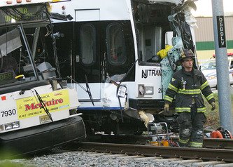


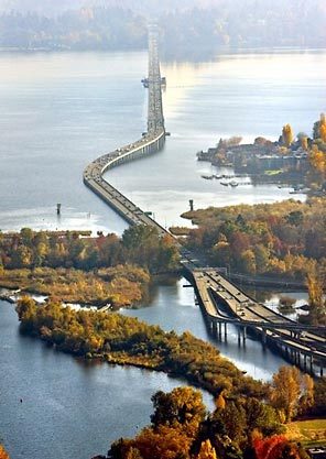
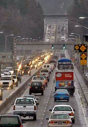


Unsound Transit
