A tour of the WSDOT facility, located at Dayton, Shoreline north of Seattle, was kindly provided by Matt Beaulieu. The centre of operations houses the extensive CCTV system to process traffic images from around the Seattle region, covering about 110 miles of Puget Sounds highways. The images are monitored by the centre staff as well as being fed to at least seven local TV stations. The live CCTV feeds are used in broadcast travel information as well as a dedicated University channel which has 24 hour a day broadcasting solely for travel information. The only condition laid down by WSDOT is that they are given the credit for the images broadcast and this is generally adhered to. A tour of the WSDOT facility, located at Dayton, Shoreline north of Seattle, was kindly provided by Matt Beaulieu. The centre of operations houses the extensive CCTV system to process traffic images from around the Seattle region, covering about 110 miles of Puget Sounds highways. The images are monitored by the centre staff as well as being fed to at least seven local TV stations. The live CCTV feeds are used in broadcast travel information as well as a dedicated University channel which has 24 hour a day broadcasting solely for travel information. The only condition laid down by WSDOT is that they are given the credit for the images broadcast and this is generally adhered to.
A best practice has been set up with the television companies and the fact that this is largely followed is an indication of how important they consider the CCTV images to be in terms of their traffic bulletins.
External links to the CCTV system include access by the Police but different levels of permission exist to manage the various users of the system. Functions carried out at the operations centre that are subject to this include camera control, ramp metering control and the variable message sign system.
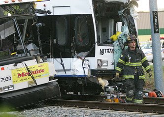
To further highlight the information sharing that exists around Seattle the operations centre is equipped with direct links to the State Police highway patrol incident computer. A dedicated monitor displays incidents as soon as the Police have entered them. Operators then have the option of using the CCTV system to verify or validate the incident. Police radio channels are also available for the same purpose. Computer entered incident reports are completed promptly and directed to the Internet server to be incorporated into the site content.
 More than 3,000 inductive detection loops installed around the freeways are used to calculate congestion levels, the same method that exists around Nottinghamshire, but in this case data is fed into a custom written piece of software to generate a graphical congestion map - the same map that is published on the Internet (see earlier this section). Visually, the map is easy to use, and an impression of the state of the entire freeway around Puget Sound can be quickly digested. The schematic map was developed using a wire-frame computer drawing of the road network and the software (written in the "C" programming language) scanning the congestion levels then shades areas of the map different colours for different levels of traffic flow. The Control Centre's display of the map also includes icons for ramp meters and other highway equipment and acts more as a geographical information system including fault status of the various equipment out on the street. We had researched the same congestion map whilst in Nottingham and the visit here provided a good insight as to how it was actually produced and valuable steps forward in producing a similar map for Nottingham. More than 3,000 inductive detection loops installed around the freeways are used to calculate congestion levels, the same method that exists around Nottinghamshire, but in this case data is fed into a custom written piece of software to generate a graphical congestion map - the same map that is published on the Internet (see earlier this section). Visually, the map is easy to use, and an impression of the state of the entire freeway around Puget Sound can be quickly digested. The schematic map was developed using a wire-frame computer drawing of the road network and the software (written in the "C" programming language) scanning the congestion levels then shades areas of the map different colours for different levels of traffic flow. The Control Centre's display of the map also includes icons for ramp meters and other highway equipment and acts more as a geographical information system including fault status of the various equipment out on the street. We had researched the same congestion map whilst in Nottingham and the visit here provided a good insight as to how it was actually produced and valuable steps forward in producing a similar map for Nottingham.
Information is also fed to travellers via a Highway Advisory Radio channel and message signs exist and are activated when a travel message is active. This indicates which frequency to tune to, to get pertinent information. These signs are in addition to the 55 variable message signs positioned around the road network, usually just prior to an interchange.
Future developments include more work on the congestion map to include click-able icons to access more information about congestion or an incident etc.
These icons would be automatically added to the map display via software and be of more use to Internet users in terms of obtaining a better view of incidents around Seattle.
My sincere thanks to Matt Beaulieu - Washington State Department of Transport
Batelle Transportation Division Chris Cluett Ph.D, is a senior research scientist with Battelle Transportation Division based in Seattle. Whilst visiting the Washington TSMC he kindly spared me some time to chat about traveller information systems. Battelle is a private sector company who develop new technologies and products for both industry and government. Their applications are spread across many fields including medical, chemical and transportation. Battelle has a wealth of experience in the evaluation of intelligent transportation system (ITS) deployments across the States.
On the subject of the future of traffic and travel information, Chris and I were both of the opinion that the existing Internet technologies are providing a firm foundation of information exchange which other information tool providers will be latching on to. A good example was demonstrated by Chris with a Palm Pilot, which is acts as an electronic personal organiser, among other things. This particular model was able to access the Internet via a wireless connection with its integrated modem. The demonstration given accessed the current Seattle traffic conditions just before having to travel from 145th back down to the TRAC offices at 45th. The Palm Pilot was able to display the impressive real time congestion map and thus enable us to decide on the best route. Other information displayed included results of a search for flight UA2111 from Seattle Tacoma airport. The information came back almost instantly with a comprehensive report that the plane had arrived in San Francisco, the time of its arrival, how late it was and why, the gate and the baggage claim area. Maybe some of this information was superfluous (maybe not) but as an active demonstration of technology and information gathering whilst on the move it was impressive. The equipment is really a glorified electronic Filofax weighing about the same but with severely enhanced functionality and flexibility. It can act as a notebook, word processor, diary, e:mail recipient, calculator, clock etc. Not to mention specialised applications and Internet access.
The Internet pages viewed were limited to frame-less web sites and there were also limitations with the monochrome graphics. It was, however, easy to see what the Palm Pilot, and variations of, would be capable of in the next few years (or more likely, months). Colour versions already exist and the prices are falling in fact some cost as little as a leather bound Filofax.
On debating the merits of charging for access to traffic and travel information. Even though this can be deemed desirable, in order to fund current and future projects with the absence of capital funding, and even though the information is clearly required by travellers, the moment that there is a hint of charging for the information then there is also hint that the number of accesses to the services would fall greatly. The Internet does allow other sources of income to be secured via sponsored pages although SmartRoute systems in Boston couldn't get any useful income even with the massive amount of web hits that they receive.
Chris Cluett is also responsible for several presentation documents based on the use, deployment and feedback of various ITS systems across the U.S. He kindly furnished me with copies of such which are full of fascinating and useful statistics further indicating the value of traveller information and include the results of both focus groups and online surveys.
Information gleaned for the commute to work: - 61% Radio
- 27% Television reports
- 22% WSDOT Internet site
- 11% Nothing
Information gleaned whilst travelling: - 90% Radio
- 1.3% WSDOT Internet site
Information gleaned for the commute from work: - 90% WSDOT Internet site
- 62% Specifically CCTV images on Internet
- 29% Radio
The main uses of the WSDOT internet are: - 99% Assessing route specific congestion information
- 96% Judging the effect of incidents on a journey
- 95% Deciding among alternative routes
- 92% Estimating trip duration
- 89% Timing trip departure
Less use is made for selecting a travel mode and decisions based on weather conditions although the numbers are still high: - 49% selected travel mode (32% found information useful)
- 60% Deciding if weather conditions made driving unsafe (51% found the information useful)
Other interesting results indicated whether or not advertising on the web site would be deemed desirable, with respondents being evenly split on this issue and comments indicating that advertising shouldn't interfere with accessing timely traffic information. Other users were vehement in rejecting all advertising on such sites.
Suggestions for improvements on the congestion map included: - Fill in information gaps on freeway network
- Add more major roads and arterial routes
- Provide estimates of travel time between self selected destination and origin
- Provide direct measures of speed for segments
- More details on traffic incidents
- Local weather conditions
Some users expressed concern that too much information may lead to a slower loading time for the map.
The presentations contain much more information but I have just included useful highlights in order to keep this report within one volume. Chris also directed me to an online electronic library of useful related information.
My sincere thanks to Chris Cluett.
Smart Trek Similar to Boston's (and many other city's) SmartRoute Systems, Seattle also boasts an impressive multi-mode, multi-media traveller information service. SmartTrek, led by the Washington State Department of Transport, incorporates real time congestion mapping on television and Internet, transit links, Weather, CCTV, incident reports, bus tracking, ferry tracking and links to other pertinent traveller information via the Internet interface of the SmartTrek service. It has been developed in partnership to service commuters, tourists and freight companies alike. Among the partners are the Federal Highway Administration, the Federal Transit Administration, the University of Washington, King County Department of Transportation, the Puget Sound Regional Council, Washington State Department of Information Services, Boeing, Microsoft, Seiko Communications Systems, the City of Seattle, the City of Bellevue, Metro Traffic Control, PB Farradyne, Battelle, IBI Group, Pacific Rim Resources and David Evans and Associates, Fastline, Etak, American Communications, ICON, Washington State Ferries, and the Greater Redmond Transportation Management Association.
Overall, Smart Trek, in the Seattle area, has been a two-year effort involving 25 public and private organisations and is devoted to increasing the efficiency of regional highways and transit systems.
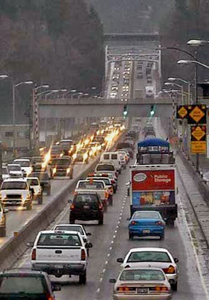
The traffic in the Puget Sound region is recognised as bad and deteriorating, partly due to an increase in population. As mentioned initially, the geography of Seattle and the Puget Sound area is such that expansion of the arterial routes and freeways is exceptionally difficult if not impossible in parts. Smart Trek's primary aim is to combine technological transportation solutions hopefully resulting in a more educated and altogether safer use of the roads with time saving benefits for all. Travellers are able to make more educated travel decisions regarding time and mode by tapping into to the various information outlets as a result of the SmartTrek project.

The same traffic information can be accessed via Internet or a local cable television channel that broadcasts both CCTV and computer generated congestion mapping.
Smart Trek is described as a Model Deployment Initiative (MDI) demonstration project and wasn't cheap to develop (approximately $18 million). However it is hoped that providing the most up to date, accessible and wide ranging travel based information the performance and efficiency of the roads will improve to cope with the expected growth. 27 individual projects have been designed to provide Seattle with one of the most developed intelligent transport systems (ITS) in the U.S.
Among the innovations are:
- A Microsoft "Sidewalk" on-line entertainment guide that includes real-time and customised traffic information as well as expected travel times for alternate routes.
- A variety of hand-held or in-vehicle systems to translate traffic and transit information into usable messages.
- A cable television program that provides up to the minute glimpses of key travel corridors along with average speeds is well under development.
- Frequently updated, colour coded, traffic flow maps.
- Expanded use of the existing variable message sign infrastructure.
- A Highway Advisory Radio system to help complete a system of information sources available throughout the region.
- Dynamic roadway signs around Seattle Centre to allow visitors to know in advance where to park.
- Custom traffic and accident information on message-receiving wrist-watches and pagers.
- Updated bus arrival information on airport-like television monitors located at major transit centres as well as the Internet.
- Closed circuit television cameras to monitor traffic on the Tacoma Narrows Bridge and video speed detectors along Interstate 5 to provide Tacoma-area traffic information on the Internet.
- Traffic updates and on AutoPC, a new in-vehicle navigation system.
- Mobile video cameras that instantly send pictures of accident victims to emergency room doctors to assess how best to move and treat patients.
- Traffic conditions displayed on monitors at SeaTac International Airport.
As well as assistance for commuters and general travellers it is hoped that the emergency services will benefit from the introduction of an enhanced 911 system that supports the introduction of "Mayday" devices from two companies. Emergency responses will be speeded up due to location information being sent to response centres. The system utilises global positioning system (GPS) technology to make the despatching of emergency vehicles efficient and the monitoring of their locations accurate.
On the traffic management front congestion and accident information is gleaned from around and beyond Seattle. As far south as Tacoma is covered.
The ultimate aim again is to enable travellers to make educated decisions about their travel choices to cut down on congestion and eliminate the requirement for new roads. Although the development costs of $17.9 million are large, to say the least, the cost of new roads and bridges would probably dwarf that amount. New roads would also probably increase car usage and certainly have a detrimental effect on the environment around Puget Sound. 
Having reviewed a lot of the impressive SmartTrek Internet site (www.smarttrek.org) and researching the background and project information, I had generated several questions and points for discussion for Pete Briglia, the ITS Program Manager at the TRAC offices of the Washington State Department of Transport.
SmartTrek was born out of the geographical constraints of the various Counties of Washington, as highlighted previously. The myriad lakes and waterways greatly limit the building of new roads into and out of Seattle. HOV lanes had been installed to encourage best use of commuting time and ramp-metering technologies were employed to control access from slip roads to Interstates based on levels of congestion and using traffic signals. A full flow of vehicles from a slip road onto an Interstate lane caused what was regarded as unnecessary congestion on the Interstate. A lot of the projects like these were funded directly from Federal road tax funds. The funds were strictly to be spent on approved Metropolitan Planning Organisation Traffic & Travel projects, a point that SmartTrek had little problem with.
Individual projects were set-up involving several all-important partnerships. Over time 6 or 7 small ITS projects had evolved and eventually were encapsulated to form the SmartTrek project. Pete stressed the importance of setting up partnerships with companies and other organisations early on in projects. They were validly described as true partnerships, or good co-operative relationships, with both parties gaining something from the investigation of ITS i.e. SmartTrek gains increased connectivity and extra real time systems and the companies involved developed new products or product components as a result of investing and researching. The key seemed to be to identify the overlaps in the various business plans to forge these relationships. An example of a good relationship came from IBM. They had developed a personal digital assistant with a view to incorporating ITS information connectivity into it. The product failed and was never launched as a serious product, which really ended IBM's interest. However, when IBM redeveloped and redefined a product that could have had ITS implications, they were very quick to forward this to what was then known as the SWIFT project
In the case of the SWIFT project (Seattle Wide-area Information for Travellers) the rules dictated that SmartTrek had to let the potential partners approach them and not the other way around. SWIFT was set-up to deploy and test various parts of the urban traveller information systems using everyday devices to provide the information. - Seiko - Message Watch (radio communications)
- IBM - Notebook computers - for bus locations and congestion information
- Delco - In car radios with GPS bearing and distance information
- More recently palmtop computers using web technologies have been on trial
Some of the companies involved had a vested interest in TTI systems for their workforce commute e.g. Microsoft were interested in access to custom route and diversion information.
The highway information gleaned was initially accessed via a telephone call centre but radio and TV companies got involved when running the call centre became to onerous a task at over 70 calls per hour with minimum staff!
The growth in the popularity of the Internet was a key signal for SmartTrek to utilise it as an information outlet, especially when considering the potential audience. Also, existing systems had links to the new SmartTrek website rather than repeating information, thus leaving SmartTrek to focus on new areas and new technologies (e.g. Riderlink and Metro King County Transit). This focus gained momentum when grant money was secured and a team set-up to explore the gaps in traveller information.
A lot of the early problems involved systems incompatibility. E.g. the web was a good outlet for information and the excellent network of road sensors was providing excellent real time road information, but only to the traffic control department. The money secured provided technical expertise to join the technologies and enhance the information product. Other technical advances were made with the AVL Busview system, which was further developed as a web based Java application (AVL information gleaned directly from Metro King County Transit Control where buses have radio communications to give location signatures and also transmission of odometer readings to track the bus).
Ferry view, another GPS application, was developed to track and publish the position of passenger and vehicle ferries with the potential of allowing travellers to decide on the best route to take. With the geography of the area being as it is, it made sense to inform travellers of road conditions ahead and the latest ferry situation. This information was previously available on VMS but could take no account of which individual vessel would be available e.g. different capacities for vehicles etc. A partnership with Media Communications enabled SmartTrek to gain line of sight communications to the ferry terminals and therefore links to the WSDOT server.
Web cameras have also been installed in ferry terminals to provide travellers with, hopefully, enough information to make route / mode decisions.
The success of the various SWIFT projects led directly to the development of the SmartTrek Internet site although the timescale allowed did not cater for usability testing for this important phase. This was noted as undesirable, but the only concession made was to access other valid evaluation reports e.g. a TRAC survey of 10,000 Seattle commuters completed around 1990 did help with certain perceptions regarding content as well as revealing that computers were acceptable tools with which to access information (not necessarily Internet).
There has been a lot of feedback to the now fairly comprehensive SmartTrek site. The overwhelming majority of this being positive with 93% agreeing with the statement:
"Using traffic information on the web has helped me to save time"
Other impressive figures include: - 81%Avoided traffic incidents and congestion
- 75% Had a reduction in stress levels
- 33% avoided unsafe driving conditions
Any problems identified are processed and active revisions and re-evaluations are all part of the process of managing the site. The University of Washington campus now has a laboratory specifically for usability testing which will soon be utilised for a new development of the weather information system.
A partnership with ETAK was forged to develop incident mapping, which is now an integral part of the web site, and personalised real-time traffic information for cellular phones was in the pipeline during my stay. ETAK, AT&T, and Motorola have combined forces to offer wireless up-to-the-minute displays of local traffic conditions. Other information outlets include auto e:mail, paging, palm tops and all forms of P.C.
In terms of web hits, SmartTrek were getting around 80 million per month, although this does cover every single file (e.g. one page with twenty individual graphics = 21 hits). However there are still a massive 8000 user sessions per day (May 1998) increasing to 12,000 per day (April 1999). A large increase occurred during a period of particularly bad weather with 16,000 per day in December 1998 and a maximum of 35,000 on the worst day for weather during that month.
After the apparent success of the SWIFT / SmartTrek project, future plans include the further development of ITS to include State-wide information. Currently SmartTrek does an excellent job for Puget Sound region of West Washington (i.e. the King County, Kitsap County, Snohomish County and Pierce County). However, Pete Briglia was in full agreement that ITS does not stop at County boundaries or at the terminal of a particular mode of transport.
Further enhancements include the introduction of construction and weather / road condition information that will be pertinent over the winter months. These systems are currently being developed and will be integrated into SmartTrek soon. The weather systems will access NEXRAD or Next Generation Weather Radar. Applications are planned for the new Doppler weather radar system to provide information pertinent to Ferries (wind speeds and directions) and more accurate short term weather predictions for better maintenance scheduling and transit operations (early snow warnings etc.) All this as well as the possibility of tying up with other systems to provide weather related transportation statistics.
In terms of information outlets, Pete's experiences have led him to believe that the Internet is the way forward. Whether the end product has full Internet access or not is becoming increasingly irrelevant. Internet technologies are developing to take web pages and forward them to other media e.g. WAP phones, palm pilots and hopefully the return of the message watch (whose decline wasn't helped when it was suggested that traffic information may become a subscription service).
Ideally traffic and travel information systems should provide one stop shopping for multi mode / multi county transport. Currently SmartTrek lacks cycling and pedestrian information, but the county does lack cycle tracks apart from in certain parks.
There is a school of thought that exists, that, even after all of this effort, the congestion problems will continue in Seattle. King County is very much a car culture place (to think otherwise has been described as subversive!) and one that is still developing and growing. Modal change on a medium scale is not expected, although if WSDOT can continue to provide and develop comprehensive information, coupled with good transit services, commuter complaints about traffic queues will hold less weight. Expected journey times depending on mode may also become a strong information feature.
 Other aspects of the discussion focused on the use of radio stations and television companies to broadcast traffic and travel information. In the U.S. this is heavily sought after information and therefore obviously classifies as prime time with all the revenue implications that go with it. Again CCTV traffic images are fed live to the TV stations who appear more than keen to broadcast them as an enhancement to their other travel and weather information services. Broadcast traffic news is frequent during the main commuter hours with bulletins as often as every ten minutes. A full time University TV channel also exists and is dedicated to TTI. This incorporates CCTV feeds, congestion maps and highway speeds. Other aspects of the discussion focused on the use of radio stations and television companies to broadcast traffic and travel information. In the U.S. this is heavily sought after information and therefore obviously classifies as prime time with all the revenue implications that go with it. Again CCTV traffic images are fed live to the TV stations who appear more than keen to broadcast them as an enhancement to their other travel and weather information services. Broadcast traffic news is frequent during the main commuter hours with bulletins as often as every ten minutes. A full time University TV channel also exists and is dedicated to TTI. This incorporates CCTV feeds, congestion maps and highway speeds.
In addition to providing useful insights into approaches to traveller information, Pete kindly provided me with a complete, and extremely valuable presentation entitled: "Successful Approaches to Deploying a Metropolitan Intelligent Transportation System".
My sincere thanks to Pete Briglia |