
Regional Financing for Transportation Projects in King, Pierce and Snohomish Counties Project Benefits King, Pierce, Snohomish • State's fastest growth, largest population • Global economy with 3 major ports • Job & freight highways serve major employers: Boeing, Microsoft, REI, Paccar, Safeway, Starbucks, Weyerhaeuser • Small, rapidly growing companies contribute many jobs Improve or fall behind • Transportation infrastructure, highways aging, over capacity • Must improve to remain competitive • Gaps in current funding for essential projects, connections • Major projects demand regional funding Essential, critical transportation investments • Three-county effort to complete road, transit, possibly light rail links in transportation network • Funding package of local taxes & fees • All tax dollars to be spent in counties where raised • Board – Members of three County Councils decide projects, funding recommendations • Region's voters must approve recommendations • Major improvements to "highways of regional significance" – I-5, I-405, SR 167, SR 9, SR 509, US 2, SR 522 • Earthquake safety – Viaduct, 520 bridge – Replace, expand • HOV lane completion – I-5, SR 167, SR 509 • Transit-related improvements • Complete 1.5-mi light-rail link to airport Project plan adopted June 3, 2004 $12.8B: These projects are an essential part of our region's long- term vision. Funding recommendation adopted June 3, 2004 Recommended • 0.2% sales tax • 0.1% RTA sales tax • 0.3% MVET • $75 license fee • 2.8¢ local option gas tax • Tolls on SR 520 Additional allowed • 0.3% sales tax • Employer tax • Parking tax • $25 license fee Making our highways safer • Region's most earthquake-vulnerable structures upgraded or replaced – Alaskan Way Viaduct – SR 520 Floating Bridge – More than 20 lane-miles • 29% of "high accident" locations improved • 24% of "high accident" road miles improved Moving our freight • In some areas, truck traffic increasing at faster rate than cars • Major freight routes targeted for nearly all improvements • Reduce truck delays by 6,400 hrs/day • Businesses save $93 million/year when projects completed (first 15 years) Environmental benefits • Update decades-old standards • More stormwater detention and treatment for runoff • Better protection for stream habitats • Rehabilitate, create wetlands and stream-side vegetation • New noise walls, landscape berms and other features will limit noise impacts • Less idle time = less polution • Less gas consumption per vehicle Improving traffic flow On highways with RTID projects, 3.4% more lane miles will allow: • 39% more trips • 28% faster commute • 21% reduction in travel time • 25% reduction in delays Every roadway benefits Across the entire three-county road network, the RTID projects will allow: • 34% more trips • 7% faster commute • 6% reduction in travel time • 14% reduction in delays Benefits to you: King County Key Projects Map available at www.rtid.dst.wa.us King - Overall Situation • 12 th largest county population in US • Population expected to grow by 1/3 between 2001 and 2010 • Suburbs growing faster than urban areas • Kent warehousing, distribution center 5 th largest in nation • Port of Seattle imports/exports to over 100 countries Project: SR 99 Alaskan Way Viaduct Map available at www.rtid.dst.wa.us Project: Alaskan Way Viaduct Threatened by quake, choked by traffic: • Major quake could cause collapse • Viaduct, seawall weak before '01 quake • Seawall built partly of wood; supports viaduct, streets, buildings • Viaduct carries 25% of downtown traffic • Built for 65,000 vehicles/day – now carries 110,000 vehicles/day = 69% over capacity • Funding – local money needed to leverage state, federal share Replacement: Alaskan Way Viaduct • Replace or tunnel • Protection from earthquake threat • Repair seawall • Wider lanes improve traffic flow • Addition of shoulders boosts safety • New water systems improve quality of runoff going into Puget Sound, and meet new standards Funding will jump start this most critical project with ¼of overall replace- ment costs. Replacement: Alaskan Way Viaduct • Replace or tunnel • Protection from earthquake threat • Repair seawall • Wider lanes improve traffic flow • Addition of shoulders boosts safety • New water systems improve quality of runoff going into Puget Sound, and meet new standards That means: Viaduct, seawall replacements will be safe in earthquake. No more squeezing into narrow lanes or driving too close to guard rails. Stalled cars can move to the side for safety, while traffic keeps moving. Project: SR 520 Evergreen Point Floating Bridge Map available at www.rtid.dst.wa.us Project: SR 520 Floating Bridge Quake, storm could sink it; traffic jams it • One of oldest floating bridges in world (1962) • Hollow columns vulnerable to quakes • Too low in water, vulnerable to storms • Far beyond capacity – high accident rates, weakening support structure • No shoulders mean accidents jam traffic • No HOV lanes restrict traffic flow • 2 replacement options: 4 or 6 lanes 111% reduction in travel time • Six-lane option includes HOV lanes • Full shoulders • Bike/pedestrian lanes link Eastside, UW • New braces for earthquakes, storms • Stronger flotation for future capacity • Remove Arboretum "ramp to nowhere" • Stormwater facilities ensure runoff meets water quality, protect Yarrow Pt. Reserve • New sound walls reduce noise • 9,900 fewer hours people spend in traffic a day • $2.0 million/year saved from accident reduction Replacement: SR 520 Floating Bridge 111% reduction in travel time • Six-lane option includes HOV lanes • Full shoulders • Bike/pedestrian lanes link Eastside, UW • New braces for earthquakes, storms • Stronger flotation for future capacity • Remove Arboretum "ramp to nowhere" • Stormwater facilities ensure runoff meets water quality, protect Yarrow Pt. Reserve • New sound walls reduce noise • 9,900 fewer hours people spend in traffic a day • $2.0 million/year saved from accident reduction That means: Bridge remains secure in storms, quakes. New shoulders allow stalled vehicles to pull over; emergency vehicles can reach accidents quickly. Buses and carpools use dedicated lane. 4 fewer hrs/day of roadway congestion. Replacement: SR 520 Floating Bridge Project: I-405 Renton to Downtown Bellevue Map available at www.rtid.dst.wa.us Project: I-405 Renton to Downtown Bellevue 1 Eastside's congested lifeline • One of fastest growing areas in the region • 800,000 travellers/day; 400,000 more in 20 yrs. • Includes the most congested areas of I-405 (6-10 hours/day) • I-405/SR 167 interchange the most congested in Washington • 'S Curves' inadequate during peak hours • Congested 'Wilburton Weave' (at I-5/I-405 interchange) 1 One portion of regional funding improvements to I-405 Road, transit improvements • 2 new lanes in each direction • Reduce congestion at Wilburton weave • New, wider Wilburton • Add highway bus stations • Much higher levels of stormwater retention, runoff treatment • Remove barriers impeding fish from moving upstream • Create new wetlands, stream-side vegetation Solution: I-405 Renton to Downtown Bellevue Road, transit improvements • 2 new lanes in each direction • Reduce congestion at Wilburton weave • New, wider Wilburton • Add highway bus stations • Much higher levels of stormwater retention, runoff treatment • Remove barriers impeding fish from moving upstream • Create new wetlands, stream-side vegetation Solution: I-405 Renton to Downtown Bellevue That means: Commuter traffic between Renton, Bellevue and across Lake Washington will get moving again. Congestion will clear at all major choke points. Water and air quality will rise dramatically. 75,480 fewer hours spent in traffic per day from Renton to Bothell! Project: SR 167 Green Valley Corridor from S. 180th Map available at www.rtid.dst.wa.us Project: SR 167 Green Valley Corridor from S. 180th Major N-S corridor desperately over capacity • One of region's major 'job highways' • 50% of King County's manufacturing employees travel to Kent and Auburn • For many, an unavoidable nightmare • No relief during peak commute times • I-405/SR 167 interchange the most congested in Washington • Dangerous merge – buses and carpools join single-occupancy vehicles Reduce time spent in traffic by 10,650 hrs/day • Additional lane in each direction • Complete and fill HOV gaps • Eliminate dangerous bus-carpool merge • Improve stormwater treatment, control flooding • 39% faster commute • $1.0 million a year saved by reducing accidents Solution: SR 167 Green Valley Corridor from S. 180th Reduce time spent in traffic by 10,650 hrs/day • Additional lane in each direction • Complete and fill HOV gaps • Eliminate dangerous bus-carpool merge • Improve stormwater treatment, control flooding • 39% faster commute • $1.0 million a year saved by reducing accidents Solution: SR 167 Green Valley Corridor from S. 180th That means: Congestion-free trips for buses, vans and carpools. Peak-hour trips expected to average 30 mph would average over 40 mph. SR 167 will become a preferred route. Map available at www.rtid.dst.wa.us Benefits to you: Pierce County Key Projects Pierce - Overall Situation • Population: 44% growth since 1980 • 5 th largest seaport in North America • Largest contiguous industrial zone in Puget Sound region • 27.5% of county residents use cross- county highways to go to work • Highway bottlenecks, inefficiencies are most serious barrier to competitiveness, development 1 1 2004, Berk & Associates, Jobs Creation Study Project: Cross Base Highway Map available at www.rtid.dst.wa.us Project: Cross Base Highway Pierce's badly needed east-west link • Fredrickson area: home to Boeing plant, vital economic engine for entire region • Largest contiguous industrial zone in the Puget Sound region • Fastest growing residential and industrial areas in Pierce County • Pressure builds, but south county still can't connect east-west to I-5 Six-mile, four-lane highway • From I-5 Thorne Lane (Exit 23) to SR 7/176 th St. East intersection • Additional route from I-5 to McChord AFB, Ft. Lewis • 7,100 fewer hours spent in traffic each day • Reduced congestion on 512 • $3.7 million saved annually by reducing accidents. • Protect western gray squirrel habitat Solution: Cross Base Highway Six-mile, four-lane highway • From I-5 Thorne Lane (Exit 23) to SR 7/176 th St. East intersection • Additional route from I-5 to McChord AFB, Ft. Lewis • 7,100 fewer hours of traffic each day • Reduced congestion on 512 • $3.7 million saved annually by reducing accidents. • Protect western gray squirrel habitat Solution: Cross Base Highway That means: Vital direct connection for people and freight to fastest growing residential and industrial areas in Pierce County. Shorter travel times in south Pierce County, Lakewood, DuPont, and Fredrickson. Better access to military bases, training areas. Project: SR 167 Port of Tacoma to Puyallup Map available at www.rtid.dst.wa.us Project: SR 167 Port of Tacoma to Puyallup Critical 'job highway' just isn't there • No direct route for freight from Port of Tacoma to SR 167 • Missing vital link to move Port products, including to Kent Valley distribution centers • Port of Tacoma freight traffic overwhelms I-5 New four-lane freeway • From SR 509 at the Port of Tacoma to SR 167 around Puyallup/Sumner • New Sumner-Auburn HOV lanes • Reduce time in congestion by 2,120 hours each day • Save $3.2 million/yr by reducing accidents • New link from Puyallup to I-5 Solution: SR 167 Port of Tacoma to Puyallup New four-lane freeway • From SR 509 at the Port of Tacoma to SR 167 around Puyallup/Sumner • New Sumner-Auburn HOV lanes • Reduce time in congestion by 2,120 hours each day • Save $3.2 million/yr by reducing accidents • New link from Puyallup to I-5 Solution: SR 167 Port of Tacoma to Puyallup That means: Completing a major freeway link, improving freight access to the Port of Tacoma and relieving congestion on I-5. Continuous, high-speed highway across the Puyallup Valley improves commuter access to I-5, and reduces delay on surface streets in the area. Project: I-5 SR 16 to Port of Tacoma Road Map available at www.rtid.dst.wa.us Project: I-5 SR 16 to Port of Tacoma Road Congested areas, no HOV lanes • Near Fife, Tacoma Dome, across Nalley Valley • Bridges at I-5/SR 16 Nalley Valley interchange cannot be widened or aligned for new HOV lanes • Corridor safety features over 40 years old • Buses and other HOV users impeded by congestion entering/leaving Tacoma • Current road patterns cause weaving, traffic lane conflicts Realigns, widens I-5 for HOV lanes • Provides HOV direct access, continuity from Gig Harbor to King County • Modernizes freeway, enhances safety • Constructs new freeway-to-freeway HOV connections at Nalley Valley interchange • Widens Puyallup River bridges • Rebuilds interchanges at I-705, SR 167, Port of Tacoma Road Solution: I-5 SR 16 to Port of Tacoma Road Realigns, widens I-5 for HOV lanes • Provides HOV direct access, continuity from Gig Harbor to King County • Modernizes freeway, enhances safety • Constructs new freeway-to-freeway HOV connections at Nalley Valley interchange • Widens Puyallup River bridges • Rebuilds interchanges at I-705, SR 167, Port of Tacoma Road Solution: I-5 SR 16 to Port of Tacoma Road That means: New HOV lanes will reduce congestion in all lanes and improve travel for buses, vans and carpools. The rebuilt roadway will make travel through Tacoma safer with fewer merge areas and traffic conflicts. Map available at www.rtid.dst.wa.us Benefits to you: Snohomish County Key Projects Snohomish - Overall Situation • Fastest population growth in Puget Sound region • 37.2% of county residents use cross- county highways to go to work • Major center for manufacturing (25% of all county jobs), including Boeing • Nearly 20% of state's biotech companies Project: SR 9 One of state's deadliest highways • Major corridor running north and south, east of I-5 • I-5 + SR 9 = backbone of Snohomish County transportation system • Built as 2-lane country road; can't support urban arterials that feed it • No lane separation, no shoulders • Frustrated commuters take greater risks when passing Project: SR 9 Arlington, Marysville Map available at www.rtid.dst.wa.us Reduce congestion at key intersections • Where SR 9 meets: – SR 528 – SR 84 th Street – SR 531 • 72 fewer hours people spend in traffic each day • New traffic signals, turn lanes and signal-controlled intersections improve safety, flow Solution: SR 9 Arlington, Marysville Reduce congestion at key intersections • Where SR 9 meets: – SR 528 – SR 84 th Street – SR 531 • 72 fewer hours people spend in traffic each day • New traffic signals, turn lanes and signal-controlled intersections improve safety, flow Solution: SR 9 Arlington, Marysville That means: Outdated Highway 9 will meet new traffic demands. Faster & safer travel, reduced congestion between Arlington and Marysville. Less idle time, lower gas consumption and reduced emissions. Project: SR 9 Bothell, Snohomish Map available at www.rtid.dst.wa.us Expand lanes, improve intersections • At some points, expand 2 lanes to 5 • Improve intersections: 132 nd St. SE, Marsh Road, US 2, 20 th St. SE, SR 204, Lundeen Parkway, SR 96, SR 92 • Complete what nickel projects get started Solution: SR 9 Bothell, Snohomish • New turn lanes will decrease accidents • 17,750 fewer hours people will spend in congestion a day • 34% faster commute during peak hours • $3.5 million saved annually from reduction in accidents • Improved water quality at Little Bear Creek, Clearview Aquifer and Snohomish River Solution: SR 9 Bothell, Snohomish • New turn lanes will decrease accidents • 17,750 fewer hours people will spend in congestion a day • 34% faster commute during peak hours • $3.5 million saved annually from reduction in accidents • Improved water quality at Little Bear Creek, Clearview Aquifer and Snohomish River Solution: SR 9 Bothell, Snohomish That means: Fewer frustrated drivers! Peak traffic will total 3 hours instead of five. What could be a 1-hour commute will take 40 minutes. If this project is not completed, the average afternoon commute speeds would be about 19 mph by 2015. Project: SR 522 Bothell, Monroe Map available at www.rtid.dst.wa.us Project: SR 522 Bothell, Monroe Critical east-west route links Monroe, Bothell, SR 9, US 2 • Another one of the deadliest highways in the region, no lane separation • 2 lanes under capacity, severe congestion • Missing Link: State Nickel Account expands Snohomish River to US 2 only – funding needed for widening from river to Paradise Lake Road More lanes complete 'missing link' • Additional lane in each direction • Median • Add interchange at Paradise Lake Rd • 20,580 fewer hours in traffic a day • 5 fewer hours of congestion • 90% reduction of evening commute time Solution: SR 522 Paradise Lake Road to Snohomish River • Improved water quality for Little Bear creek and Snohomish River • 25,700 fewer hours people spend in congestion each day • 5 hours vs. 8 hours of peak hours a day • 38% faster commute • $2.6 million saved a year from reduction in accidents Solution: SR 522 Bothell, Monroe • Improved water quality for Little Bear creek and Snohomish River • 25,700 fewer hours people spend in congestion each day • 5 hours vs. 8 hours of peak hours a day • 38% faster commute • $2.6 million saved a year from reduction in accidents Solution: SR 522 Bothell, Monroe That means: 522 will be a safe, reasonable route for residents of Bothell and Monroe. Without improvements, the average peak hour speed could be 16 mph by 2015. www.rtid.dst.wa.us For more information
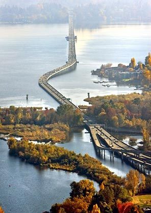
tunnel/bridge
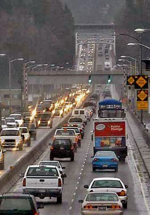
tunnel/bridge


Unsound Transit
