Rail transit ballot measures lost in Kansas City and San Jose, but won in Seattle, Sonoma-Marin counties, and Los Angeles. From the point of view of sensible transportation policy, the biggest disaster of the election was passage of the California high-speed rail measure.
Sometimes I think it is wonderful that we can live in a country that is so wealthy that we can afford to build rail lines that cost five times as much per mile as freeway lanes yet carry only one-fifth as many people. But, as it turns out, we really can’t afford to do so.
The bursting of the stockmarket bubble in 2001 would have sent us into a recession but for the increase in consumer spending that resulted from the housing bubble. Now that the housing bubble has burst, our weak economy stands naked and trembling for all to see. Yet this did not much dampen enthusiasm for ridiculous rail projects.
First, the good news. After rejecting light rail seven times, then approving a plan that turned out to be unworkable, Kansas City once again resoundingly defeated a new light-rail plan. It would be nice to think that after 56 percent of voters rejected this plan that it will stay dead and buried, but these things always come back.
As it came back to Santa Clara County, California, which in 2000 approved a sales tax increase for a BART line from Fremont to San Jose. But the line turned out to cost a lot more than expected, so votes were asked for another sales tax increase. The latest count says that 66.27 percent said yes, which means that it failed because California requires a two-thirds majority to pass tax increases. But it was painfully close.
In two other ballot measures, San Jose residents gave up what little oversight they have over the nation’s worst transit agency, the Valley Transportation Authority (VTA). Under VTA’s charter, the agency must submit its transportation plan to the voters every six years. In measure C, VTA asked voters to approve a plan that it had not yet completed. In measure D, VTA asked voters to repeal the requirement that it submit plans to the voters. Both passed by huge margins.
In Los Angeles, the “red” subway line is, by all accounts, a failure, costing 50 percent more to build than the original estimates and carrying less than half as many people as estimated. The Los Angeles County Metropolitan Transit Authority (MTA) was content to focus instead on light rail. But L.A.’s new mayor, Antonio Villaraigosa, wanted to complete the “subway-to-the-sea” line, and he managed to persuade 67.4 percent of voters to raise sales taxes to do so.
The “SMART” train is a proposed commuter-rail line in Sonoma and Marin counties that would end near (but not at) a San Francisco ferry terminal but otherwise not approach any major job centers. Voters twice before failed to muster the two-thirds majority needed to fund it, but in this case, the third time’s the charm.
Finally, California high-speed rail passed with 52.2 percent of the vote. This commits California to spend $9 billion starting construction on what ultimately will be a $50 to $60 or more billion megaproject.
Backers of the plan are counting on getting matching or even more than matching funds from the federal government. They may even get it, but not without starting high-speed rail crazes in other parts of the country.
It is widely agreed that government failure caused the current economic crisis (though not everyone agrees on just what that failure was). Ironically, as NBC anchor Brian Williams noted during Tuesday night’s election coverage, “There is evidence that more people are now viewing government as the solution and not the problem.” It will be sad indeed if we end up suffering from more government failures as a response to government failures of the past.
Transportation
Friday, November 14, 2008
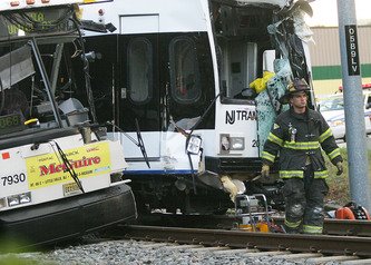
Light Rail wins in Seattle, LA,; loses in Kansas City and San Jose
Monday, April 14, 2008
Light Rail: comparing six West coast cities
April 2008
The Facts on Light Rail
A comparative analysis of light rail systems in six West Coast cities
by Michael Ennis
Director, Center for Transportation
Key Findings
As Washington cities consider whether light rail is right for them, this study on
the performance of the six existing systems on the West Coast provides factual, real life
examples of what taxpayers could expect here. Policymakers and the public should
consider whether diverting transportation taxes away from other programs and services
is worth the opportunity costs. Based on the data, this analysis concludes that it is not.
Often, public agencies try to estimate, with little success, how such a system in
Washington would perform. Through unrealistic modeling and ambitious assumptions,
they typically underestimate operating and capital costs, and overestimate revenue and passenger demand.
This is especially true with light rail systems.
For example, in 1996, Sound Transit officials in the Seattle area promised its first light rail segment would be completed by 2006 and would cost about $5 billion.1 Today, Sound Transit says the total cost is about $15 billion and the segment will not be
finished until around 2020.2
Analyzing the performance of existing light rail systems sidesteps these guesses and offers a factual picture.
There are six light rail systems on the West Coast that have been operating since
at least 1995: Los Angeles, Portland, Sacramento, San Jose, San Diego and San Francisco.
This study looks at their past performance and results in the following key findings:
• Light rail systems on the West Coast served only about 2% of the
workforce in the service areas of the six systems.
• On average, these systems only remove between 0.39% and 1.1% of
cars from the roadway.
• On average, West Coast light rail systems require taxpayer subsidies to
pay for 73% of operations and 100% of capital improvements per year.
• The average cost to add one additional rider to the light rail systems on
the West Coast is between $82,285 and $242,014 per rider.
• Attracting a new rider to light rail costs 16 to 47 times as much as
attracting a new rider to a traditional bus system.
1 Sound Move, The 10‐Year Regional Transit System Plan, May 1996. 2 Sound Transit, University Link Financial Plan, June 2006.
Washington Policy Center 2
• When accounting for passenger demand, light rail on the West Coast is
12% more expensive to operate than bus service.
• In the ten years between 1996 and 2005, the public subsidy (operating
costs only) for all light rail systems in the U.S. grew from $250 million to
$729 million. An increase of 191%.
• The relationship between light rail and any environmental or economic
development advantages is so slight that their use on influencing policy
decisions should be proportionally minor.
Examining the six existing light rail systems in major West Coast cities helps residents in the Puget Sound, Vancouver and Spokane understand what they could expect from spending on similar systems in Washington.
The most relatively efficient systems on the West Coast are San Francisco and
Portland. They move the most people for the least cost and beat the six‐city average in
most cases.
By a large margin, the worst‐performing system is San Jose. In every category, its performance is worse than the six‐city average.
Regardless of how each system ranks with another, the overall poor
performance of all six light rail systems on the West Coast shows that there is a very large gap between public costs and public benefits.
Even the best‐performing systems require a large taxpayer subsidy and have little or no affect on reducing traffic congestion. And on average, light rail is more expensive to operate than a normal bus service.
Policymakers and the public should consider whether diverting transportation
taxes away from other programs and services is worth the opportunity costs. Based on the data, this analysis concludes that it is not. There must be a stronger relationship
between public spending and congestion relief. Spending significant amounts of
transportation tax revenue on projects that have no influence on reducing congestion inevitably makes traffic worse.
Washington Policy Center 3
Introduction
As congestion continues to grow in major cities across the United States,
policymakers are looking toward light rail transit as a possible solution. In 1980, there were only nine light rail systems in the U.S.; today, there are twenty‐nine.3
In Washington, Puget Sound voters in 1996 approved the region’s first light rail segment by authorizing Sound Transit to build a line between the airport and North of Seattle. Last November, regional voters rejected Sound Transit’s proposed second
phase, which would have added another 40‐50 miles of light rail. Sound Transit officials are already planning to go to voters with a second measure.
In Clark County, public officials are considering a light rail system across a new
Columbia River bridge to Portland. And while Spokane voters recently rejected
continuing to look at light rail, officials there may yet try again to fund a system.
This study compares the performance of the six major West Coast cities
operating light rail since 1995. The cities are Los Angeles, Portland, Sacramento, San
Jose, San Diego and San Francisco. The following table summarizes key background data (2004) on each system.4
Six major cities on the West Coast with light rail, 2004 data
System Individual
Length, Light Rail Riders per Annual Operating Annual Farebox
in Miles Vehicles day5 Cost Revenue
Los Angeles 116.3 121 40,503 $111,654,300 $18,899,600
Portland 92.9 105 38,856 $56,965,800 $19,822,200
Sacramento 62.6 72 13,589 $35,225,800 $7,853,400
San Diego 97 123 32,718 $41,830,500 $24,196,900
San Francisco 72.9 181 55,710 $105,899,500 $21,473,700
San Jose 71.5 80 6,748 $45,752,500 $4,367,700
Source: National Transit Database
3 Bureau of Transportation Statistics, Available at
http://www.bts.gov/publications/national_transportation_statistics/html/table_transit_profile.html
4 Data adapted from the American Public Transportation Association (APTA), Rail Statistics. Available at:
http://www.apta.com/research/stats/rail/index.cfm
5 Light rail ridership is typically measured in unlinked trips. The American Public Transportation Association defines unlinked trips as “the number of passengers who board public transportation vehicles. Passengers are counted each time they board vehicles no matter how many vehicles they use to travel from their origin to their destination.” Unlinked trips can double or triple count the same rider. In order to translate unlinked trips into individual daily riders, this report uses a conversion factor of 45%.
Washington Policy Center 4
Spending transportation taxes on light rail instead of traffic relief is a
controversial decision. Light rail opponents often argue it is too expensive for such little benefit, while supporters like its reliability and speed.
Based on its rapid growth across the country, light rail supporters are clearly
winning the public debate. Today, there are nearly 1,400 miles of light rail track in cities across the country with another 190 miles under construction.6
But analyzing the performance data of existing systems shows that light rail is not providing the benefits supporters so eagerly claim.
In a recent study by the Brookings Institution, On the Social Desirability of Urban
Rail Transit Systems, authors Clifford Winston and Vikram Maheshri argue that every
public transit rail system (25 at the time of the study) had a negative impact on social
welfare; meaning the average value of the service was less than the average cost to
society.7
Annual Net Social Cost of Rail to
Six Major West Coast Cities
Los Angeles $125 million
Portland $221 million
Sacramento $106 million
San Diego $29 million
San Francisco $250 million
San Jose $211 million
Winston and Maheshri show the annual
monetary social cost of rail to the host city. The
adjacent table shows these costs to the six major
West Coast cities that have had light rail since 1995.
As the authors point out, these negative impacts occur for two reasons: high costs (capital and operating) and low passenger demand.
As with any public transit system, passenger fares only recover a minor percentage of the total operating costs and no capital expenditures. In
1995, the public subsidy (operating costs only) for all light rail systems in the U.S. was
$250 million. In 2005, public assistance grew by 191%, to $729 million.8 Combining both capital and operating costs, the public subsidy for light rail in 1995 was $938 million. In 2005, the subsidy grew to $3.2 billion.9
As with most public services, taxpayers will tolerate high costs as long as they think their purchase results in a proportional benefit. Winston and Maheshri show that rail transit fails to produce this return on investment. And comparing the performance of the six systems on the West Coast indicates they are right.
6 APTA, 2007 Public Transportation Fact Book. Available at
http://www.apta.com/research/stats/factbook/documents/section_19_rail_pages_63_to_79.pdf.
7 C. Winston, V. Maheshri, On the social desirability of urban rail transit systems, Journal of Urban Economics, 2006.
8 APTA, 2007 Public Transportation Fact Book. Available at
http://www.apta.com/research/stats/factbook/documents/section_19_rail_pages_63_to_79.pdf.
9 Ibid.
Washington Policy Center 5
Light Rail Demand is Low
Ridership is generally the best factor for measuring the success of any transit
service, and light rail is no different. If passenger demand is high enough, then the space between cost and benefits is small. Likewise, if passenger demand is low, then the space between cost and benefits is high.
Consider the following table that compares the combined working populations of the six major west coast cities with their respective light rail passenger demand in 1995, 2000 and 2005.
Combined Daily Light Rail Ridership: Los Angeles,
Sacramento, San Diego, San Francisco, San Jose & Portland
12,000,000
1.06% 1.69% 1.97%
10,000,000
8,000,000
6,000,000
4,000,000
2,000,000
0
1995 2000 2005
Combined Daily Light Rail
Ridership
Combined Working Population
The combined regional working population of the six West Coast cities that have light rail was about 10.7 million people in 2005.10 The number of daily riders using light rail in the same cities in 2005 was about 206,694 per day.11 This means only 1.97% of all workers within those cities choose to use light rail in any given day.
10 Population data adapted from the Federal Highway Administration. Available at: http://www.fhwa.dot.gov/ctpp/jtw/jtw8.htm.
11 Light rail ridership is typically measured in unlinked trips. The American Public Transportation Association defines unlinked trips as “the number of passengers who board public transportation vehicles. Passengers are counted each time they board vehicles no matter how many vehicles they use to travel from their origin to their destination.” Unlinked trips can double or triple count the same rider. In order to translate unlinked trips into individual daily riders, this report uses a conversion factor of 45%.
Washington Policy Center 6
Light Rail Does Not Reduce Congestion
For transit to appreciably reduce traffic congestion, it must shift a large number of drivers from the roadways to its system.
It is unlikely the 206,694 daily riders on West Coast light rail systems in 2005 translate to an equal number of cars that would otherwise be on the roadway. Most light rail riders come from the existing bus systems.
For example, Sound Transit officials in Seattle estimated that nearly two‐thirds of its ridership would have come from the existing transit system if its second phase had been approved in 2007.12
206,694 cars are not insignificant but there are about 18 million vehicles in the six regions studied.13 Assuming two‐thirds of passenger demand draws from existing public transit, the light rail systems on the West Coast shift a miniscule 0.39% of cars off the roadway. Assuming every rider translates to one vehicle, then light rail still only
removes 1.1% of cars from the roadway.
In either case, passenger ridership on light rail is not nearly great enough to
reduce traffic congestion. In fact, it can be argued that diverting such a large proportion of transportation tax revenue to light rail takes money away from and weakens
programs that actually reduce congestion.
Per‐Rider Cost is High
Accounting for passenger demand shows the eye‐popping cost required to add one additional rider to a light rail system on the West Coast.
Combined ridership in 1995 was 107,751 people per day for all six systems. Over
the next ten years, the six cities spent about $8.1 billion in capital and operating
expenses to serve an additional 98,943 people per day.14 So the capital cost to add one
additional rider to the system between 1996 and 2005 was $82,284 per person.
Again, assuming two thirds of those riders came from existing bus transit means the capital cost to add one additional new transit rider was $242,015 per person.
12 Gregory Roberts, Prop 1. no cure for commute, Seattle Post Intelligencer, 2007. Available online at:
http://seattlepi.nwsource.com/transportation/336095_worth19.html
13 http://www.fhwa.dot.gov/ctpp/jtw/jtw8.htm
14 Data adapted from the federal government’s National Transit Database. Available at:
http://www.ntdprogram.gov/ntdprogram/data.htm.
Washington Policy Center 7
To put this in perspective, King County (Seattle) recently passed Transit Now, which will expand its bus system by 20%.
King County officials estimate Transit Now will add up to 27,000 new daily riders to the county’s transit system. Adjusting for inflation, the cost of Transit Now will be about $140 million per year. This means the total cost for King County to add one new rider to its system will be about $5,185 per person.15
This means attracting a new rider to light rail costs 16 to 47 times as much as attracting a new rider to a traditional bus system.
Weighing these costs and benefits shows that light rail is extremely inefficient, even when compared to other public transportation alternatives. To look at it another way, consider the following chart, which compares the total cost per trip between light rail and traditional bus service on the same six agencies on the West Coast.
Operating Cost Per Trip (2005): Bus & Light Rail.
Los Angeles, Sacramento, San Diego, San Francisco,
San Jose, Portland
$3.00
$2.62
$2.50
$2.00
$1.50
$1.00
$0.50
$0.00
Light Rail: Operating Cost Per Trip
$2.34
1
Bus: Operating Cost Per Trip
The total annual operating costs (not including capital) for the six light rail
systems on the West Coast was about $439 million in 2005.16 The total trips for the
15 Part V: The Imbalance of Roads and Transit, 2007. Washington Policy Center. Available at:
http://www.washingtonpolicy.org/Transportation/PN_partvimbalance.html.
16 Data adapted from the federal government’s National Transit Database. Available at:
http://www.ntdprogram.gov/ntdprogram/data.htm.
Washington Policy Center 8
same systems in 2005 were 167.6 million.17 This means the operating cost for the six light rail systems on the West Coast was $2.62 per trip.
The total operating costs for traditional bus service in the same six agencies was about $1.5 billion and annual trips were about 642 million.18 The operating cost for traditional bus service in 2005 was about $2.34 per trip.
When accounting for passenger demand, light rail on the West Coast costs 12% more to operate than traditional bus service.
This is important because light rail supporters will say that after the initial capital spending, light rail is cheaper to operate than other modes of public transit. On average and among the six western cities with light rail, this is not true.
Other Benefits of Light Rail Lack Evidence
Backers also claim that light rail has certain environmental and economic
development benefits that help justify costs. But there is little evidence to support these
claims.
For example, Portland officials say that the Max light rail system has brought more than $6 billion in new development since the decision for light rail was made in 1978.19 But through zoning changes, tax breaks, outright grants and selling publicly owned property at below market rates, the city was able to attract development along the rail line or near the stations.20 More than light rail, the large public subsidies were likely the main reason for the new development.
The commercial growth claim also fails to account for potential development
that would have naturally occurred in other areas. The Brookings Institution’s Winston and Maheshri say,
“Case studies have yet to show that after their construction transit systems have had a significant effect on employment or land use close to stations and that such benefits greatly exceed the benefits from commercial development that would have occurred elsewhere in the absence of rail construction.”21
17 Ibid.
18 Ibid.
19 http://trimet.org/about/history/maxoverview.htm.
20 Randal O’Toole, Debunking Portland, CATO, 2007. Available online at: http://www.cato.org/pubs/pas/pa‐596.pdf.
21 C. Winston, V. Maheshri, On the social desirability of urban rail transit systems, Journal of Urban Economics, 2006.
Washington Policy Center 9
Because of these alternative and perhaps more influential variables, it is difficult to casually conclude that a light rail system stimulates economic development; light rail is not as impactful for economic development as public agencies try to claim.
Furthermore, because ridership is so low, the environmental benefits of light rail over the same riders using higher emission buses or passenger cars are easily erased with slight improvements in efficiency and alternative fuels.22 Likewise, light rail
construction and expansion also tempers any environmental advantages due to its long construction period and high energy consumption.
The relationship between light rail and any environmental or economic
development advantages is so slight that their use on influencing policy decisions should be proportionally minor.
Conclusion
Examining the six existing light rail systems in major West Coast cities helps
residents in the Puget Sound, Vancouver and Spokane understand what they can expect from spending on similar systems in Washington.
The following table illustrates the combined mean, high and low results of several key performance data in the six West Coast cities with light rail.
Key performance of six West Coast cities with light rail, 2004 data
Annual
Daily Public Annual Public Operating
Individual Riders Per Mode Share as Subsidy, Subsidy, Cost Per Operating
Riders Track a Percent of Operating Operating & Rider, Light Cost Per
Per Day Mile Workers Costs Capital Costs Rail Rider, Bus
Los Angeles 40,503 348 1.08% 83% 91% $2,757 $1,759
Portland 38,856 418 3.23% 65% 89% $907 $2,258
Sacramento 13,589 217 1.61% 78% 86% $3,078 $3,109
San Diego 32,718 337 2.47% 42% 89% $3,237 $2,398
San Jose 6,748 94 Included in SF 90% 97% $6,781 $4,490
San Francisco 55,710 764 1.77% 80% 91% $1,023 $1,542
Average 31,354 363 2.03% 73% 91% $2,964 $2,593
Source: National Transit Database
22 Todd Myers, Light Rail on I‐90 Will Do Little to Reduce CO2, Washington Policy Center, 2007. Available online at:
http://www.washingtonpolicy.org/Centers/environment/PolicyBrief/07_light_rail.html.
Washington Policy Center 10
The most relatively efficient systems on the West Coast are San Francisco and
Portland. They move the most people for the least cost and beat the six‐city average in
most cases.
By a large margin, the worst performing system is San Jose. In every category, its performance is worse than the six‐city average.
Further study should be conducted to gain a better understanding on why San
Francisco, Portland and San Jose appear so far from the average of the other systems.
Regardless of how each system ranks with another, the overall poor
performance of the six light rail systems on the West Coast shows that there is a very large gap between public costs and public benefits.
Even the best‐performing systems require a large taxpayer subsidy and have little or no affect on reducing congestion. On average, light rail is more expensive to operate than a normal bus service.
Policymakers and the public should consider whether diverting transportation taxes away from other programs and services is worth the opportunity costs. Based on the data, this analysis concludes that it is not.
There must be a stronger relationship between public spending and traffic congestion relief. Spending transportation tax revenue on projects that have no influence on reducing congestion inevitably makes traffic worse.
Wednesday, March 12, 2008
US Light Rail Systems by Ridership and Track Miles
Rank System Largest city served Daily ridership Date Miles of track
1 MBTA T Green line and Ashmont–Mattapan High Speed Line* Boston 255,100 Third quarter of 2007 25.4[2]
2 Muni Metro, cable car, and F Market* San Francisco 146,200 Third quarter of 2007 66.1[3] + 5.4[3]
3 Los Angeles County Metro Rail Blue, Green, and Gold lines* Los Angeles 134,400 Third quarter of 2007 55.7[4]
4 San Diego Trolley San Diego 124,300 Third quarter of 2007 53.5[5]
5 MAX Light Rail and Portland Streetcar Portland 107,900 Third quarter of 2007 44[6] + 6.0[7]
6 SEPTA Subway-Surface Lines, Suburban Trolley Lines, and Girard Avenue Trolley* Philadelphia 89,600 Third quarter of 2007 60[8]
7 MetroLink St. Louis 82,000 Third quarter of 2007 46[9]
8 DART Light Rail, MATA streetcar Dallas 62,200 Third quarter of 2007 45[10] + 3.6[11]
9 RTD Light Rail Denver 59,700 Third quarter of 2007 35[12]
10 Sacramento Regional Transit District Light Rail Sacramento 49,500 Second quarter of 2007 36.9[13]
11 UTA TRAX Salt Lake City 042,500 First quarter of 2007[14] 19[15]
12 METRORail Houston 41,700 Third quarter of 2007 7.5[16]
13 Santa Clara VTA Light Rail San Jose 36,000 Third quarter of 2007 28.6[17]
14 Hiawatha Line Minneapolis 29,500 Third quarter of 2007 12[18]
15 Baltimore Light Rail* Baltimore 27,300 Third quarter of 2007 30.0[19]
16 Hudson-Bergen Light Rail* Jersey City 25,850[20] Second quarter of 2006 27.2[20]
17 The T Pittsburgh 24,200 Third quarter of 2007 25[21]
18 Buffalo Metro Rail Buffalo 19,100 Third quarter of 2007 6.4[22]
19 Newark Light Rail* Newark 18,000[20] Second quarter of 2006 9.9[20]
20 The Rapid Blue and Green Lines* Cleveland 11,400 Third quarter of 2007[14] 15[23]
21 River Line Trenton 7,350[20] Second quarter of 2006 69.7[20]
22 Streetcars in New Orleans New Orleans 4,500 Third quarter of 2007 21.5[24][25]
23 Memphis RTA Main Street Trolley Memphis 003,300 Third quarter of 2007 7[26]
24 Tacoma Link Tacoma 2,873[27] First quarter of 2007 1.6[28]
25 TECO Line Streetcar System Tampa 800 Third quarter of 2007 2.3[7]
26 Charlotte Trolley Charlotte 700[29] Fourth quarter of 2004 2.1[30]
27 River Rail Streetcar Little Rock 340[31] 2005 2.5[7]
28 Kenosha Transit Kenosha 300 Second quarter of 2007 2.0[7]
29 Island Transit trolley Galveston 200 Second quarter of 2007 5.2[32]
[edit] Ridership per Mile
The following is a list of light rail systems in the United States, ranked by ridership per mile of track. Figures are computed using the 'ridership' and 'miles of track' numbers above.
Rank Largest city served Ridership per mile
1 Boston 10,043
2 Houston 5,560
3 Buffalo 2,984
4 Minneapolis 2,458
5 Los Angeles 2,412
6 San Diego 2,323
7 Salt Lake City 2,237
8 Portland 2,158
9 San Francisco 2,045
10 Newark 1,818
11 Tacoma 1,799
12 St. Louis 1,782
13 Denver 1,705
14 Philadelphia 1,493
15 Sacramento 1,341
16 Dallas 1,280
17 San Jose 1,258
18 Pittsburgh 968
19 Jersey City 950
20 Baltimore 910
21 Cleveland 760
22 Memphis 529
23 Tampa 391
24 Charlotte 333
25 New Orleans 209
26 Kenosha 150
27 Little Rock 136
28 Trenton 105
29 Galveston 38
Notes
1. ^ American Public Transportation Association, Light Rail Transit Ridership Report, Third Quarter 2007.
2. ^ Boston Metropolitan Planning Organization, Transportation System Performance, The MBTA System: Quick Facts, 2003.
3. ^ a b San Francisco Municipal Railway, Short Range Transit Plan, Chapter 8: Infrastructure Program, December 6, 2005.
4. ^ Los Angeles County Metropolitan Transit Authority, Facts at a Glance, June 19, 2007.
5. ^ Metropolitan Transit System, Fact Sheet, May 2007.
6. ^ Tri-Met, Facts about Tri-Met, October 2006.
7. ^ a b c d American Public Transportation Association, APTA Streetcar and Heritage Trolley Site, Overview.
8. ^ SEPTA, SEPTA Operating Facts, Fiscal Year 2006.
9. ^ St. Louis Metro, Inside Metrolink, 2007.
10. ^ Dallas Area Rapid Transit, DART Rail Facts
11. ^ American Public Transportation Association, APTA Streetcar and Heritage Trolley Site, Dallas Overview.
12. ^ Regional Transit District, RTD Facts, February, 2006; Regional Transit District, About Southeast Light Rail, 2007.
13. ^ Sacramento Regional Transit District, RT at a Glance.
14. ^ a b American Public Transportation Association, Light Rail Transit Ridership Report, First Quarter 2007.
15. ^ Schneider, Keith. "A Rail Line Drives Development in Utah", New York Times, April 22, 2007.
16. ^ News: News Releases
17. ^ Santa Clara Valley Transportation Authority Web Site, Frequently Asked Questions, Where does VTA provide service?
18. ^ Metro Transit, Facts about trains and construction, 2007.
19. ^ Roads to the Future: Baltimore Central Light Rail Line
20. ^ a b c d e f New Jersey Transit, Facts at a Glance, Fiscal Year 2006. The APTA combines statistics for all New Jersey Transit light rail operations, which includes the Hudson-Bergen Light Rail, the Newark Light Rail, and the River Line.
21. ^ Port Authority of Allegheny County, T Quick Facts.
22. ^ NFTA-Metro, Metro Rail Facts, 2004.
23. ^ Greater Cleveland Regional Transit Authority, RTA Facts.
24. ^ [1] Saint Charles Line
25. ^ [2]Canal and Riverfront line
26. ^ [3]Memphis Streetcar
27. ^ Sound Transit, Quarterly Performance Report, First Quarter 2007.
28. ^ Sound Transit, Light Rail Fares
29. ^ Ridership Is Low For Charlotte's Morning Trolley Service - Charlotte News Story - WSOC Charlotte
30. ^ American Public Transportation Association, APTA Streetcar and Heritage Trolley Site, Charlotte, July 2005.
31. ^ MassTransitMag.com » Article » Builders Like Rail Line, but Riders are Sparse
32. ^ American Public Transportation Association, APTA Streetcar and Heritage Trolley Site - Galveston Overview,
Tuesday, March 11, 2008
History of Light Rail in North America
History of Streetcar and Light rail
From the mid-19th century onwards, horse-drawn trams (or horsecars) were used in cities around the world. In the late 1880s electrically-powered street railways became technically feasible following the invention of a trolley pole system of collecting current by American inventor Frank J. Sprague who installed the first successful system at Richmond, Virginia. They became popular because roads were then poorly-surfaced, and before the invention of the internal combustion engine and the advent of motor-buses, they were the only practical means of public transport around cities.[2]
The streetcar systems constructed in the 19th and early 20th centuries typically only ran in single-car setups. Some rail lines experimented with multiple unit configurations, where streetcars were joined together to make short trains, but this did not become common until later. When lines were built over longer distances (typically with a single track) before good roads were common, they were generally called interurban streetcars in North America or radial railways in Ontario.
In North America, many of these original Streetcar systems were decommissioned in the 1950s and onward as the popularity of the automobile increased. Britain abandoned its last light rail system except Blackpool by 1962.[3] Although some traditional trolley or tram systems still exist to this day, the term "light rail" has come to mean a different type of rail system. Modern light rail technology has primarily German origins, since an attempt by Boeing Vertol to introduce a new American light rail vehicle was a technical failure. After World War II, the Germans retained their streetcar networks and evolved them into model light rail systems (stadtbahnen). Except for Hamburg, all large and most medium-sized German cities maintain light rail networks.[4]
The renaissance of light rail in North American began in 1978 when the Canadian city of Edmonton, Alberta adopted the German Siemens-Duewag U2 system, followed three years later by Calgary, Alberta and San Diego, California. Britain began replacing its run-down local railways with light rail in the 1980s, starting with Tyneside and followed by the Docklands Light Railway in London. The trend to light rail in the United Kingdom was firmly established with the success of the Manchester Metrolink system in 1992.
Historically, the rail gauge has had considerable variations, with narrow gauge common in many early systems. However, most light rail systems are now standard gauge.[4] An important advantage of standard gauge is that standard railway maintenance equipment can be used on it, rather than custom-built machinery. Using standard gauge also allows light rail vehicles to be delivered and relocated conveniently using freight railways and locomotives. Another factor favoring standard gauge is that low-floor vehicles are becoming popular, and there is generally insufficient space for wheelchairs to move between the wheels in a narrow gauge layout.
Origins of light rail in North America
The renaissance of light rail in North American began in 1978 when Edmonton, Alberta adopted the German Siemens-Duewag U2 system, followed three years later by Calgary, Alberta and San Diego, California. These modern light-rail systems are more like subway or metro systems that operate at street level. They include modern, multi-car trains that can only be accessed at stations that are spaced anywhere from a couple blocks to a mile or more apart. Some of these systems operate within roadways alongside automobile traffic, and others operate on their own separate right-of-way.
[edit] Politics of light rail in North America
Due to lower density of many American cities, LRT speed relative to the automobile, generally lower ridership levels, and questions of cost-effectiveness, the construction of light rail systems has spurred political controversy as a use of public funds. Arguments made against light rail systems often bill it as less practical than equivalent bus systems and less effective than increases in highway capacity. Arguments in favor of light rail point to overall improvements in safety and quality of life in cities supporting rail-based mass transit and long-term sustainability benefits.
[ Usage of light rail in North America
North American Light Rail Ridership City Number of Boardings
Average Weekday (thousands)1 Annual Total (millions)²
Toronto 322.4 88.6
Calgary 220.0 52.6
Boston 200.4 70.6
San Francisco 148.2 43.4
Los Angeles 137.7 39.7
Portland 104.3 32.1
San Diego 100.9 28.8
Philadelphia 68.6 18.8
Dallas 62.4 17.6
St. Louis 58.7 16.1
Salt Lake City 58.3
Edmonton 42.7 15.6
Houston 37.8 10.6
Denver 30.8
San Jose 30.5
Minneapolis 28.8 7.9
Pittsburgh 26.0 7.3
Buffalo 18.0 5.4
1Second Quarter 2006
22005
Sources: American Public Transportation Authority,
Diesel light rail
A few recently-opened systems in North America use diesel-powered trains, including the River Line in New Jersey (opened in 2004), the O-Train in Ottawa (opened in 2001), and the upcoming SPRINTER in northern San Diego County, California (projected to be opened by late 2007). Diesel operations are chosen in corridors where lower ridership is expected (and thus do not justify the expense of the electric power infrastructure) or which have an "interurban" nature with stations spaced relatively far apart (electric power provides greater acceleration, making it essential for operations with closely-spaced stations). Operations with diesel-powered trains can be an interim measure until ridership growth and the availability of funding allow the system to be upgraded to electric power operations.
Light rail in the United States
United States use of light rail is low by European standards. According to the American Public Transportation Authority, of the 20-odd light rail systems in the United States only five (Boston, San Francisco, Los Angeles, San Diego and Portland, OR), achieve more than 25 million passenger boardings per year, and only Boston exceeds the 50+ million boardings per year of the London Docklands Light Rail system.
Compared with that of Canada, the United States federal government offers considerably more funding for transportation projects of all types, resulting in smaller portions of light rail construction cost to be borne at the local and state levels.[citation needed] This funding is provided by the Federal Transit Administration though as of 2004 the rules to determine which projects will be funded are biased against the simpler streetcar systems (partly because the vehicles tend to be somewhat slower). Some cities in the U.S. (e.g. San Pedro, California) have set about building the less expensive streetcar lines themselves or with only minimal federal support.
Boston
The oldest and busiest light rail in the United States is the MBTA Green Line in Boston. With 235,300 daily ridership on its 25.4 miles (40.9 km) of track, the Green Line is a primary transportation route in Brighton and Allston for students and for the work force where the line runs further downtown.
The subsurface portion of the line had originally built to alleviate congestion for street level trolley cars. In 1932, the expansion of the Boston subway resulted in the creation of four westbound surface portals as the line split off four ways above ground to what would later be called the B, C, D, and E lines. Though, unlike most trolleys, the lines have their own separate path in the medians of their respective roads, still three of the four lines do not have grade-separated right-of-ways and consequently are forced to wait in traffic lights. The D line is an exception to this because it runs on a disused grade-separated railroad right-of-way.
A recent project by the MBTA was the 2004 removal of the Causeway Street Elevated portion of the line, which was replaced with underground tunnel, as a part of Big Dig environmental remediation, leaving the Lechmere Viaduct as the only remaining elevated part of the line. Other work includes many station overhauls that will improve handicapped accessibility.
Los Angeles
The Los Angeles County Metro Rail light rail system comprises three lines: the Green, Gold, and Blue lines. Collectively they have 134,300 daily weekday boardings. The Blue line, in particular is the second-busiest line in the United States with 72,295 boardings. The Blue and Gold Lines run mostly at grade, with some street-running, elevated, and underground stretches in more densely populated areas. The Green Line is entirely grade separated, running in the median of the I-105 Freeway and then turning southward along an elevated route. The Blue Line opened first, in 1990. The Green Line began service in 1995, and the Gold Line entered service in 2003.
This short section requires expansion.
San Francisco
The San Francisco Municipal Railway (MUNI) light rail lines are vestigial from its streetcar days, and it is one of few American cities to continuously operate light rail from the streetcar era. As a result, the present-day system has above ground portions running in mixed traffic, stopping at traffic lights as streetcars, while buried sections have their own right-of-way like a subway. Though in other United States cities in 1950s, the trend was to replace streetcars with bus service, five heavily used lines traveled through tunnels or otherwise had private right-of-ways, making bus replacement not viable. About this time, plans for a subway, the Muni Metro, were drawn up, opening in 1980. Similar to Boston's Green Line, five separate lines above ground converge to one subway route, though in the former, the underground line was constructed first and surface routes later.
In response to the dot com boom, the system became strained and Muni ordered newer, larger vehicles, which turned out to have their own noise and braking problems. In 1998, a four station extension of the trunk line was built, and in 2007 light rail service began on a new line going south from downtown, achieving limited success. Plans are underway for a three station underground light rail line, expected to serve 78,000 daily riders by 2030. Due to underground routing, the cost for the 1.7-mile (2.7 km) line is estimated at $1.5 billion.
Portland, Oregon
The Metropolitan Area Express (MAX) system serves the Portland metropolitan area. It has 44.3 miles (71.3 km) between three lines: the Blue, Red and Yellow and serves 104,200 daily, counting the free boarding "Fareless Square". Like most modern light rail systems MAX runs in mixed traffic in the city, but has its own right-of-way further out. The 2-car trains are length limited by the relatively small (200 ft) blocks in downtown Portland.
The MAX system was born out of funds left over from the canceled Mount Hood Freeway, with the Blue line opening in 1986, the Red Line connection to Portland International Airport opening in 2001, while the latest line to be opened was the Yellow Line in 2004, which connects downtown to Portland Expo Center via Interstate Avenue. The Green Line is a 6.5-mile (10.5 km) track under construction intended to connect Gateway Transit Center and a new Clackamas Town Center Transit Center, while a planned Orange Line would be built from the Green Line's southern terminus at Portland State University.
San Diego
San Diego Trolley currently comprises three lines, the Blue, Orange and Green, collectively running on 51.1 miles (82.2 km) of track and achieving a ridership of 107,000. During the time that the Metropolitan Transit Development Board (MTDB) was drawing up options for a transit system, Hurricane Kathleen made landfall, damaging many of the tracks operated by the freight carrier, San Diego and Arizona Eastern Railway, and cutting them off from the greater Southern Pacific Railroad, and South Pacific petitioned for abandonment. The auspicious timing of the incident led the MTDB to buy and repair the tracks, opening a 13.5-mile (21.7 km) light rail segment on 1981, while also reestablishing freight service on the same line (the Blue Line runs on shared-use track). The system has been expanded incrementally ever since. There are currently plans for an 11-mile (18 km) extension to the University City community, connecting the University of California, San Diego (UCSD) campus and University Towne Centre shopping center to the rest of the system.
St. Louis
St. Louis light rail consists of two lines, both running through the city center with 73.3 kilometers (46 miles) of track. There are terminals across the Mississippi River in western Illinois, at Lambert Field Airport, and in the southwestern part of the county. The first part of the system opened in 1993. The second line of the system, the "Cross County Extension," entered service in 2005. All track is in independent right of way, mostly at surface level. In the downtown area, the system uses abandoned railway tunnels built in the 19th century. There are three underground stations, which have an ancient appearance with rough-hewn rock walls. The "Cross County Extension" also has a few portions in tunnels, which are large and of modern concrete construction. Since it opened expansion has continued, if slowly. Ridership, at more than 16 million yearly, has always exceeded expectations.
Dallas
Dallas Area Rapid Transit (DART) is the operator of the 45-mile (72 km) light rail system that runs in Dallas and three of its suburbs, along with a 34-mile (55 km) commuter rail line that connects to Fort Worth and runs through Irving, a DART member city. The LRT lines began with the opening of the 20-mile (32 km) starter system in 1996. In the first few years after the turn of the century, DART opened several small expansions, culminating in the opening of Victory Station, serving the American Airlines Center in 2004.
DART currently runs two LRT lines. The Red Line begins in southwest Dallas at Westmoreland Station and runs northeast to downtown, then runs north through the suburbs of Richardson and Plano to its terminus at Parker Road Station. The Blue line begins in South Dallas at Ledbetter Station and runs north, joining the Red Line at 8th and Corinth Station on its trek to downtown. It continues north to Mockingbird Station before it breaks away from the Red Line and turns northeast toward Garland, ending its run at Downtown Garland Station.
The system is currently under expansion as the Green Line is under construction and will run from Pleasant Grove in southeast Dallas to the suburbs Farmers Branch and Carrollton. It is set to open in two phases, first in September 2009, then in December of 2010. Other expansions include the Orange Line, to run from downtown, the Las Colinas in Irving and on to DFW Airport. Also, the Blue Line is set to expand east to Rowlett and south to Interstate 20. When the latest expansion round is completed, DART's system will have 93 miles (150 km) of LRT.
Salt Lake City
The Utah Transit Authority (UTA) runs the 19 mile (31km) light rail system known as TRAX in the Salt Lake Valley. The system, which opened in 1999, serves approximately 58,300 people every day and contains 69 vehicles.[5] The system has 2 lines, both of which end Downtown at EnergySolutions Arena. One line ends at the University of Utah, while the other ends in the suburb of Sandy. Four extensions have recently been approved and funded, with completion expected by 2014.
Houston
The Metropolitan Transit Authority of Harris County, Texas (METRO), started its opened its METRORail service on January 1, 2004 to very large crowds. The system currently consists of a single track of 7.5 miles (12.1 km). The system serves 45,000 passengers daily. Like many other light rail systems in America, METRORail runs in city streets and does not have its own right of way. Two-car trains are the maximum on the line due to Downtown Houston's city block size.
San Jose
San Jose's light rail network, owned and maintained by the Santa Clara Valley Transportation Authority, consists of 42.2 miles (67.9 km) of track across three different lines.
The Alum Rock - Santa Teresa line serves the eastern, northern, downtown, and southern areas of San Jose. The Mountain View - Winchester line operates between Mountain View and the Winchester neighborhood of San Jose. Both of these lines share the same tracks and stations on First Street between Tasman Drive in northern San Jose and the San Jose Convention Center in downtown. A third line, the Ohlone-Chynoweth - Almaden line, is a three-stop spur that connects the Almaden Valley area to the Alum Rock - Santa Teresa Line.
Minneapolis
The Twin Cities have one LRT Line, the Hiawatha Line. This line runs from downtown Minneapolis, next to the Metrodome, near the University of Minnesota campus, to the Minneapolis-St. Paul International Airport, then to the Mall of America. This line opened in 2004. Two other lines are in planning: the Central Corridor, which runs from downtown Minneapolis to downtown St. Paul; and the Southwest Corridor, which runs from Eden Prairie to downtown Minneapolis.
[edit] New Jersey
In New Jersey, New Jersey Transit provides light rail service along three lines in different parts of the state.
Jersey City
In Jersey City, New Jersey, the Hudson-Bergen Light Rail (HBLR) services the eastern and southern parts of the city and other areas of the Gold Coast to North Bergen, New Jersey, extending south to Bayonne on one branch.
Newark
The Newark Light Rail, previously the Newark City Subway, is a grade-separated line running through the center of Newark that now runs northward to Belleville, with a second branch to Newark-Broad St. station. This line originally was the #7 streetcar line before its conversion to light rail in the early 2000s.
Trenton to Camden via Burlington City
The River Line is a diesel light rail line in southern New Jersey, running along, except at its ends, what was previously the Bordentown Secondary, from Trenton to Camden, serving communities along the Delaware River between thee cities. This line is one of only two diesel light rail lines in North America, and the only one in the United States.
Baltimore
The Baltimore Light Rail is a single line reaching from BWI Airport south of Baltimore, through the city and north to a strip mall and office park. With 30 miles (48 km) of track, the line achieves a daily ridership of 24,500.
Major efforts toward the creation of the light rail were championed by then mayor William Donald Schaefer, who wanted a transit link to the new baseball park, Camden Yards, about to be built downtown. In order to have the line completed the month that the Baltimore Orioles started playing in Camden Yards, the system was built entirely without federal money, a rarity in late 20th century U.S. transit projects. Federal funds would later be used to double track the whole system, decreasing headways which had been restricted to 17 minutes.
The light rail line was built entirely at grade, even through downtown's narrow streets. Though the majority of the track's length is grade-separated from acquiring disused railroad rights-of-way, trains run in the streets in some portions downtown and must obey traffic lights there as well. The Maryland Transit Administration has drawn up plans for an additional four lines which may be light rail, bus rapid transit, or heavy rail to create a comprehensive city system. As of 2007, only the future of one line is certain. The Red Line, which is in its intermediate planning stages, would be an East-West link via either bus rapid transit or light rail. Whichever mode is selected, officials have insisted that the line be underground through the city center because of Baltimore's narrow streets and dense traffic.
Charlotte
Charlotte's LYNX system consists of a single 9.6-mile (15.4 km) line called the Blue Line. After receiving a positive Record of Decision from the Federal Transit Administration on May 19, 2003, continued preparation and land acquisition would finally result in its groundbreaking in spring 2005. The line is in full operation, at a projected final cost of $462.7 million. This price tag does not include indirect or ancillary costs such as rerouting water and sewer lines to accommodate the line, estimated at an additional $72 million as of April 2006.
The Blue Line's construction was part of a greater comprehensive transit network for the Charlotte region. 70.6 more miles of track are planned, though many of these may be Bus Rapid Transit or streetcar lin
Pittsburgh
Pittsburgh Light Rail
Pittsburgh's light rail network, commonly known as The T, is a 25-mile (40 km) light rail system in Pittsburgh, Pennsylvania; it functions as a subway in downtown Pittsburgh and largely as an at-grade light rail service in the suburbs. The system is owned and operated by the Port Authority of Allegheny County (PAT). It is the successor system to the far more extensive streetcar network formerly operated by Pittsburgh Railways.
The current lines, which run south from the downtown into the South Hills area, were formerly operated by PCC streetcars. Beginning in the 1980s PAT reconstructed the lines along the existing right-of-way and ordered new trams from Siemens. PCCs continued to operate in tandem with the new light rail vehicles until 1999 when the last five were retired from service. PAT also constructed a new subway line in the downtown, ending decades of street-running in the Golden Triangle. Current expansion plans include an extension from the downtown subway under the Allegheny River to connect with PNC Park and Heinz Field; the North Shore Connector is slated to open by 2011.
Buffalo
Buffalo's light rail line of only 6.6 miles (10.6 km) was to be a starter line in a much larger system. However with the declining population of the area, no expansions were sought. The small line still averages over 20,000 daily riders
[edit] Seattle
Seattle's Sound Transit light rail system consists of a 1.6-mile (2.6 km) line known as Tacoma Link. Extensions to the University of Washington are planned to begin operation in 2009. The initial phase, Link light rail in Tacoma, is already operational. Voters in the Sound Transit service area rejected a controversial plan to extend light rail and roads in a 2007 vote, but may approve a light rail-only extension on the ballot in 2008.
Light rail in Canada
A Calgary Transit Siemens-Duewag U2 LRV #2043, part of Calgary, Alberta's C-Train.
Canadian cities have much higher transit use than comparable U.S. cities. Toronto, Ontario (metropolitan population 5 million) has twice the transit ridership of comparable U.S. cities, while Calgary, Alberta and Edmonton, Alberta (metro population 1 million each) have riderships three times comparable U.S. cities. Most Canadian cities average 100-200 annual boardings per capita, whereas only the largest U.S. cities with subway and rapid transit systems (Chicago, San Francisco, Washington) exceed 100 boardings per capita. However, Canadian cities have significantly lower capital spending (less than US$60 per capita, versus US$50-$100 for American cities).[6] As a result of lower federal government funding, Canadian cities have to recover a much higher share of their costs out of operating revenues. This lack of federal funding may explain why there are only a few light rail systems in Canada, and why there are intense budget fights over building new ones.
Calgary
Despite the fact that Calgary, Alberta has a lower population density than the sprawling Denver, Colorado, the Calgary C-Train system is the most successful and busiest light rail system in North America, averaging about 250,000 riders per workday.[7][8]
The Calgary system was started in 1981 as the result of decisions to avoid building either downtown freeways or a heavy rail system. At that time, Calgary had less than half a million people and was considered too small for rail transit, but when it first opened the C-Train carried about 40,000 passengers per day. By 2007, Calgary was twice as big with 1 million people, but the C-Train system was over three times as long and carried over six times as many passengers.[7]
As of 2007 45% of the people working in downtown Calgary took transit to work, and the city's objective was to increase that to 60%.[9] The reason is that Calgary's downtown core covers only 1.4 square miles (3.6 km²), is isolated from the rest of the city by two rivers and a railway line, and was built with relatively narrow streets by North American standards. In the 1960s planners proposed a comprehensive freeway system to improve access, but this was rejected due to intense public opposition. However, subsequent growth exceeded expectations and by 2006, Calgary had become the second largest head office center in Canada, with 32,000,000 square feet (3,000,000 m²) of office space and 120,000 people working in the downtown core.[8] The downtown street system is at maximum capacity and has no room for traffic growth, but the city is confident it can add another 60,000 downtown workers in the next 20 years without making space for more cars.[9] Peak hour travel by LRT is equivalent to the capacity of about 16 free flow traffic lanes and allows the city to have fewer than 0.4 downtown parking places available per worker. [10]
Despite the downtown rush, 25% of the riders during rush hour are counterflow commuters - going out of downtown during the morning and into it during the afternoon. Many of these are students going to educational institutions, who receive deep discounts because they are filling seats that otherwise would be empty, and workers doing crosstown commutes to avoid the lack of freeways.[10] However, as of 2007, the C-Train is suffering growing pains. Because population growth has exceeded expectations and LRT ridership has outpaced population growth, Calgary has had trouble buying enough new LRT vehicles and hiring enough new drivers to meet the demand. As a result, many passengers experience lengthy train waits due to overcrowding.[7]
Despite funding problems resulting from lack of support from the provincial and federal governments, there are two extensions under construction. In November 2007, Calgary City Council approved another two further extensions on the two lines, to be completed by 2012. [11]
In addition, on November 20, 2007, Council gave final approval for the new West Leg of Calgary's LRT, which would be the system's fourth leg. Construction for the West leg will begin in 2009, with completion expected in 2012. When the new light rail vehicles ordered for the extension are finally delivered, the city will have a total of 223 LRVs.
Besides the ongoing program of extending all station platforms to 100 m to accommodate four-car trains, transportation planners have identified two additional lines to be constructed within the next 25 years. They are to the North-Central and South-East districts of the city. BRT service is in place along the future North-Central route, and is expected to begin on the South-East route within a year. Calgary will also one day have to place a tunnel in their downtown to accommodate one of these new lines, or a combination of lines, much like Edmonton has already done.
[edit] Edmonton
Main article: Edmonton Light Rail Transit
By contrast with Calgary, in Edmonton, Alberta the Edmonton Transit System built much of its light rail system underground, which meant that it could not afford to lay as much track to the suburbs. In addition, Edmonton's central business district has less office space and the single line which was built did not reach areas which housed many commuters to downtown. The system is successful by North American Standards, but not nearly as successful as Calgary's: it has attracted only a sixth of the ridership. Edmonton is building new extensions at grade that will extend to the TOD Century Park.
According to John Bakker, professor emeritus at the University of Alberta and one of the original designers of the system, going underground was a serious mistake. "Going into tunnels is about 10 times as expensive as going on the surface because you have to relocate utilities", said Mr Bakker. "Edmonton went into tunnels first, and it really bogged down everything thereafter, because they didn't have money". Edmonton's system is only 12 km long, while Calgary's light-rail system covered 42.1 km for about the same cost.[12] As a result, by 2006 Edmonton's LRT ridership was relatively static at 42,000 per day, while Calgary's was over 250,000 and growing rapidly. However, a 10 km South LRT expansion was underway, almost all of it at surface, and was expected to be completed by 2009.
[edit] Ottawa
The O-Train, Ottawa's light rail train system
In the 1970s and 1980s Ottawa, Ontario opted for grade-separated busways (the Ottawa Transitway) over light rail on the theory that buses were cheaper. In practice, the capital costs escalated from the original estimate of C$97 million to a final value of C$440 million, a cost overrun of about 450%.[13] This is nearly as high as Calgary's C-Train system, which had a capital cost of C$548 million, is about the same length, and carries more passengers.[14] Unfortunately, the Ottawa Transitway has reached capacity, with over 175 buses per hour on the downtown section, and has no cost-effective way to increase the volume.[15]
In 2001, to supplement its BRT system, Ottawa opened a diesel light rail pilot project, (the O-Train), which was relatively inexpensive to construct (C$21 million), due to its single-track route along a neglected freight-rail right of way and use of diesel multiple units (DMUs) to avoid the cost of building overhead lines along the tracks. O-Train has had some success in attracting new ridership to the system (a few thousand more riders), due to its connection of a south end big box shopping mall (South Keys), through Carleton University to the east-west busway (Ottawa Transitway) near the downtown core of the city.
Ottawa produced plans to expand both the Transitway and to open additional rail routes. The intention of the light rail project was to add to the system, not to replace the existing Transitway. However, in mid-December 2006, the new Ottawa city council voted to cancel the LRT system despite the fact that funding was already in place and contracts were already signed. As of 2008, lawsuits against the city of Ottawa over its canceled light rail system totaled over $280 million.[16] Examinations for discovery are expected to start in the fall, with the trial beginning in 2009. The trial is expected to be lengthy.[17]
Toronto
Main article: Transit City
LRT in Toronto is somewhat difficult to classify, since the city employs several forms of transit that may or may not be considered "light rail". The legacy streetcar system is still largely in place in the downtown area and is extensive in terms of routes and service intervals. Some lines even tie into integrated subway stations without the need for a transfer, and many traffic signals give priority to streetcars. However, the system as a whole is not normally considered true light rail because the mixed running with surface traffic slows travel considerably. Because of the differences in technology and speed, Canadian transportation planners do not usually classify historic streetcar systems as LRT, although they may technically qualify as such.[18] Two streetcar lines (Spadina/Harbourfront and St. Clair) have been recently rebuilt and come closer to meeting light rail standards as they run in dedicated rights-of-way. However, the largest vehicles used are articulated double streetcars which are much smaller than most LRT trains and these use trolley wheels rather than pantographs to collect electricity. Streetcar fares must also be paid upon boarding as with a local bus. Finally, the Scarborough RT was a demonstration project for elevated light rail that served as a prototype for Vancouver's SkyTrain and JFK's AirTrain). However, it does not meet the common definition of light rail either since it supplies electricity to the trains using two extra power rails (one at +300 VDC and the other at -300 VDC), uses linear induction motors acting on a metal plate between the tracks for propulsion, requires a fully grade-separated right-of-way, and has large stations that have much more in common with a heavy-rail metro. In Toronto it is usually mapped as part of the subway system.
All of the above is now under reconsideration as vehicles near the end of their lifespan and the future size and type of vehicle and trackway is contemplated. On March 16 2007, the Toronto Transit Commission announced a 120 Kilometre Light Rapid transit web throughout the city. This will be a 15 year project predicted to have 175 million-users by 2021. Funding has been announced at the municipal and provincial level, though not the federal. The plan has been released and can also be viewed at TransitCity.ca
Vancouver
In 1986, Vancouver, British Columbia built the Expo Line of the SkyTrain. It is the longest automated light rapid transit system in the world.[19] In addition to using driverless trains, it uses two energized power rails (one at +300 VDC and the other at -300 VDC) rather than overhead wires to supply electricity, making it unsafe to operate in the street or use level crossings. Since it is not conventional light rail it is often called an advanced light rapid transit or light metro system. The network, including the newer Millennium Line and extension, carries about 66 million passengers annually. Vancouver's two new lines under construction, the Canada Line and Evergreen Line, are planned to be grade-separated automated light transit and at-grade light rail, respectively. Additional extensions are planned for the Millennium Line mostly underground under Central Broadway to University of British Columbia. There is preliminary talk about extending the Expo Line (although its routing has not yet been determined).
Monday, March 10, 2008
Rail is losing riders and money; yet cities keep building them
The Search for the Holy Rail
Rail transit systems all over the country are losing riders and hemorrhaging money, yet city governments keep building them.
by Rachel DiCarlo
03/13/2003 12:00:00 AM
Rachel DiCarlo, editorial assistant
IMAGINE THIS SCENARIO: The CEO of a large corporation calls a meeting of the board of directors to deal with a crisis: The business is losing four dollars for every dollar earned, much of the capacity goes unused, and the customer base, never large to begin with, is eroding at an alarming rate. The board huddles and after a lengthy session the solution emerges: Expand.
Hard as it is to imagine that any business would "solve" a problem this way, the description accurately sums up the state of rail transit in this country. In all but a handful of American cities where it exists, transit ridership is flat or declining, cars run half-empty, and the system hemorrhages money. Take Baltimore, for example.
The city's heavy-rail subway carries 50,000 commuters per day, half the 100,000 daily ridership originally envisioned. The situation is even more discouraging when it comes to revenue. Although mandated by law to recover 40 percent of operating costs through the farebox, the subway took in just $10.3 million in 2001 while operating costs were $30.3 million. Maryland taxpayers made up the difference.
Baltimore's light rail, an above-ground trolley, is in even worse shape. The hastily built, single-track system only garnered $8 million in revenue in 2001, while it cost state taxpayers $32.4 million. Its near empty cars are the embarrassing legacy of former Governor William Donald Schaefer, who built the line to shuttle baseball fans to and from Oriole Park at Camden Yards. Since opening in 1992, the original route has had other lines cobbled onto it, yet the entire system still runs far under capacity, carrying only 30,000 daily riders.
None of these problems deters supporters, who see rail transit's dismal performance not as proof of its failure, but as evidence that still more needs to be built. The Baltimore Sun recently reported that Maryland state officials are aggressively seeking federal funds for a project that would extend the city's subway from 43 miles of track to 109 miles at an initial cost of $12 billion. Transportation officials believe this ambitious expansion will boost ridership to the extent that the city's system will rival the heavy rail Metro in Washington, D.C., which carries 643,000 riders per day.
UNFORTUNATELY FOR TAXPAYERS, Baltimore is not unique. Other cities that have experienced the disappointing results of rail transit are forging ahead with plans to build more. Among them is Portland, which has the nation's most aggressive "smart growth" policies.
Over two decades, Portland has gotten hundreds of millions of dollars for its two existing light rail lines only to see the share of commuters using them drop 20 percent. As of 2000, just 80,000 of the 6 million daily trips made in Portland were on rail transit--about 1.3 percent. And the city's traffic conditions are as bad as ever. The Texas Transportation Institute reported that Portland had third worst traffic congestion in the 1990s, behind Los Angeles and Washington. Still, a third line is scheduled to open in Portland in 2004.
The situation in San Jose isn't much different. The city opened its first light rail line in 1988. Although original estimates projected that it would carry 40,000 riders per day, the high-water mark occurred in 1998 with an average daily ridership of just 22,700. Today San Jose's light rail cars carry fewer than 15 people at any one time. By mid-year the system is expected to fall a whopping $6 billion short of the money it needs over the next 20 years. Yet in the 2000 election, voters approved a referendum for two additional lines which are scheduled to open in 2004.
But the problems are not confined to small cities. In Los Angeles, the city with the worst traffic congestion in the country, rail transit's market share is 270,000 daily trips out of a total of 65 million, about 0.4 percent. Miami is about the same: Of 15 million daily trips, only 55,000 are on rail transit, about 0.4 percent. And in Dallas, where $17.2 million of federal money was spent on three light rail branches and a commuter line, just 0.25 percent of daily trips are made on rail transit.
Still, almost two hundred other cities around the country have requested federal money for rail transit. Demand has become so great that sparsely populated places like Sioux City, Iowa, Harrisburg, Pennsylvania, and Staunton, Virginia, want federal money for their own systems. The twin cites of Minneapolis-St. Paul, one of the nation's least dense urban areas, have begun construction on their Northstar Hiawatha light rail line. If the new system were to pay for itself, commuters would have to fork over $19.00 per trip or $8,550 per year--enough money to lease a luxury SUV.
WHY HAS RAIL TRANSIT been such a spectacular bust? Experts cite a number of reasons, one of which has to do with the way the systems are configured.
Most rail transit is built to serve the downtown business districts in cities. But the days when downtowns functioned as the primary centers of employment are long gone. Since about 1955, when people and office equipment began taking up more space, most new jobs have been created in industrial parks and small office parks--areas outside of downtown. Now, less than 10 percent of the nation's employment in metropolitan areas is located in the old central business districts. So for more than 90 percent of commuters, rail transit isn't an option.
Yet this fact is not an argument for extending rail transit into the suburbs. Employment outside of downtown areas is spread too thin to support rail transit. And any system serving the suburbs would have to include an expansive shuttle network to ferry commuters from transit stops to their homes or offices. So far, commuters have shown little interest in such a system. As transportation expert Wendell Cox puts it, "The problem has to do with the environment transit tries to serve. There is not a transit situation that can be superimposed on [a large city] that can get people to and from and around the suburbs."
So is there a place for rail transit anywhere?
If it makes sense at all, rail transit only seems to do so in the nation's largest cities like New York and Chicago, where more than 30 percent of commuters ride transit to work. But in other places the numbers plunge. And where transit extends into suburban edge cities, like Bethesda in suburban Maryland, or Perimeter in Atlanta, the trip share of rail transit is miniscule.
But there is an even more compelling reason rail transit will never be a serious transportation alternative in more than a handful of places: It can't match the convenience of cars. Most people prefer to come and go on their own schedule, not one set by a mass transportation authority. Plus, in cars they can travel privately in much less time than a typical transit trip takes. Transportation consultant Alan Pisarski estimates that in most situations the average auto travel time is less than half that of rail transit.
What's more, people do a lot of "trip-chaining." That is, they make side trips while they are out. A trip to the dry-cleaners might include a side trip to the bank, to the pharmacy, and to the day-care center. No transit system can replace the convenience of cars for these kinds of needs.
BUT DOESN'T mass transit ease traffic as supporters contend? The evidence shows otherwise. Between 1960 and 2000, 1,500 new miles of transit were built and 64 million new jobs were created. During the same time frame, 71 million more commuters drove to work and 1.7 million fewer rode mass transit. In Washington, D.C., where the high ridership volume makes the subway somewhat of a success (though not a profit maker), the traffic is still the second worst in the country. "There is no documented case of mass transit making a material traffic reduction anywhere in the United States," Cox says.
If the average commuter--the one who keeps voting for rail transit expansions--can be forgiven for not knowing the facts, what about elected officials and their advisers? Why do they consistently show such a willful disregard for those same facts? The answer has to do with several different groups which support rail transit. There are those who despise cars, roads, and SUVs, and want to limit them as much as possible--the "smart growth" types who would be perfectly happy to see people living the way they did 100 years ago. They subscribe to the "Field of Dreams" justification for transit, the idea that if you build it they will come.
Then there are the civic boosters, whose desire for rail transit stems from the same impulse that motivates politicians to fund expensive stadiums to lure sports teams: The desire for status. As with big-time sports, most cities believe that they are not "big league" unless they have an extensive rail transit system. And lacking justification for the massive amounts of money it involves, rail supporters often appeal to civic pride as a way around economic accountability.
In Baltimore, Mayor Martin O'Malley has come up with the novel justification that "if we don't have any better mass transit 20 years from now than we have today, we are going to be continually chasing our tail." But, when it comes to rail transit, it's the taxpayers who are chasing their tails. And they will continue to do so. That is, until they demand a reckoning of costs versus benefits and insist that elected officials at all levels stop making decisions that would get any CEO and his board of directors fired for incompetence.
Rachel DiCarlo is a staff assistant at The Weekly Standard.
LA Light Rail interferes with civil rights
Rail Interfering With Civil Rights in Los Angeles
Prospects for Seattle
From: Emory Bundy
Subject: LA as Harbinger for Seattle
Date: Sunday, 24 September, 2000 05:00
Friends: For the last four-plus years I've followed the transit experience of LA closely, because it has such striking similarities to the rail-building aspirations and funding mechanisms of the Seattle area, and it is a decade further down the road. Both the motivations and consequences are revealed in this article, from today's LA Times.
Reference to the civil rights consent decree is the settlement agreement brought by the LA NAACP Legal Defense Fund on behalf of low-income, largely minority bus riders, and bus drivers. They were victimized by the rail projects, inflicted with higher fares, deteriorating service, and radically lower per-rider subsidies contrasted to up-scale train riders. It was a harbinger for Seattle that, when Ron Sims put forth his TRIP 21 plan--which would raid the local option tax provided by the state legislature to assist the I-695-impacted local bus transit agencies, and deflect part of the money to a Sound Transit rail bailout--it was accompanied by raised fares for bus riders.
While LA's model provides rewards for the construction industry and political establishment, it is retrogressive in terms of transit service and ridership, and is accompanied by acute social injustice. Today, in order to sustain the flow of lucrative construction contracts, MTA proposes to cut the wages of bus drivers, and it is resisting in court its consent decree to restore better bus service. At this time, Save Our Valley has a federal civil rights case before the courts, pertaining to Sound Transit's treatment of lower income, minority, and immigrant communties of the Rainier Valley, with underlying causes strikingly similar to the earlier litigation of the LA NAACP Legal Defense Fund.
LA's story offers an object lesson of the short-term incentives, and long-term, adverse consequences, that accompany the unseemly pursuit of pork barrel construction subsidies
Emory
"The prospect of more rail lines is far more appealing to most MTA board members than running a bus system. Rail projects are seen as politically sexier than buses. They bring the potential to award large contracts to engineering, construction and other companies, which have a history of being active contributors to political campaigns, which the MTA's board members must regularly conduct." (Yet the buses still serve 85 percent of LA's transit patrons. The average annual income of a train rider is $65,000, a bus rider, less than $15,000.)
Wednesday, March 29, 2006
The Case for More Road Capacity
Seattle's Congestion Future Is Bleak Without More Road Capacity
We can build our way out of this mess
By David T. Hartgen and Robert W. Poole, Jr.
3/29/06
When it comes to traffic jams, the Seattle-Tacoma area is the most congested in the Northwest, just ahead of much-smaller Portland, and ranks 12th nationwide. The area has a congestion index of 1.38, meaning that trips at rush hour take 38 percent longer than off-peak journeys. But if you think that's bad, just wait until 2030.
Over the next 25 years, after absorbing almost 1 million more residents and even more car and truck trips, that same rush-hour trip will take 79 percent longer than a trip made at off-peak times, making Seattle's congestion even worse than the gridlock experienced in Los Angeles today. A trip in Seattle that is supposed to take 30 minutes, will take over 52.
And by 2030, Seattle will have jumped up to the 8th worst commute in the nation.
This forecast comes from our new Reason Foundation study and assumes that all transportation projects in the region's current 25-year plan are actually implemented. The Seattle transportation plan proposes to spend $102 billion over 25 years, including $46 billion for transit and $49 billion for highway projects.
Many motorists or taxpayers might well be asking: do you mean that we are going to spend $102 billion over the next 25 years, and our congestion will be significantly worse after all the spending? Sad to say, the answer is yes.
That's because local transportation planners have bought the idea that we can't build our way out of congestion, so it's hopeless to try. In keeping with recent trends around the country they focused more on reducing driving, proposing mass transit systems and high-density housing projects intended to get people out of their cars. They know that the demand for highway travel will be greater than the supply, but instead of increasing road space in response to what people want they hope to reduce the demand instead to fit within the limited available road space.
This is the approach California tried for 20 years. In the 1980's California stopped building freeways and poured billions of dollars into rail transit systems in Los Angeles, San Francisco, San Jose and San Diego. Unfortunately, the planners couldn't close the door: people kept moving to California and they brought their cars with them. Transit use and carpooling today handle a smaller fraction of trips than they did 20 years ago. The result is that Los Angeles and San Francisco top the national charts in congestion. Other cities that have lately tried the California model have seen their congestion soar, as well. Seattle is one of them.
But the tide may be turning. To its credit, Seattle is among a handful of cities that have gingerly begun to investigate the costs and benefits of expanded highway capacity. And our new research suggests that adding highway capacity is the most important part of an effective effort to reduce traffic congestion.
Our study modeled the hypothetical addition of enough capacity in every U.S. metro area to eliminate the worst congestion by 2030. Seattle was one of the participating cities in that analysis. We found the Seattle region would require adding 704 lane-miles to the existing highway system over the next 25 years, on freeways, arterials, and local roadways. We estimate the cost of that as $4.8 billion in today's dollars. That amounts to a bit under $34 per resident per year, but is less than a tenth of what Seattle plans to spend anyway. So, just by re-focusing its present spending, Seattle could actually reduce congestion if it chose to do so. That investment would save 200 million hours of delay per year that would otherwise be spent stuck in traffic, and the cost, just 96 cents per hour of delay saved – and that is 1/ 20th the minimum cost for light rail proposals.
Where would the new capacity go? While our study did not get into this level of detail, one of most likely possibilities is to add a complete network of HOT or express toll lanes to the existing freeway system. Another possibility is adding truck-only toll lanes in selected corridors, as Atlanta and Los Angeles are now planning to do. Many major thoroughfares that serve growing suburbs should also be widened to handle the traffic that we know is coming.
The Seattle region is at a crossroads in transportation planning. Pulling one way are those who favor the California model: try to get people out of their cars by diverting transportation funds away from highways and into transit and land-use densification. On the other side are harried commuters just trying to cope. In reality, there is no realistic alternative to highways for personal mobility, goods movement, and bus transit, so we need to keep growing the highway system in step with demand for vehicular travel. Cities like Atlanta and Houston – and now Seattle - are beginning to re-think their planning to focus more on congestion relief, and we applaud this trend.
The Seattle region is in competition with other cities as a place to live, do business and play. Seattle's ace cards are its great environment and easy access to the world stage. But these will not be enough. A key factor in people and companies' location choices is mobility: does the transportation system permit smooth and reliable commuting, goods movement and personal trips for recreation and tourism? Those metro areas that can offer such mobility will break out of the pack, ahead of those whose systems are increasingly gridlocked.
Which future do you want for Seattle?
Sunday, November 13, 2005
Why BRT is better than Light Rail for the Puget Sound
Bus Rapid Transit for the Metropolitan Puget Sound
Donald F Padelford
Nov 13 2005
Seattle
"We wish we had never started the whole thing. Fixed rail is not the answer to the transportation needs of our city. We should stop all this insanity that has gone on these past years."
Richard Riordan, Mayor of Los Angeles, on public radio program,
"Which Way LA?," June 1998.
The mayor was right, both for his city and for ours. We should stop railing at gridlock and put in place a Bus Rapid Transit system that would
*
Cover the entire metro Puget Sound region at 60 mph 24/7,
*
Have far more capacity than competing systems such as light rail or monorail,
*
Support "walkable," mixed-use neighborhoods, and
*
Set the stage for a total regional mobility solution.
The spine of the Puget Sound BRT system would be comprised of 150+ miles [1] of freeway HOT lanes (described below). Another 100+ miles [2] would be made up of arterial bus-only lanes. Additionally there would be short sections of busways, bus tunnels, and possibly elevated bus-on-rail (guided-bus) structures, similar in size and mass to the existing Seattle Center monorail. Finally Sound Transit’s downtown Seattle to SeaTac Airport "Initial Segment" of light rail, currently under construction, would be converted to guided-bus technology.
HOT lanes (high occupancy / toll) are HOV lanes that have been converted to transit priority and emergency vehicle use [3], with other vehicles admitted, but only to the extent that there is room, via a variable toll. This toll is collected electronically and varies every few minutes [4]. Transit vehicles include buses, vanpools, and qualifying carpools [5]. The objective is to keep the HOT lanes in free-flow (50 to 60 mph) at all times, even during the height of rush hours. Several such systems are in place around the nation [6], and one is being implemented here on Highway 167 south of Renton [7].
Bus-only lanes would be built primarily in the parking strips of major arterials. Gates, such as one finds at parking lots, would keep out non-transit vehicles [8]. These lanes could be rush-hours-only or full time. Particularly if they are full time, it would be necessary to more than replace parking lost to merchants with pubic parking lots or garages, perhaps providing 200% of the parking formerly found on-street [9].
Busways are simply bus streets, such as the E3 Busway south of downtown Seattle. There are times when bus through-put is such that it requires a street rather than a lane. Bus tunnels, of course, are busways that are under ground.
Guided-bus systems are a hybrid of bus and rail systems, having some of the characteristics of each. On the one hand buses ride on (concrete) rails (like some trains in the Paris Metro), producing a smoother ride than is normally found on surface streets [10]. On the other hand they are able to drive off the rails at each end of the track to pick up and drop off passengers. Such guided-bus operations can be on the surface, in tunnels, or elevated. A first-generation guided-bus system, parts of it elevated, was built 20 years ago in Adelaide, Australia. Other systems have been built in Germany and England [11].
Finally, while Sound Transit’s Initial Segment of light rail represents a foolish squandering of literally billions of scarce transportation dollars [12], it is becoming a "sunk cost" which cannot be just abandoned [13]. Therefore the right thing to do is to convert it to a more appropriate technology, such as bus-on-rail (guided-bus), which would dovetail with Bus Rapid Transit in other corridors [14].
BRT Issues
Capacity vs light rail. The plain fact is that Bus Rapid Transit on HOT lanes (BRT/HOT) has more capacity than heavy rail (BART-type) let alone light rail (Portland Max-type) systems. The reason for this is that the capacity of any transit system is determined at the stations. With rail a train cannot, of course, enter the station unless the one before it has left. The time between trains is called the "headway," and it invariably is two or three minutes at a minimum, more on "non-grade-separated" systems (systems running on surface streets and therefore prone to auto and truck interference, such as Sound Transit’s Initial Segment of light rail). With BRT/HOT, however, the transit unit (bus) pulls off the right of way (HOT lane) to discharge and take on passengers. Under these circumstances, you can put a transit unit down the right of way every few seconds rather than every few minutes. [15] (Note that buses on busways also have the ability to unload and load passengers "off-line" in the manner of BRT/HOT.)
Stuck in traffic? As demonstrated around the nation, HOT lanes flow at highway speeds at all times. And because buses and vanpools always have absolute priority, their travel time is guaranteed. Off the freeway, buses on bus-only lanes with traffic signal preemption move without being subject to undue traffic interference. And of course buses on busways or guided-bus structures move at their design speed. [16]
Support for "walkable" neighborhoods. Some proponents of light rail believe that Bus Rapid Transit cannot support "walkable" neighborhoods. However this view is becoming a minority one now that many examples of just such support are showing up around the nation and world. Below is a representative quote, this from a recent "Railvolution" conference in Salt Lake City [17].
"BRT-transit" Oriented Development
Is it really true that you have to have steel wheels to make a good [transit oriented development, ie a "walkable" neighborhood anchored by transit]? Many would suggest that this is a myth - one that can be dispelled by examples from South America, Australia, Canada and the United States. This session will provide an international perspective on how BRT and TOD can and do work together. Learn how TOD can be more than an accidental result of BRT development, but how with attention to design elements and partnerships, BRT actually shapes communities and achieves the same developmental objectives of its steel-wheeled cousins.
O v e r v i e w : Find out the myths vs. realities of whether you really need steel wheels to make a good TOD.
Quality of service. A persistent theme among certain local politicians is that you can’t have a "world class" city region without rail. Possibly this is true if your buses are stuck in traffic, if they "belch" diesel fuel, if their stops are exposed to the weather, and if the buses lurch down the road. But none of these apply to high-quality BRT systems. Being stuck in traffic was dealt with above. As for diesel belching, our buses are increasingly first generation hybrids, and the next generation will be even cleaner and quieter. Stops can and should be the equivalent of rail stations: clean, dry and comfortable, with tickets bought off the bus and boarding level with the platforms [18]. As for lurching, this is a matter of the controls and the roadbed. With modern controls, buses can start and stop as gradually as a train [19]. And the roadbed can be as good as we are prepared to pay for. Of course with busways and guided-bus structures no other vehicles are allowed in the right of way, which aids in their maintenance [20].
Expense vs light rail. This is a big subject, but because most of the right of way (roadbed) is already in place, BRT systems are about a tenth of the cost of light rail in this region. Where light rail has been built economically, such as in San Diego or Salt Lake City, either the rails have already been in place or the topography is such that it’s easy to lay them without condemnations or tunneling [21]. Because it is so much less expensive, for the same budget BRT can cover about ten times the area and support ten times as much Transit Oriented Development ("walkable" neighborhoods) as LRT.
Guided-bus technology. Guided buses are not necessary for BRT. On the other hand, given the money spent to date by Sound Transit, it makes sense to convert their Initial Segment of light rail to a bus-on-rail system (see above). The same technology, because it so accurately guides them, would allow four lanes of buses to pass each other in the Downtown Seattle Transit Tunnel, and thus permit "skip stops" with the consequent doubling of transit through-put [22]. Also, this technology, along with the relatively light weight or buses compared to trains, enables elevated bus structures to be slim and compact, making them a good neighbor to communities along major arterials, such as SR99 (Aurora). While earlier, first-generation systems use a mechanical guide-wheel to steer the buses, today’s guided-bus systems generally use magnetic or optical means of guidance (although mechanical systems may be used as a safety back-up) [23].
Through-put of HOT vs general purpose lanes. This is not strictly a Bus Rapid Transit issue. However, it is germane because it indicates where the technology underlying BRT/HOT could lead. We all know that if you put too many cars on a freeway, it bogs down into gridlock, this due to demand exceeding supply (potential through-put). When this condition prevails for any period of time, the "traffic pipes" in effect contract, causing the highway equivalent of a coronary thrombosis. The fact that this "thrombosis" happens just when supply is needed the most, at rush hours, is doubly ironic. One approach that has had success with this problem is ramp metering, which has markedly increased the through-put of our local freeways. Congestion Pricing, the mechanism behind HOT lanes, could be considered "ramp metering on steroids". If it were applied to all freeway lanes [24] (which, of course, is not necessary for BRT/HOT), it could increase the capacity of our freeway network by up to twice their current rush hours through-put [25].
Bus Rapid Transit is, or should be, the mode of choice for high capacity transit in the metropolitan Puget Sound region. It has far more capacity than competing systems, supports "walkable" neighborhoods, and provides 60 mph transit mobility to the entire metro region 24/7. Furthermore if implemented, it would set the stage for an increase of freeway capacity up to double current rush hours through-put -- with free-flow conditions guaranteed literally forever, should we decide to pursue that sometime in the future.[26]
The Puget Sound BRT System in Concept [27]
Footnotes
1. 150 miles = 300 "lanes miles", ie a lane each direction for one mile. Currently 200 lane miles of the core HOV lane system are complete, and the remaining 100 lane miles have been funded.
2. This is just a guess, albeit I believe a reasonable one.
3. The role of emergency vehicle mobility is not explored in the OpEd, but it is extremely important. In every-day situations, ambulances, police cars, tow trucks and the like need to get to accidents to clear them off. Incidents and accidents cause somewhere between 30 and 50% of daily congestion on the region’s freeways (Niles 10/10/05, Hallenbeck 10/11/05). This is not to mention the necessity for emergency vehicle mobility in 911 or Hurricane Katrina type situations.
4. In the case of San Diego’s I-15 HOT lanes, the toll is varied every 6 minutes. Once a vehicle is on the HOT lane, however, the toll does not change for that vehicle.
5. What counts as a "qualified" carpool varies from HOT lane to HOT lane. On San Diego’s I-15 HOT lanes it’s HOV2 (2 or more people per vehicle). In other places it’s higher. The extreme situation, favored by most people who have spent time pondering the optimal arrangement, is that "qualified" be limited to "vanpools and better" (vanpools and emergency vehicles go free, everybody else pays) which would make management of the HOT much easier. All vehicles using the lanes would have a transponder (a gizmo about the size of a pack of cards which goes on the windshield and which tells the "reader" the identity of the vehicle). Of course if you’re in a two-person carpool, each person pays half to toll; a three person carpool, a third, etc. With "vanpools and better" the "mobility agency" will never have to "raise the bar" from HOV3 to HOV4 etc, the way it otherwise may have to. With that lower standard (eg HOV3) there is also the issue how do you tell who is cheating? There’s a car on the HOT lanes, indicating it has at least 3 people in it, but does it? How do you know? There are technological solutions (a. Make everyone "check in" with a kiosk that looks like one of those remote drive-through bank tellers; a person on a remote video would randomly check the cars. b. Every car in the HOT lanes would need to carry a cell phone capable of streaming video to do the so same kind of random check-in), but they are expensive and complicated to set up and administer. However, in the end this is obviously not just a technology question. Politics ultimately decides.
6. For instance San Diego, Houston, Minneapolis. In addition many cities are planning HOT lanes, including an extensive systems slated for the Washington DC ring freeway. Related but different are the "cordon pricing" systems in Singapore and central London, and considered for Manhattan.
7. This is a test or prototype, although if extended to the full HOV lane system some changes would be required. For instance on SR167 HOV2’s (2 person carpools) will be allowed to drive free. If extended to the full HOV lane system, the bar would need to be raised to HOV3 or higher.
8. Right turns would be permitted.
9. These would charge the same as or less than on-street parking. Inexpensive municipal lots, built to support merchants, can be found, for example, on Rodeo Drive in Beverly Hills (where the items for sale, of course, are not inexpensive).
10. Rails also allow the electronic "training" (hooking together) of buses. When in "train mode" such a system would be virtually indistinguishable to the transit patron from, eg, a rubber-tired Paris metro train. The difference is that guided-buses can go their separate ways when they reach the end of the tracks, delivering the patron directly to their destination without need of a transfer.
11. At about 12 miles, the Adelaide system, which uses German guide-wheel technology (therefore their name for this technology, "O-Bahn", which translates as "omnibus," ie bus, "rail" – which I have translated as "bus-on-rail") is the longest. The UK seems to be in the lead in terms of the most number of systems.
12. About $3,630,000,000 (2005$), per MacIsaac (8/19/05), using Sound Transit source data.
13. Having obtained federal dollars, the region has made a commitment to the federal government to complete it the Initial Segment of the light rail line between downtown Seattle and just north of SeaTac Airport. It may be, however, that the guided-bus technology could fall within the definition of "light rail" (it does run on rails) and could thus fulfill that commitment. Of course within the political realm what ultimately counts is not so much legal agreements as it is political clout. If you’ve got the votes, virtually anything is possible.
14. It is important that the various segments of a transit systems to fit together as much as possible.
Following this principle, Sound Transit is pushing for light rail on the I-90 bridge. However, according to the agency’s own numbers, while doing this and building out the rest of the first phase of the Eastside system would cost in excess of $6 Billion, it would have no effect at all on total trans-lake transit ridership! Compared to implementing Bus Rapid Transit on both bridges (SR520 and I-90) rail would simply shift riders from one bridge (520) to the other (I-90). This for $6,300,000,000?
15. See http://www.bettertransport.info/padelford/DSEIS%20ST2%201204.htm
footnotes # 17 and 18. I refer to this document as "My DSEIS Comments".
16. HOT lanes, bus tunnels and elevated bus-on-rail structures are "grade separated" and not prone to interference from cars or trucks. (It could be argued that HOT lanes are not technically grade-separated since non-transit vehicles are allowed on these lanes. However, transit and emergency vehicles always have absolute priority and other vehicles are ejected to the extent needed to keep the lanes running in free-flow. Therefore, at a minimum, they are "virtually" grade-separated.)
17. http://www.railvolution.com/workshops.html
18. Ciritiba, Brazil was a pioneer in various aspects of BRT systems, including this feature. Note that the Ciritiba system is not a guided-bus technology.
19. I don’t specifically know whether systems have been deployed with this objective, but it’s not exactly rocket science.
20. One of the main benefits of a guided-bus system is the smoothness of their ride. The Adelaide authorities claim the ride to be as good as or better than high end light rail.
21. The relative pricing of BRT/HOT vs light rail is has numerous "moving parts", not the least of which is that Sound Transit has never priced out their full, 125 mile system. And more often than not, when they have priced out a segment, costs have turned out to been lowballed to say the least. For example Sound Move, the document used to sell the light rail system to the voters, estimated a cost of $110 Million per mile (year-of-expenditure dollars) and repeatedly claimed this to be "consciously conservative." But the system is turning out to be more like a $234 Million per mile system (SeaTac to Northgate) (MacIsaac 8/19/05).
Therefore any comparison of BRT to light rail must be largely "back of the envelope." However, when the cost of one systems are an order of magnitude (10x) higher than another, an envelope may be all that’s needed. In any event, for my take on this see
My DSEIS Comments, footnotes #8 and 9, as well as Appendix B, footnote #3
22. The Right of Way (ROW) in the Downtown Seattle Transit Tunnel (DSTT) is 34.8 feet. The ROW for a guided-bus system (Adelaide) is 20.3 feet for 2-way travel.
The sidewalks in the DSTT are 14 feet.
20.3' x 2 (2 lanes each way) = 40.6'
40.6 - 34.8 = 5.8', the amount by which the existing ROW is too narrow for 4 lanes
5.8 / 2 = 2.9' or 2' 11", the amount of sidewalk that would need to be taken for 4 lanes. Call it 3'
14 – 3 = 11 feet, the width of the sidewalk remaining after 4 lanes of guided-buses put into the DSTT.
(Padelford to MacDonald 4/27/05)
(See also My DSEIS Comments, Appendix B, footnotes #12 and 13)
23. More precisely, test systems in Japan and elsewhere have demonstrated magnetic and optical guidance.
24. For another view of regional "congestion pricing" see
http://archives.seattletimes.nwsource.com/cgi-bin/texis.cgi/web/vortex/display?slug=tolls09&date=20020509
25. The HOT lanes on Highway 91 in Orange County, California carry twice the numbers of cars per lane and the adjoining general purpose lanes. However, a more typical number is 40% more (Burris, 10/4/05). Since the Puget Sound region is in the upper reaches of congestion, a number somewhere between 40% and 100% is probably the ballpark. The halfway point between those numbers is 70%. Whatever the exact number, if HOT technology were applied to all freeway lanes, they would carry a lot more cars per hour.
26. While any freeway lane will stay in free-flow forever, this does not speak to the issue of how many lanes or lane-miles should be added to the regional freeway system. For instance, it may be that I-405 should acquire an additional 2 lanes each way. Congestion pricing does not change this one way or the other, except in the sense that HOT lanes will carry more traffic during rush hours than current, general-purpose lanes (see preceding footnote) and in the sense that they will flow at 50 or 60 mph 24/7, in perpetuity.
If all freeway lanes were congestion priced several issues would arise.
> What do you do with the HOT lanes (ie the HOV lanes turned into HOT lanes), and in particular, what do you do with the HOT to HOT interchanges, which are quite expensive. Provisional answer: turn them into truck lanes. Separating truck and non-truck traffic would make the freeways considerably safer.
> What do you do with all the money raised by congestion pricing tolls? One thing you could do is use it to maintain and improve the highways. Another thing you could do is distribute it, periodically and per capita, to the voters of the region (Snohomish, King, and Pierce counties). This would work something like the annual distributions to citizens of Alaska from the Alaska Investment Fund, which was funded from North Slope oil receipts. In any event, deciding how to spend a surplus is a good problem to have.
27. Not, of course, to scale.
See also http://www.bettertransport.info/padelford/DSEIS%20ST2%201204.htm ("My DSEIS Comments") This document, which embodies my comments on a Draft Environmental Impact Statement, goes into numerous other aspects of this issue not covered here, including demonstrable bad faith on the part of Sound Transit.