Toll-booth-free tolling on SR 520 and I-90
As early as 2010, the east-west transportation corridor could see a return to the pay-as-you-go model, done without the slowdown of a toll booth.
By Matt Rosenberg
November 18, 2008.
The State Route 520 Tolling Implementation Committee's "November Scenario Evaluation" document (pdf) released last week shows that the most robust regional financing for replacing the dangerously sub-par 520 bridge comes from time-variable tolling starting in 2010 and tolling the parallel I-90 span across Lake Washington, starting in 2010 or 2016. Tolling in this key east-west corridor would be done on the fly, electronically, with vehicle windshield transponders and overhead gantries — no toll booths. Tolls that vary by time of day are likely, though flat rates are also an option. Special lanes that would be free to buses and ride-sharers could be made available to solo drivers, for a price.
The committee's members are WSDOT Secretary Paula Hammond, Puget Sound Regional Council Executive Director Bob Drewel, and Washington State Transportation Commission board member Richard Ford. This latest analysis, along with public comment, will inform a January 2009 final report from the committee to the state legislature, which is then to approve a tolling plan for the SR 520 bridge and perhaps the I-90 bridge as well. Then, specific toll rates would be set by the state transportation commission and approved by the legislature, with construction of pontoons for the new 520 bridge beginning later in 2009 if all goes as envisioned.
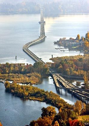
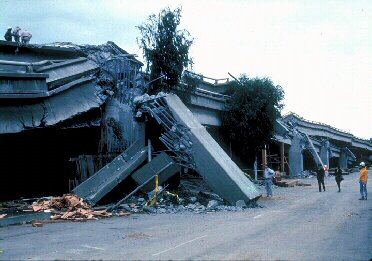
The weary and crowded 1963-vintage 520 bridge connects Seattle with Eastside job centers such as Bellevue, Redmond, and Kirkland but is at major risk of catastrophic failure in a 70 mph windstorm, or earthquake. At the same time, growing regional traffic congestion has prompted a public warming to expansion of regional transit, and bettered the odds for a system of electronic, time-variable tolling on major highways and state routes across metro Puget Sound. A priced-lanes pilot project for carpoolers and solo drivers is already underway on SR 167, and flat-rate electronic tolling in place, to rave reviews, on the new southbound span of the Tacoma Narrows Bridge.
The 520 tolling committee's latest report reveals that:
# Starting tolling in 2010 instead of at bridge completion in 2016 would pry loose an additional $400-$500 million, lowering the costs of bond borrowing for construction, which is to be repaid by tolls;
# The most revenue toward completion of the $3.7 to $3.9 billion project comes from tolling both the SR 520 and I-90 bridges starting in 2010 ($2.4 billion, Scenario No. 9) or 520 in 2010 and I-90 in 2016 ($2.4 billion, Scenario No. 4);
# One-way tolls on both bridges would range from 75 cents off-peak to $2.95 at peak hours in Scenario No. 9, and from 75 cents off-peak to $3.25 at peak in Scenario No. 4;
# Tolling 520 alone starting in 2010 (Scenario No. 7) would cut peak-hour traffic volume in the vicinity of 17 to 26 percent while peak-hour flow would rise three to seven percent on I-90;
# Tolling both 520 and I-90 starting in 2016 (Scenario No. 9) would deliver peak-hour volume cuts of 10 to 11 percent on 520 and 12-16 percent on I-90, as commuters shift travel times or use transit;
# Time-variable tolling increases peak-hour speeds on 520 by 13-16 mph, nearly double the speed gain from flat toll rates.
Tolling opponents somehow imagine they are due a free ride because the construction, maintenance, and operations costs of Puget Sound roads and bridges, as population continues to swell in coming decades, can somehow all be covered by the incredible shrinking gas tax and ... what? More sales tax hikes or vehicle fees? They're nice if you can get 'em, but the well only runs so deep.
Pay as you go is the way to go in this day and age — coupled with cost-saving, performance-based consortium contracting to design, build, operate, and maintain surface transportation facilities and systems.
The four-lane SR 520 bridge across the lake is to be replaced with a six-lane structure. Current plans call for two "general purpose" lanes and one high-occupancy vehicle lane in each direction, the former would be tolled via either a flat or time-variable rate if a plan is adopted. This is confirmed by WSDOT, though it can get a bit confusing because one doesn't necessarily think of general purpose lanes as being tolled. On the I-90 bridge, the agency also confirms, tolling would be on all general purpose vehicle lanes, except under one scenario that exempts eastbound traffic from Mercer Island. On both bridges the possible HOV lane could be designated a High Occupancy and Toll (HOT lane), free to transit and ride-share vehicles, but also available, for a toll, to solo drivers.
The more time-variable tolling, and the sooner, the better: It will further drive alternative choices such as ride-sharing and telework, and raise more money for regional surface transportation needs, transit included.
The policy decisions to come on tolling the SR 520 bridge, and perhaps the I-90 bridge as well, are an important turning point for the state and region. Going forward, a broad regional plan to implement time-variable tolling on several highways and major state routes is needed. That would allocate scarce peak-hour capacity, ease congestion, and help pay for billions more in needed safety, repair, and mobility improvements on I-5, SR 99, SR 704, SR 509, US 2 and I-405/SR 167.
The question is, how serious are we about doing this? The legislature will provide the first piece of the answer when it next meets.
Editor's Note: This article first appeared at Cascadia Prospectus.
Matt Rosenberg is a senior fellow at the Cascadia Center for Regional Development, a transportation think tank that is part of the Discovery Institute in Seattle. E-mail him at mattr@discovery.org.
View this story online at: http://crosscut.com/2008/11/18/520-bridge/18637/
Transportation
Tuesday, November 18, 2008
Tolls without the toll-booth heading for SR 520 and I 90


Tuesday, March 18, 2008
Olympia Transport Bills 2008 Tolls, Eastside Rail, Ferries
Washington Legislature Advances Tolling For Puget Sound
Matt Rosenberg
In its election year "short session" concluded last week, the Washington state legislature took several important, albeit partial steps to advance tolling, commuter rail, passenger-only ferries and innovative transportation funding partnerships with non-government entities.
Let's review some key '08 transportation bills that made it through both legislative chambers, and now await the signature of Gov. Christine Gregoire.
ESHB 3096 (bill as passed - bill report - legislative history) has to do with the State Route 520 floating bridge connecting Seattle across Lake Washington to fast-growing Eastside business and residential centers such as Bellevue, Kirkland and Redmond. As the bill reports reminds us, the bridge carries 115,000 vehicles and about 150,000 people per day; it is 1.5 miles long and 44 years old. As has been widely noted, the rickety span could suffer a catastrophic failure in a severe windstorm or earthquake. So 3096 codifies the intent of lawmakers to toll State Route 520 to help pay for replacement of the current bridge. It creates an SR 520 bridge tolling implementation committee to guide coming decisions by the state transportation department and state legislature.
The committee's charge includes making recommendations to avoid traffic diversion to other state and regional roads such as the parallel I-90. Effectively, this will mean tolling on I-90 as well as 520. This will be a crucial second step toward regional tolling for Puget Sound - following on tolling which began last year on the new Tacoma Narrows Bridge, and the four-year SR 167 congestion pricing pilot project starting next month. While politically sensitive, regional highway tolling, and in particular congestion pricing to control peak hour flows, are crucial if we are to handle a projected 52 percent increase in population by 2040.
The committee must also consider technology. That means, in accordance with the current industry standard and tolling on SR 167 and the Tacoma Narrows Bridge, that electronic transponders and overhead gantries will be prioritized over tollbooths. Additionally, the bill requires that the SR 520 tolling committee consider "partnership opportunities." This is a clear reference to possible alliances limiting taxpayer exposure if costs will ultimately exceed available public monies. Partners would be non-government entities, perhaps labor or public employee union pension funds. Private transportation investment funds also enter into a variety of partnership agreements with willing government sponsors, but it's best if the public entity retains ownership of the asset and toll rates.
The 520 tolling committee must also consider input from the public and local elected officials, and report back to the governor and legislature by January of 2009. Then, the bill says, the state department of transportation may seek legislative approval for tolling the existing 520 bridge, and work with the feds to get around a generic prohibition of tolling on Interstates, barring a special agreement tailored to a facility. This is considered eminently do-able; and tolling on I-90 to limit traffic diversions is essential if tolling 520 is to work.
As noted in this Washington Post story yesterday, Seattle is one of five regions nationwide to receive a special federal "Urban Partnerships" grant for innovative solutions to road congestion. Here, it is $139 million, to help pay for implementation of congestion pricing on the new SR 520 bridge and various transit projects including $3.5 million to help launch a new passenger-only ferry in the metro region's western reaches, between Kingston in Kitsap County, and downtown Seattle. But for Puget Sound to get this federal largesse, there's a hook: the grant requires that "variable" tolling, levied at different rates depending on time of day or road congestion level, be approved by the state by September 30, 2009 for the 520 corridor.
To set the stage for that '09 legislation, state lawmakers in the recent session also approved E2SHB 1773, which sets a broader state policy framework for tolling (bill as passed - final bill report - legislative history). The bill states that the legislature must authorize any specific tolls; that tolls can be applied to bridges, highways, transportation corridors, approaches and bi-state facilities; and that the aims of tolling in Washington state will be to improve transportation system efficiency and provide funding, not only for construction but also for maintenance, operations and management. This last part represents an important acknowledgement that tolling is not just for getting things built; it is also now necessary for a big share of life-cycle costs. That's because federal and state gas tax revenues are in an irreversible decline as sources for construction and maintenance.
Without specificly mentioning the word, the bill leaves open the possibility that with legislative approval some future tolling revenues could be used to help fund transit. This is something Cascadia Center supports, as our director Bruce Agnew tells the Seattle Post-Intelligencer this morning.
HB 2730 (bill as passed - bill report - legislative history) advances regional passenger-only ferries, rescinding a state prohibition against their operations by port districts on Puget Sound. This bill is tailored to the above-noted Kingston-Seattle foot ferry route for which the Port of Kingston has received federal grant funding contingent on tolling of SR 520.
The Eastside commuter rail line which Cascadia Center has championed as part of a rails and trails partnership will get a feasibility analysis, under HB 3324 (bill as approved - bill report - legislative history). It directs Sound Transit and the Puget Sound Regional Council to do a fresh analysis of proposed north-south commuter rail between residence-rich east Snohomish County and the booming Eastside business centers of King County, along the abandoned BNSF freight rail line.
Supplemental transportation appropriations via HB 2878 provide an additional peek into the legislature's thinking on metro-region roads and transit (bill as passed - bill report - legislative history).
Included in the bill are provisions which:
# secure $300,000 for a consultant to devise a plan for co-development and public private partnerships at public ferry terminals (page 22, line 30);
# direct WSDOT to analyze, and if found feasible, seek requests for distribution of alterrnative fuels along WSDOT rights-of-way (page 22, line 34);
# underscore the importance to the $4 billion bi-state I-5 Columbia River Crossing bridge replacement project of fully assessing "opportunities for the joining of state and local government agencies and the private sector in a strong partnership that contributes to the completion of the project" (page 51, between lines 14-23);
# direct that $8.5 million of the state's passenger-only ferries account is provided for "near- and long-term costs of capital improvements in a business plan approved by the governor for passenger-only service."
The state is getting out of operating passenger-only ferries, and local operators including King County, the Port of Kingston, Kitsap Transit and others are filling the void. Cascadia Center continues to advocate a voluntary interlocal agreement between ports, cities, counties, private boat operators, tribes, labor and others - coupled with combined funding for foot ferries and Puget Sound cleanup - to help establish a coordinated regional foot ferry system on Puget Sound.
Wednesday, March 12, 2008
I-90 Took 40 years from idea to completion
What Happened
Planning for upgrading SR 90 to I-90 began in 1957 when population forecasts indicated that fast suburban growth would quickly overwhelm the capacity of SR 90 to service the needs of those commuting to jobs in Seattle. The land-acquisition process for the highway expansion began in the 1960s, with the bulk of it occurring in Seattle, not the growing suburbs. By 1970, there was increasing public concern in Seattle over the environmental impacts and equity of the project. Officials in the suburbs largely favored the project because of the decreased travel time to Seattle. Seattle saw the project as favoring suburbanites at the expense of its own neighborhoods and was concerned with the scale of relocations required in Seattle and the repeated disruption of mature neighborhoods. These concerns led to a court case that resulted in a 1971 Federal Appeals Court injunction prohibiting further I-90 land acquisition and construction. The court ordered the preparation of a relocation-assistance plan and an Environmental Impact Statement (EIS) pursuant to the National Environmental Policy Act (NEPA) of 1969.
Six years of impasse followed. Concerns among the affected municipalities were focused on the final scale and alignment of I-90. The impasse inspired the creation of unique groups to find areas of agreement among the municipalities, hear community concerns, and offer design recommendations. In 1972, FHWA convened a board of review to arbitrate disputes between the city of Seattle and WSDOT. It consisted of members appointed by the city of Seattle and WSDOT. At the suggestions of WSDOT, Citizen Advisory Committees were created for Seattle and the suburban communities. Composed of community representatives appointed by their respective city councils, the role of the committees was to hear community concerns and to provide local input to WSDOT. Representatives for the Judkins Park, South Atlantic Street, and Mount Baker neighborhoods sat on the Citizen Advisory Committee for Seattle.
In 1974, a groups was created to develop an overall solution to the I-90 impasse. The Governor appointed a 10-member, I-90 Commission consisting of State, county, and local officials from all the affected municipalities. Although the I-90 Commission failed to agree on the alignment or the capacity of I-90, the airing of community concerns ultimately led to the design of acceptable mitigation measures.
The idea of lids was discussed throughout the project, but there was no agreement on their use, even among community members. Originally, the Judkins Park and South Atlantic Street neighborhoods did not want a park over the lid, fearing that the space would attract crime. Later, the neighborhoods wanted a part. Also, the community groups at one time had not wanted an access ramp from I-90 into the community, but changed their position after the highway was redesigned.
The issue of noise and safety impacts of I-90 on an adjacent, common, local elementary school was also a critical concern for the three neighborhoods. The I-90 alignment require the acquisition of a smaller sliver of land (less than 1 acre) from the Coleman Elementary School playground. The neighborhoods, however, voiced concerns for the safety of school children because during construction they would have to cross a temporary, pedestrian-bridge structure over the active freeway to get to school. The long-term, daytime noise impact on the school children was also a strong concern of parents and educators.
When the draft EIS was completed in 1976, extensive negative comments were received, and serious differences of opinion emerged among the major local participants on the I-90 Commission, including Seattle, two suburban communities, and King County. The Governor appointed a two-person mediation team to identify areas of agreement among the parties--an approach that finally bore fruit.
In 1977, the affected municipalities signed a memorandum of agreement reducing the proposed configuration of the freeway from 12 to 8 lanes. The agreed-upon configurations of the lid over the freeway in the Judkins Park and South Atlantic Street neighborhoods was fixed at a length of 2,100 feet across the width of the highway. In addition to providing physical access across the freeway, the lid would serve as mitigation to reduce noise and aesthetic impacts from the proximity of the freeway and enhance the landscape of the affected neighborhoods. In 1979, the Federal Court of Appeals ruled that the EIS was adequate and lifted the injunction prohibiting I-90 construction. Work began that year.
Project Chronology
1940 U.S. 10 is completed as a four-lane road connecting Seattle, WA, to Mercer Island and Bellevue.
1947 The general alignment of U.S. 10 is selected for future upgrade to Interstate standards.
1955 Designation of U.S. 10 is changed to SR 90.
1957 Washington State Department of Highways (WSDOT) initiates engineering studies for I-90.
1960s R. H. Thomson Expressway is proposed, going through parts of Judkins Park and South Atlantic Street neighborhoods. Right-of-way (ROW) acquisition commences.
1963 The project alignment is selected for I-90 with a 10-lane project design. ROW acquisition commences.
1966 With revised traffic projections, design capacity for I-90 increases to 12 lanes.
1970 Construction is halted in response to public concern over environmental issues and lane arrangements for the entire facility.
1971 The U.S. Court of Appeals orders an injunction against further construction and land acquisition in the project corridor. The court also orders the preparation of a relocation-assistance plan and an Environmental Impact Statement (EIS) to comply with the National Environmental Policy Act of 1969.
1972 R. H. Thomson Expressway is deleted from the regional transportation plan.
The Federal Highway Administration convenes a Board of Review to arbitrate Seattle's issues, with the nine members selected by the Mayor and approved by WSDOT and Seattle's City Council. 1974 Governor appoints a 10-member commission consisting of State, county, and local officials to develop a solution to the construction impasse. The Governor and Mayor of Seattle propose a revised lane configuration of the project.
1976 Serious disagreement persists on the draft EIS among the jurisdictions involved--city of Seattle, two suburban communities, and King County. To address the impasse, the Governor appoints a two-person mediation team to find areas of agreement among the parties. Seven months later, the parties sign a memorandum of agreement stipulating an eight-lane arrangement with two center lanes designated for transit and high-occupancy vehicles as well as other mitigation, including the Seattle lid.
1979 The court rules that the EIS is adequate and the injunction is lifted. Construction of I-90 begins.
1987 Construction begins on the roadways of the Seattle lid.
1991 The new elementary school is completed.
1992 Construction of the Seattle lid is completed.
1993 I-90 is officially opened. (The project is constructed with the original SR 90 open to traffic throughout the I-90 construction process.)
1996 Landscaping work on the lid is largely completed
Is Eastside Transportation Association a Campaign Group?
9/3/07
The Eastside Transportation Association, a transportation issues group, supports expanding bus service rather than extending light rail across the Interstate 90 bridge from Seattle to the Eastside - a proposal in the regional roads/transit ballot issue. It has run ads questioning the new system the ballot measure proposes.
Several of its members wrote a voter's pamphlet statement opposing the measure.
So, is that campaigning, and does the association need to register as a campaign group with the state?
The group's chairman, Jim Horn, says no.
But this week the state Public Disclosure Commission began considering the question in response to a complaint from a roads/transit backer, Will Kelley-Kamp, who thinks the association is, indeed, campaigning.
Citing radio ads and statements made by ETA members in public, Kelley-Kamp said in his complaint that the association "is making expenditures in opposition to the Roads and Transit ballot measure and operating as a political committee in opposition to (it). The ETA has not filed a (registration document) with the Public Disclosure Commission or other required reports and is in violation of Washington State law."
"If they're going to be a campaign, they should make it official," Kelley-Kamp said in an interview. Kelley-Kamp filed the complaint Monday and reported it on the liberal political blog Horsesass.org on Wednesday.
Horn, contacted Wednesday, said he hadn't seen the complaint. He said ETA is "an educational organization" that tries to inform the public on transportation issues.
He said the group supports high-frequency bus service in special highway lanes to move people between cities, but the ads were aimed at attracting people to the group's Web site and "we have not put anything out in support of that ballot issue. We certainly discussed the elements of transportation."
Disclosure commission staffers confirmed they've received Kelley-Kamp's complaint but haven't decided yet whether to investigate it. "We want to learn a little bit more about (the association) and determine whether or not they are a political committee," said commission spokeswoman Lori Anderson.
Monday, March 10, 2008
East Transportation Letter to sec Macdonald re Use of I-90 Center Lanes

EASTSIDE TRANSPORTATION ASSOCIATION
“Dedicated to improving our quality of life and the environment by reducing congestion thru increased mobility”
October 12, 2005
Douglas MacDonald, Secretary
Washington State Department of Transportation PO Box 47316
Olympia, WA 98504-7316
Subject: Preservation of I-90 Use
Dear Secretary MacDonald:
Following up on our letter to you dated April 12, 2005, we encourage DOT to continue its independent study of the I-90 Bridge. By initiating an independent study of capacity and congestion issues on the I-90 Corridor and the impact of changing current operations of the Corridor, we believe that DOT has responded to our request in the last paragraph of our letter which stated:
“Certainly the bottom line of our message to you is for you to assure us that the WSDOT will
We understand that these studies will be completed in March of 2006.
We were concerned, as noted in our April 12th letter, by the efforts of various political entities which tried to prevent the study from being done by the first amendment to the 1976 I-90 Memorandum of Agreement (MOA) that concluded “the best use of the center roadway is High Capacity Transit (HCT)” without any studies leading to this unfounded decision.
Unfortunately, we are now further concerned that a second amendment to the MOA has been secretly rushed through in an effort not only to undermine the objectivity of this study and influence its outcome but also to influence the results of local elections. This letter to you dated September 8th from Sims, Marshall, Merkle, Ladenburg, and Nickels was introduced into the Mercer Island City Council meeting of October 3rd late at night (9:45pm) under another agenda item. This amendment also introduces the controversial issue of “congestion based pricing” on I-90 as a coming event. The residents had no chance to read and comment on it. Some members of the Mercer Island City Council had not even seen it or seen it in its final form before the meeting. It was hurriedly approved and signed without benefit of public availability and comment.
We would again call to your attention that the Sound Transit led study to develop and evaluate
alternatives that would modify I-90 to provide two-way priority Transit/HOVoperations selected R-8a as the preferred alternative of those evaluated in the draft EIS. R-8a, which squeezed a fourth lane in each direction onto the outer roadways for priority Transit/HOV use, did not change the current operation of the center roadway. Page 3.2-43 of the draft EIS stated quite emphatically:
Page 1 of 2

The Project is not a light rail or High Capacity Transit (HCT) project; it is intended to improve regional express bus transit and HOV operations. If there is a high capacity transit project proposed for I-90 in the future, it would have its own environmental analysis. The project alternatives have been reviewed (only) to determine whether they would be adaptable for a future light rail project.
Despite this disclaimer, the final EIS was released with many references to conversion of the
center roadway to exclusive “high capacity transit” (HCT) use. And with absolutely no study or analysis of such an alternative, the WSDOT not only allowed the MOA to be revised accordingly, but was signatory to the revised MOA. We believe the MOA was erroneously revised and may in fact be illegal, having no environmental impact assessment of that change prior to its enactment.
We believe that the public wants reduced congestion by maximizing the overall throughput of the I-90 bridge for all modes of travel. It is hard to visualize how the dedicated use by HCT of the costly center two lanes with five minutes or one mile of wasted space between trains at best due to the downtown tunnel limitation and forcing all non-transit traffic into the existing three general purpose lanes and bringing them to a virtual standstill is a better utilization of the I-90 Corridor than the continued multi-use of the two center lanes with the addition of the outside roadways for priority transit.
Your independent study of capacity and congestion issues on the I-90 Corridor and the impact of changing current operations of the Corridor will allow the public to finally become aware of the increased congestion and traffic delays caused by various operational modes of the I-90 Corridor.
We would encourage you to not limit your studies to HCT in the center roadway as suggested by the MOA amendments but to keep BRT with HOV/Mercer Island traffic (current use) combined with the use of the 4th lane in each direction for priority Transit/HOV use (R-8a) as one
configuration for evaluation.
The I-90 corridor deserves the same type of analysis that preceded the publicly accepted I-405 ROD. We would further encourage you not to introduce the controversial congestion based pricing into the study. Perhaps then we can make informed policy decisions based on facts rather than out-of-the-blue political decisions that often make things worse.
We look forward to your response.
Sincerely,
Ward Truess, President
Eastside Transportation Association
cc: Dan O’Neal, Chair, State Transportation Commission
Dave Dye, Urban Corridors Administrator
Dan Mathis, FHWA Regional Administrator
Page 2 of 2
Saturday, March 8, 2008
Light Rail will greatly increase congestion on I-90
By Michael Ennis, Director, Center for Transportation Policy Summary Introduction One of the more controversial projects in Sound Transit's proposed second phase (ST2) is reconfiguring the center lanes of Interstate 90 (I-90) to accommodate up to 19 miles of light rail between Seattle and Bellevue. The proposal includes replacing the two center High Occupancy Vehicle (HOV) lanes that cross the bridge with light rail, a form of high capacity transit (HCT). Because Sound Transit is already re-striping the outer lanes across the bridge to squeeze one HOV lane in each direction (approved in its first phase) Sound Transit claims there would be no net-change in lane capacity due to replacing the center lanes with light rail.[1] This claim is not entirely accurate and will be examined later. Called East Link, Sound Transit estimates the light rail lines to Bellevue will have capital costs of $3.017 billion in 2006 dollars, which represents nearly one-third of the total asset package in ST2. Sound Transit also estimates that once the East Link project is complete in 2030, ridership would range between 31,000 and 36,000 daily riders, depending on the routes chosen.[2] Light Rail Would Make Traffic Congestion Worse Sound Transit's East Link, which includes reconfiguring the center lanes on I-90 to accommodate light rail, would have a negative impact on the bridge's vehicle carrying capacity. In other words, Sound Transit's plan to place light rail across the I-90 bridge would make traffic congestion worse. Consider the following charts, which illustrate the average daily vehicle carrying capacity of the I-90 bridge with and without light rail in 2030.[3] Light rail would cut morning vehicle carrying capacity by 15%. Light rail would cut afternoon vehicle carrying capacity by 8%. Including all modes, the morning peak commute at mid-span on the I-90 bridge would experience a 15% reduction in overall capacity and the afternoon peak commute would experience an 8% reduction in capacity. This means the number of vehicles that can physically cross the I-90 bridge during the morning and afternoon peak commutes would be reduced as a direct result of adding light rail to I-90. Accounting for different modes, freight vehicle drivers would suffer the most. During the morning peak drive, the number of freight trucks able to cross the bridge into Seattle would drop by 24%. Leaving Seattle, truck drivers would see a 19% reduction during the afternoon peak commute.[4] Drivers of single passenger vehicles would see a 20% reduction in throughput during the morning peak commute and a 10% reduction during the peak afternoon commute. Drivers of High Occupancy Vehicles (HOVs) would not pay as steep of price as freight and single passenger drivers. During the morning peak commute, both 2-person and 3-person HOVs would enjoy a 9% increase in capacity. But peak afternoon HOV commuters will endure a 3% capacity reduction. Increased Delay and Lower Vehicle Speeds The reduction in throughput will lead to an increase in delay for drivers crossing Lake Washington on I-90. In 2030, peak travel times in the morning from Eastgate to Seattle would increase from 32.5 minutes to 41.4 minutes with light rail.[5] That is a 27% increase in delay over doing nothing. And eastbound drivers in the afternoon would see a 24% increase in delay. In another measure, the average speed to cross the I-90 bridge would worsen with light rail. Westbound vehicle speeds would fall from 16.8 miles per hour in 2030, to 13.2 mph during the morning peak commute, a 21% reduction. Eastbound drivers in the afternoon would see a 17% decrease in their average speed. Economic Impact on Freight The Federal Highway Administration (FHWA) estimates that freeway congestion costs each truck about $32.15 per hour of delay in 2005.[6] A free-flow commute across the 9.1 mile corridor on I-90 between Bellevue and Seattle should take 9.6 minutes, or 19.2 minutes roundtrip.[7] Delay does not exist in this ideal scenario and thus does not result in a cost to the freight industry. In 2005, the average roundtrip peak commute along the 9.1 mile corridor was 28.2 minutes.[8] This means delay represented about 9 minutes, or 32% of a roundtrip peak commute. Using the FHWA's estimate, trucks making a roundtrip peak-hour commute across the I-90 bridge in 2005 incurred a cost from delay of about $561,725. The following chart illustrates the I-90 bottleneck and the cost to the commercial trucking industry, with and without light rail in 2030. In 2030, if I-90 remains the way it is today, the average roundtrip peak commute is estimated to take 45.1 minutes.[9] Adjusting for inflation, the cost to the freight industry would be about $4.9 million per year, or $8,596 per truck.[10] Under the light rail option, the average roundtrip peak commute would climb to 54 minutes and truck capacity would fall by 20%. Despite 20% fewer trucks able to cross the bridge during the peak commute, the cost to the freight industry would be more than $5.2 million annually, costs that will be passed on to consumers through higher prices. Assuming the remaining 20% of trucks would still need to cross the lake either by finding an alternative route or waiting for the congestion on I-90 to clear, the total cost to the commercial trucking industry would climb to $7.5 million, or $13,157 per truck. In other words, Sound Transit's light rail proposal would directly increase the cost to the commercial trucking industry by $2,624,425 million a year, or $4,561 more per truck, just to cross the I-90 bridge during the peak commute. This is 54% more costly than if Sound Transit did nothing on I-90. Causes of Increased Delay The negative traffic impacts caused by Sound Transit's light rail plan across I-90 can be attributed to three factors: narrower lanes, weave and capacity. In order to squeeze a single HOV lane into the main-line, Sound Transit is re-striping the current roadway to make the shoulders and general purpose lanes smaller. The narrower roadway will have two effects: drivers would generally be forced to slow down, and traffic accidents would make it harder for drivers to negotiate the smaller roads. As with most restricted lanes, merging will also slow traffic. Without direct access ramps, transit and carpool drivers would have to cross three general-purpose lanes before they reach the exclusive HOV lane. The third factor is lane capacity. Sound Transit says that replacing the two reversible center lanes with single HOV lanes in the outer roadways does not reduce lane capacity.[11] This is not entirely accurate. During the morning peak commute drivers have a total of five westbound lanes (three general purpose and two HOV lanes). With Sound Transit's reconfiguration, capacity would fall to only four westbound lanes. The same reduction would occur during the eastbound commute in the afternoon. This is a 20% reduction in lane capacity during the morning and afternoon peak commute hour. The Federal Government's Concerns Sound Transit intends to seek federal funds for its East Link Project, but the federal government has already expressed "concern for the degradation of the function of I-90."[12] And since the corridor is a federal highway, the federal government has jurisdiction over the approval process.[13] The I-90 project also appears to violate the federal government's National Strategy to Reduce Congestion, which allocates federal dollars based on a project's ability "to reduce congestion."[14] In fact, the Federal Highway Administration (FHWA) has already raised concerns to Sound Transit "about how the proposal of HCT in the I-90 corridor will impact I-90 operations and safety."[15] If the federal government decides the loss of vehicle capacity is unacceptable, Sound Transit could either lose all federal funding, which means taxpayers could be on the hook for the additional costs or be forced to abandon light rail entirely for another HCT alternative, like a Bus Rapid Transit/High Occupancy Vehicle (BRT/HOV) option. Either way, the changes would be significant and occur only after voters had already decided on the current proposal laid before them by Sound Transit. Conclusion Not only would this proposed project fail to reduce traffic congestion, Sound Transit's $3 billion plan to place light rail across I-90 would ironically make congestion worse. This would have a negative impact on drivers, and would cost the commercial trucking industry millions of dollars. It is not fair to voters for Sound Transit to include the light rail project on I-90 in its $30 billion proposal, when federal officials have already expressed their unease with a plan that increases traffic congestion and Sound Transit officials know the risks. Interstate 90 is a federal highway and is the primary east/west corridor from Seattle to the eastern United States for both passenger and freight vehicles. Deliberately increasing congestion contradicts the core functions of government and further perpetuates the public's skepticism about the process. When comparing Sound Transit's light rail plan across I-90 with the no-action option, drivers and consumers actually would be better off if policymakers did nothing. This is the fourth chapter in an ongoing series of analysis on the RTID/ST2 ballot measure. The previous installments include: "Part I: The Cost of Sound Transit," "Part II: Your Transportation Tax Burden," and "Part III: Cost Exceeds Benefits in Sound Transit's Light Rail Expansion." Michael Ennis is the Center for Transportation Policy Director at Washington [1] http://www.soundtransit.org/Documents/pdf/projects/eastlink/East%20Link_Segment_A.pdf [2] http://www.soundtransit.org/Documents/pdf/projects/eastlink/EastLinkBoardBriefingBook.11.9.06.pdf [3] Data adapted from the Interstate-90 Center Roadway Study completed by the Washington State Department of Transportation in July 2006. The full report can be found here: http://www.wsdot.wa.g ov/NR/rdonlyres/2D30E991-6159-4F2A-A84B-284622643B79/0/I90CenterRoadwayStudy.pdf. [4] Ibid. [5] Ibid. [6] http://www.fhwa.dot.gov/policy/otps/bottlenecks/execsum.htm [7] The free-flow commute time was estimated using a Time, Speed and Distance calculator found here: http://www.csgnetwork.com/csgtsd.html. Assumed a highway speed of 60 miles per hour for 9.1 miles. [8] Data adapted from the Interstate-90 Center Roadway Study completed by the Washington State Department of Transportation in July 2006. The full report can be found here: http://www.wsdot.wa.g ov/NR/rdonlyres/2D30E991-6159-4F2A-A84B-284622643B79/0/I90CenterRoadwayStudy.pdf. [9] Ibid. [10] Assumes an annual 3.5% rate of inflation. The WSDOT corridor study estimates an average of 570 trucks crossing the bridge in 2030 during the morning and afternoon peak commute. [11] http://www.soundtransit.org/Documents/pdf/projects/eastlink/East%20Link_Segment_A.pdf [12] http://www.soundtransit.org/Documents/pdf/projects/eastlink/EastLinkBoardBriefingBook.11.9.06.pdf [13] Ibid. [14] http://www.fhwa.dot.gov/congestion/index.htm [15] http://www.soundtransit.org/Documents/pdf/projects/eastlink/EastLinkBoardBriefingBook.11.9.06.pdf
2007-12

Policy
Center. Nothing in this document should be taken as any attempt to aid or hinder the passage of any legislation before any legislative body.
Contact Washington Policy Center at 206-937-9691 or www.washingtonpolicy.org.
Friday, March 7, 2008
Hammond sees tolls on I 90, 520; surface road maybe for Viaduct
 State's new DOT chief faces big challenges
It shouldn't be hard to find people unhappy with new Transportation Secretary Paula Hammond.
There are the ferry riders whose trips have been disrupted by aging, broken-down boats.
There are the truck drivers who lost millions of dollars when I- 5 was closed during the December floods in Lewis County and when the mountain passes were shut down this winter because of avalanches.
There are the ferry workers who have seen their schedules upended by the uncertainties of which boats would be running on which routes.
Yet Hammond, who took over the state's top transportation job in November, is so popular, and comfortable in her role, she can even mock herself.
"I'm the person who shuts things down," she joked at a recent meeting.
Hammond, 51, the first woman to head the state Department of Transportation, is no novice when it comes to transportation issues. She's been with the DOT for nearly 30 years, working her way up from entry-level engineer.
She was the chief aide to former Secretary Doug MacDonald, who recommended her as his successor. Hammond manages more than 7,000 employees, 7,000 miles of highways, 3,300 bridges and tunnels and 29 state ferries that carry 26 million passengers each year.
She is paid $163,500 a year.
"What we've learned in the past three to four months is how much we've taken the transportation system for granted and how much we can't," said Hammond, sitting in her Olympia office near the state Capitol, where she's been spending much of her time this winter. "My job is to be steward of the system. We have to keep transportation whole."
She knows she's been clobbered with the ills of the state ferries and the closed freeways. Yet even those people most affected don't blame Hammond.
One reason may be that she's been on the job only a few months.
"Paula Hammond is new. She couldn't do anything," said Bremerton resident Ann Erickson, who has been critical of what she sees as Bremerton taking the brunt of the ferry woes. "Every little hiccup and burp, they punish Bremerton, and we're sick of it," she said.
Erickson blames legislators, not Hammond, for the trouble. "We have to give Paula a chance. Let's give her a chance to see what she can come up with."
Gordon Baxter, lobbyist for the Inlandboatmen's Union, which represents workers on the state ferries, agrees.
"I think she's been doing a great job," he said. "She's the first one who's had the nerve to say, 'Let's look at all the vessels and the fleet and not make a political decision, but a decision that is best for the system and best for the users.' Yanking those four Steel Electrics out of service, that couldn't have been an easy decision."
Hammond pulled the four 80-year-old boats out of service in November because of extensive hull damage, eliminating car-ferry trips between Keystone on Whidbey Island and Port Townsend. It caused a huge uproar.
MacDonald, who retired in July, said he's not sure he would have had the political nerve to do the same thing.
"Her decision to pull the four boats was a very gutsy decision that showed her quality — no baloney," MacDonald said. "I wonder if I would have been so bold or so decisive. I'm not sure I could have done it."
State Sen. Cheryl Pflug, R-Maple Valley and member of the Transportation Committee, said she supported Hammond's appointment, but criticized her appointment of David Moseley as new head of the state ferries.
"I was critical of hiring a director of ferries with no maritime experience," said Pflug, who believes Gov. Christine Gregoire heavily influenced the decision.
From "grunt work" to top job
Hammond was born and raised in Klamath Falls, Ore., and graduated in 1979 from Oregon State University in civil engineering, one of eight women in a class of 120. Recently she returned to Corvallis with her two daughters to be inducted into the OSU College of Engineering's Academy of Distinguished Engineers.
She had several job offers after she graduated and accepted the one from the Washington Department of Transportation.
Her first job was engineer I, inspecting an asphalt plant in Montesano. She also worked on the survey crew for the replacement of the Hood Canal Bridge. "It was grunt work young engineers had to do," she said.
The benefit is that she knows a lot of the people she now bosses.
"When I applied for the [top DOT] job I was overwhelmed by the support I got," Hammond said. "I have a sense we are a very big family."
Even though she considers him her mentor, Paula Hammond is no Doug MacDonald. She doesn't send e-mails at 2 a.m. She doesn't have a cellphone glued to her ear. She's unlikely to pull over when she sees a road-construction site, as MacDonald was prone to do, often making him late to meetings.
It annoys her when she's at a meeting and all the participants are working on their BlackBerries. When she pulls out her own at home, her children chide her.
She has three: son Greg, 19, who attends Western Washington University; daughter Rachel, 16, who wants to be a government lawyer; and daughter Kerry, 10, who has an artistic flair. Both girls are active in Irish dancing.
Hammond said one reason she's been able to balance her work and home life is her husband, Alan, to whom she's been married nearly 30 years. A land surveyor with the Department of Fish and Wildlife, he's the one who picks the girls up from school.
"I have very little free time," she said. "Doug [MacDonald] had no life."
By her own accounts, Hammond is not a patient person.
"I'm the kind of person who likes decisiveness," she said. "My style is to make a decision and move forward, and it's nice to have a governor like that."
"Never loses her cool"
Much of Hammond's work recently has been dealing with the Legislature on various transportation issues. House Transportation Chairwoman Judy Clibborn, D-Mercer Island, gives her high marks.
"What a breath of fresh air," she said. "She never loses her cool. I saw her at 4 a.m. on Snoqualmie Pass, at 8 a.m. in Olympia and at noon in Spokane with the governor."
As for the decision to pull the four ferries out of service, "I think she did everything she had to do, and she had the guts to do it," Clibborn said.
"She answers questions straight and owns up to things that go wrong." Clibborn said she had no idea when Hammond was appointed that she was an engineer. An engineer hasn't led the department, known for political appointments, since 1981. When MacDonald was hired six years ago, he confessed that he knew little about roads and engineering.
MacDonald said that when Hammond was his chief of staff, a lot of the day-to-day work got funneled through her office.
"A lot of stuff went in her door and out her door," he said. "In dealing with the Legislature, there's a quality of candor about her and a sense of humor. Her personality is enormously warm and open. She's had to deal with one crisis after another in an extraordinary way."
Hammond said she doesn't spend every day wondering what MacDonald would have done, and that's probably no more apparent than when she was dealing with the ferry crisis.
If she'd known what faced her in ferries, would she still have taken the job? Yes, she says.
"Every problem has a solution," she said. "We knew when we lost the [motor-vehicle excise tax] we had to rebuild the fleet. We let it linger too long until things started to suffer."
But she is no apologist for the DOT. She said when the ferry system realized two years ago it couldn't build a new dock in Keystone, it took too long to come up with a new plan.
"Is the DOT clean in all this? No," she said. "We knew we needed more than the three 144-car ferries, but there was group indecision. We were put in a place where there was no answer."
She said the sense of ownership people feel about the ferry system has never been fully understood, but it's finally caught the attention of the Legislature. She said a substantial revenue source is needed for ferries, and raised the possibility of a property tax for ferry commuters.
On other transportation issues, Hammond said she is optimistic about the Alaskan Way Viaduct. Work is being done now on the south end, and Gov. Christine Gregoire is expected to decide by the end of the year on what to do with the central waterfront portion.
Hammond said the state will look at a surface option for the viaduct, "but it would have to prove it can take a lot of the traffic." Some surface-option critics say that's a high hurdle for the state to overcome.
As for Highway 520, she believes that both that bridge and the Interstate 90 bridge will eventually have tolls to pay for the 520 replacement. Hammond is a believer in user fees, time-of-day tolling, and HOT lanes that drivers pay to use. "We're beyond the place where the gas tax can sustain us," she said.
Hammond was appointed by a Democratic governor, but says she's made friends across the political spectrum.
"Many of my Republican friends are telling me I'm doing a good job," said Hammond. "That's a small measure of satisfaction."
Susan Gilmore Seattle Times staff reporter
Saturday, March 1, 2008
Nickel and TPA Gas Tax Projects are way behind
Despite Claims, Gas Tax Projects Are Not on Track
by Michael Ennis
Director, Center for Transportation
March 2008
In 2003 and 2005, state officials raised the gas tax by 14.5 cents to pay for 432 Nickel and Transportation Partnership (TPA) projects. Now, state leaders are not fulfilling what they said when they imposed these tax increases.
Despite overestimating revenues and underestimating costs by $3.8 billion, state policymakers assert this year’s supplemental transportation budgets preserves these projects. Through a series of accounting adjustments, lower interest rates and overhead reductions, leaders claim they have funded the gap.
The following remarks illustrate how state leaders explain their assurances to the public:
“We followed the governor’s lead, scrutinized every last project and were able to produce a budget that keeps projects on track...”
-Rep. Judy Clibborn, February 20, 2008
“The House Chair’s proposed budget maintains the commitment to the Nickel and Transportation Partnership projects.”
-Budget Highlights, House Transportation Budget, February 20, 2008
“The Governor’s 2008 budget proposal keeps these projects moving forward and addresses immediate safety needs.”
-Statement on the Governor’s website for her proposed Transportation budget
“Democrats…said their budget keeps all of the 400-plus planned highway and bridge projects moving forward.”
-David Ammons, AP article, February 22, 2008
Upon reviewing each of the proposed budgets however, shows that state policymakers are not maintaining their commitment. In 2003, state officials promised taxpayers that 158 Nickel projects would be complete by 2013 and that the 274 TPA projects would be completed by 2021.
The Governor’s budget delays ten projects beyond these original promise dates; the Senate delays eleven and the House delays fifteen. Some projects are delayed more than fourteen years, which implies they may never be built. Pushing projects beyond their original completion dates breaks the promises made to voters when the tax increases were first adopted.
The following table shows the delays in each of the budget proposals.
Michael Ennis is director of the Center for Transportation at Washington Policy Center, a non-partisan public policy research organization with offices in Seattle and Olympia. Nothing here should be construed as an attempt to aid or hinder the passage of any legislation before any legislative body. For more information contact WPC at 206-937-9691 or online at washingtonpolicy.org.
Friday, March 12, 2004
RTID Plan for Roads 2004
Regional Financing for Transportation Projects in King, Pierce and Snohomish Counties Project Benefits King, Pierce, Snohomish • State's fastest growth, largest population • Global economy with 3 major ports • Job & freight highways serve major employers: Boeing, Microsoft, REI, Paccar, Safeway, Starbucks, Weyerhaeuser • Small, rapidly growing companies contribute many jobs Improve or fall behind • Transportation infrastructure, highways aging, over capacity • Must improve to remain competitive • Gaps in current funding for essential projects, connections • Major projects demand regional funding Essential, critical transportation investments • Three-county effort to complete road, transit, possibly light rail links in transportation network • Funding package of local taxes & fees • All tax dollars to be spent in counties where raised • Board – Members of three County Councils decide projects, funding recommendations • Region's voters must approve recommendations • Major improvements to "highways of regional significance" – I-5, I-405, SR 167, SR 9, SR 509, US 2, SR 522 • Earthquake safety – Viaduct, 520 bridge – Replace, expand • HOV lane completion – I-5, SR 167, SR 509 • Transit-related improvements • Complete 1.5-mi light-rail link to airport Project plan adopted June 3, 2004 $12.8B: These projects are an essential part of our region's long- term vision. Funding recommendation adopted June 3, 2004 Recommended • 0.2% sales tax • 0.1% RTA sales tax • 0.3% MVET • $75 license fee • 2.8¢ local option gas tax • Tolls on SR 520 Additional allowed • 0.3% sales tax • Employer tax • Parking tax • $25 license fee Making our highways safer • Region's most earthquake-vulnerable structures upgraded or replaced – Alaskan Way Viaduct – SR 520 Floating Bridge – More than 20 lane-miles • 29% of "high accident" locations improved • 24% of "high accident" road miles improved Moving our freight • In some areas, truck traffic increasing at faster rate than cars • Major freight routes targeted for nearly all improvements • Reduce truck delays by 6,400 hrs/day • Businesses save $93 million/year when projects completed (first 15 years) Environmental benefits • Update decades-old standards • More stormwater detention and treatment for runoff • Better protection for stream habitats • Rehabilitate, create wetlands and stream-side vegetation • New noise walls, landscape berms and other features will limit noise impacts • Less idle time = less polution • Less gas consumption per vehicle Improving traffic flow On highways with RTID projects, 3.4% more lane miles will allow: • 39% more trips • 28% faster commute • 21% reduction in travel time • 25% reduction in delays Every roadway benefits Across the entire three-county road network, the RTID projects will allow: • 34% more trips • 7% faster commute • 6% reduction in travel time • 14% reduction in delays Benefits to you: King County Key Projects Map available at www.rtid.dst.wa.us King - Overall Situation • 12 th largest county population in US • Population expected to grow by 1/3 between 2001 and 2010 • Suburbs growing faster than urban areas • Kent warehousing, distribution center 5 th largest in nation • Port of Seattle imports/exports to over 100 countries Project: SR 99 Alaskan Way Viaduct Map available at www.rtid.dst.wa.us Project: Alaskan Way Viaduct Threatened by quake, choked by traffic: • Major quake could cause collapse • Viaduct, seawall weak before '01 quake • Seawall built partly of wood; supports viaduct, streets, buildings • Viaduct carries 25% of downtown traffic • Built for 65,000 vehicles/day – now carries 110,000 vehicles/day = 69% over capacity • Funding – local money needed to leverage state, federal share Replacement: Alaskan Way Viaduct • Replace or tunnel • Protection from earthquake threat • Repair seawall • Wider lanes improve traffic flow • Addition of shoulders boosts safety • New water systems improve quality of runoff going into Puget Sound, and meet new standards Funding will jump start this most critical project with ¼of overall replace- ment costs. Replacement: Alaskan Way Viaduct • Replace or tunnel • Protection from earthquake threat • Repair seawall • Wider lanes improve traffic flow • Addition of shoulders boosts safety • New water systems improve quality of runoff going into Puget Sound, and meet new standards That means: Viaduct, seawall replacements will be safe in earthquake. No more squeezing into narrow lanes or driving too close to guard rails. Stalled cars can move to the side for safety, while traffic keeps moving. Project: SR 520 Evergreen Point Floating Bridge Map available at www.rtid.dst.wa.us Project: SR 520 Floating Bridge Quake, storm could sink it; traffic jams it • One of oldest floating bridges in world (1962) • Hollow columns vulnerable to quakes • Too low in water, vulnerable to storms • Far beyond capacity – high accident rates, weakening support structure • No shoulders mean accidents jam traffic • No HOV lanes restrict traffic flow • 2 replacement options: 4 or 6 lanes 111% reduction in travel time • Six-lane option includes HOV lanes • Full shoulders • Bike/pedestrian lanes link Eastside, UW • New braces for earthquakes, storms • Stronger flotation for future capacity • Remove Arboretum "ramp to nowhere" • Stormwater facilities ensure runoff meets water quality, protect Yarrow Pt. Reserve • New sound walls reduce noise • 9,900 fewer hours people spend in traffic a day • $2.0 million/year saved from accident reduction Replacement: SR 520 Floating Bridge 111% reduction in travel time • Six-lane option includes HOV lanes • Full shoulders • Bike/pedestrian lanes link Eastside, UW • New braces for earthquakes, storms • Stronger flotation for future capacity • Remove Arboretum "ramp to nowhere" • Stormwater facilities ensure runoff meets water quality, protect Yarrow Pt. Reserve • New sound walls reduce noise • 9,900 fewer hours people spend in traffic a day • $2.0 million/year saved from accident reduction That means: Bridge remains secure in storms, quakes. New shoulders allow stalled vehicles to pull over; emergency vehicles can reach accidents quickly. Buses and carpools use dedicated lane. 4 fewer hrs/day of roadway congestion. Replacement: SR 520 Floating Bridge Project: I-405 Renton to Downtown Bellevue Map available at www.rtid.dst.wa.us Project: I-405 Renton to Downtown Bellevue 1 Eastside's congested lifeline • One of fastest growing areas in the region • 800,000 travellers/day; 400,000 more in 20 yrs. • Includes the most congested areas of I-405 (6-10 hours/day) • I-405/SR 167 interchange the most congested in Washington • 'S Curves' inadequate during peak hours • Congested 'Wilburton Weave' (at I-5/I-405 interchange) 1 One portion of regional funding improvements to I-405 Road, transit improvements • 2 new lanes in each direction • Reduce congestion at Wilburton weave • New, wider Wilburton • Add highway bus stations • Much higher levels of stormwater retention, runoff treatment • Remove barriers impeding fish from moving upstream • Create new wetlands, stream-side vegetation Solution: I-405 Renton to Downtown Bellevue Road, transit improvements • 2 new lanes in each direction • Reduce congestion at Wilburton weave • New, wider Wilburton • Add highway bus stations • Much higher levels of stormwater retention, runoff treatment • Remove barriers impeding fish from moving upstream • Create new wetlands, stream-side vegetation Solution: I-405 Renton to Downtown Bellevue That means: Commuter traffic between Renton, Bellevue and across Lake Washington will get moving again. Congestion will clear at all major choke points. Water and air quality will rise dramatically. 75,480 fewer hours spent in traffic per day from Renton to Bothell! Project: SR 167 Green Valley Corridor from S. 180th Map available at www.rtid.dst.wa.us Project: SR 167 Green Valley Corridor from S. 180th Major N-S corridor desperately over capacity • One of region's major 'job highways' • 50% of King County's manufacturing employees travel to Kent and Auburn • For many, an unavoidable nightmare • No relief during peak commute times • I-405/SR 167 interchange the most congested in Washington • Dangerous merge – buses and carpools join single-occupancy vehicles Reduce time spent in traffic by 10,650 hrs/day • Additional lane in each direction • Complete and fill HOV gaps • Eliminate dangerous bus-carpool merge • Improve stormwater treatment, control flooding • 39% faster commute • $1.0 million a year saved by reducing accidents Solution: SR 167 Green Valley Corridor from S. 180th Reduce time spent in traffic by 10,650 hrs/day • Additional lane in each direction • Complete and fill HOV gaps • Eliminate dangerous bus-carpool merge • Improve stormwater treatment, control flooding • 39% faster commute • $1.0 million a year saved by reducing accidents Solution: SR 167 Green Valley Corridor from S. 180th That means: Congestion-free trips for buses, vans and carpools. Peak-hour trips expected to average 30 mph would average over 40 mph. SR 167 will become a preferred route. Map available at www.rtid.dst.wa.us Benefits to you: Pierce County Key Projects Pierce - Overall Situation • Population: 44% growth since 1980 • 5 th largest seaport in North America • Largest contiguous industrial zone in Puget Sound region • 27.5% of county residents use cross- county highways to go to work • Highway bottlenecks, inefficiencies are most serious barrier to competitiveness, development 1 1 2004, Berk & Associates, Jobs Creation Study Project: Cross Base Highway Map available at www.rtid.dst.wa.us Project: Cross Base Highway Pierce's badly needed east-west link • Fredrickson area: home to Boeing plant, vital economic engine for entire region • Largest contiguous industrial zone in the Puget Sound region • Fastest growing residential and industrial areas in Pierce County • Pressure builds, but south county still can't connect east-west to I-5 Six-mile, four-lane highway • From I-5 Thorne Lane (Exit 23) to SR 7/176 th St. East intersection • Additional route from I-5 to McChord AFB, Ft. Lewis • 7,100 fewer hours spent in traffic each day • Reduced congestion on 512 • $3.7 million saved annually by reducing accidents. • Protect western gray squirrel habitat Solution: Cross Base Highway Six-mile, four-lane highway • From I-5 Thorne Lane (Exit 23) to SR 7/176 th St. East intersection • Additional route from I-5 to McChord AFB, Ft. Lewis • 7,100 fewer hours of traffic each day • Reduced congestion on 512 • $3.7 million saved annually by reducing accidents. • Protect western gray squirrel habitat Solution: Cross Base Highway That means: Vital direct connection for people and freight to fastest growing residential and industrial areas in Pierce County. Shorter travel times in south Pierce County, Lakewood, DuPont, and Fredrickson. Better access to military bases, training areas. Project: SR 167 Port of Tacoma to Puyallup Map available at www.rtid.dst.wa.us Project: SR 167 Port of Tacoma to Puyallup Critical 'job highway' just isn't there • No direct route for freight from Port of Tacoma to SR 167 • Missing vital link to move Port products, including to Kent Valley distribution centers • Port of Tacoma freight traffic overwhelms I-5 New four-lane freeway • From SR 509 at the Port of Tacoma to SR 167 around Puyallup/Sumner • New Sumner-Auburn HOV lanes • Reduce time in congestion by 2,120 hours each day • Save $3.2 million/yr by reducing accidents • New link from Puyallup to I-5 Solution: SR 167 Port of Tacoma to Puyallup New four-lane freeway • From SR 509 at the Port of Tacoma to SR 167 around Puyallup/Sumner • New Sumner-Auburn HOV lanes • Reduce time in congestion by 2,120 hours each day • Save $3.2 million/yr by reducing accidents • New link from Puyallup to I-5 Solution: SR 167 Port of Tacoma to Puyallup That means: Completing a major freeway link, improving freight access to the Port of Tacoma and relieving congestion on I-5. Continuous, high-speed highway across the Puyallup Valley improves commuter access to I-5, and reduces delay on surface streets in the area. Project: I-5 SR 16 to Port of Tacoma Road Map available at www.rtid.dst.wa.us Project: I-5 SR 16 to Port of Tacoma Road Congested areas, no HOV lanes • Near Fife, Tacoma Dome, across Nalley Valley • Bridges at I-5/SR 16 Nalley Valley interchange cannot be widened or aligned for new HOV lanes • Corridor safety features over 40 years old • Buses and other HOV users impeded by congestion entering/leaving Tacoma • Current road patterns cause weaving, traffic lane conflicts Realigns, widens I-5 for HOV lanes • Provides HOV direct access, continuity from Gig Harbor to King County • Modernizes freeway, enhances safety • Constructs new freeway-to-freeway HOV connections at Nalley Valley interchange • Widens Puyallup River bridges • Rebuilds interchanges at I-705, SR 167, Port of Tacoma Road Solution: I-5 SR 16 to Port of Tacoma Road Realigns, widens I-5 for HOV lanes • Provides HOV direct access, continuity from Gig Harbor to King County • Modernizes freeway, enhances safety • Constructs new freeway-to-freeway HOV connections at Nalley Valley interchange • Widens Puyallup River bridges • Rebuilds interchanges at I-705, SR 167, Port of Tacoma Road Solution: I-5 SR 16 to Port of Tacoma Road That means: New HOV lanes will reduce congestion in all lanes and improve travel for buses, vans and carpools. The rebuilt roadway will make travel through Tacoma safer with fewer merge areas and traffic conflicts. Map available at www.rtid.dst.wa.us Benefits to you: Snohomish County Key Projects Snohomish - Overall Situation • Fastest population growth in Puget Sound region • 37.2% of county residents use cross- county highways to go to work • Major center for manufacturing (25% of all county jobs), including Boeing • Nearly 20% of state's biotech companies Project: SR 9 One of state's deadliest highways • Major corridor running north and south, east of I-5 • I-5 + SR 9 = backbone of Snohomish County transportation system • Built as 2-lane country road; can't support urban arterials that feed it • No lane separation, no shoulders • Frustrated commuters take greater risks when passing Project: SR 9 Arlington, Marysville Map available at www.rtid.dst.wa.us Reduce congestion at key intersections • Where SR 9 meets: – SR 528 – SR 84 th Street – SR 531 • 72 fewer hours people spend in traffic each day • New traffic signals, turn lanes and signal-controlled intersections improve safety, flow Solution: SR 9 Arlington, Marysville Reduce congestion at key intersections • Where SR 9 meets: – SR 528 – SR 84 th Street – SR 531 • 72 fewer hours people spend in traffic each day • New traffic signals, turn lanes and signal-controlled intersections improve safety, flow Solution: SR 9 Arlington, Marysville That means: Outdated Highway 9 will meet new traffic demands. Faster & safer travel, reduced congestion between Arlington and Marysville. Less idle time, lower gas consumption and reduced emissions. Project: SR 9 Bothell, Snohomish Map available at www.rtid.dst.wa.us Expand lanes, improve intersections • At some points, expand 2 lanes to 5 • Improve intersections: 132 nd St. SE, Marsh Road, US 2, 20 th St. SE, SR 204, Lundeen Parkway, SR 96, SR 92 • Complete what nickel projects get started Solution: SR 9 Bothell, Snohomish • New turn lanes will decrease accidents • 17,750 fewer hours people will spend in congestion a day • 34% faster commute during peak hours • $3.5 million saved annually from reduction in accidents • Improved water quality at Little Bear Creek, Clearview Aquifer and Snohomish River Solution: SR 9 Bothell, Snohomish • New turn lanes will decrease accidents • 17,750 fewer hours people will spend in congestion a day • 34% faster commute during peak hours • $3.5 million saved annually from reduction in accidents • Improved water quality at Little Bear Creek, Clearview Aquifer and Snohomish River Solution: SR 9 Bothell, Snohomish That means: Fewer frustrated drivers! Peak traffic will total 3 hours instead of five. What could be a 1-hour commute will take 40 minutes. If this project is not completed, the average afternoon commute speeds would be about 19 mph by 2015. Project: SR 522 Bothell, Monroe Map available at www.rtid.dst.wa.us Project: SR 522 Bothell, Monroe Critical east-west route links Monroe, Bothell, SR 9, US 2 • Another one of the deadliest highways in the region, no lane separation • 2 lanes under capacity, severe congestion • Missing Link: State Nickel Account expands Snohomish River to US 2 only – funding needed for widening from river to Paradise Lake Road More lanes complete 'missing link' • Additional lane in each direction • Median • Add interchange at Paradise Lake Rd • 20,580 fewer hours in traffic a day • 5 fewer hours of congestion • 90% reduction of evening commute time Solution: SR 522 Paradise Lake Road to Snohomish River • Improved water quality for Little Bear creek and Snohomish River • 25,700 fewer hours people spend in congestion each day • 5 hours vs. 8 hours of peak hours a day • 38% faster commute • $2.6 million saved a year from reduction in accidents Solution: SR 522 Bothell, Monroe • Improved water quality for Little Bear creek and Snohomish River • 25,700 fewer hours people spend in congestion each day • 5 hours vs. 8 hours of peak hours a day • 38% faster commute • $2.6 million saved a year from reduction in accidents Solution: SR 522 Bothell, Monroe That means: 522 will be a safe, reasonable route for residents of Bothell and Monroe. Without improvements, the average peak hour speed could be 16 mph by 2015. www.rtid.dst.wa.us For more information
tunnel/bridge
tunnel/bridge